
Meteorology Matters
258 episodes — Page 2 of 6

S2 Ep 149The Environmental Impact of Artificial Intelligence: Energy, Water, and Sustainability
Meteorology Matters is testing episodes in English and Spanish.Seasons 1–100: English EpisodesTemporadas 101–200: Episodios en EspañolThe rapid integration of Artificial Intelligence (AI) into daily life is driving an unprecedented and escalating demand for computational resources, resulting in a significant and growing environmental footprint. This briefing synthesizes key data on AI's consumption of energy and water, its contribution to carbon emissions and e-waste, and the emerging strategies for mitigating these impacts.The core of AI's environmental burden lies in the vast data centers required to train and operate its models. These facilities consumed 4.4% of U.S. electricity in 2023, a figure projected to triple by 2028. Globally, data center electricity consumption is on track to double between 2022 and 2026, reaching a level comparable to the entire nation of Japan. This surge is primarily fueled by generative AI, which requires constant, reliable power, thereby increasing dependence on fossil fuels and locating data centers in regions with higher-carbon energy grids.Beyond electricity, AI's thirst for water to cool its hardware is creating acute, localized crises. Reports indicate that major tech companies' water usage has increased by as much as 34% in a single year, straining municipal supplies, impacting local communities, and sparking protests in regions from the U.S. to South America.A critical challenge in addressing these issues is the pervasive lack of transparency from technology companies, which treat their resource consumption data as trade secrets. This "black box" approach hinders effective regulation, research, and public accountability. In response, legislative and standardization efforts are beginning to emerge in the U.S. and E.U. to mandate reporting.While the energy cost of training models like GPT-4 is immense—estimated at over 50 gigawatt-hours—the majority of AI's energy demand (80-90%) now comes from "inference," the day-to-day use of these models by billions of users. The future trajectory points toward even greater consumption, with the development of AI "agents" and "reasoning models" that could require orders of magnitude more energy. Proposed solutions focus on a multi-pronged strategy: developing more efficient AI models and hardware, transitioning data centers to renewable energy sources, and fostering interdisciplinary research to guide sustainable development.

S2 Ep 148Hurricane Season Stalls as Ocean Waters Heat Up
In this episode of Meteorology Matters, we break down the latest hurricane season update, science behind extreme weather, from record-breaking heatwaves to rapidly intensifying hurricanes, and explore how shifting ocean patterns like La Niña may shape the months ahead. We also examine the growing battles over science, misinformation, and public trust. Stay informed with the facts that matter most in 2025.
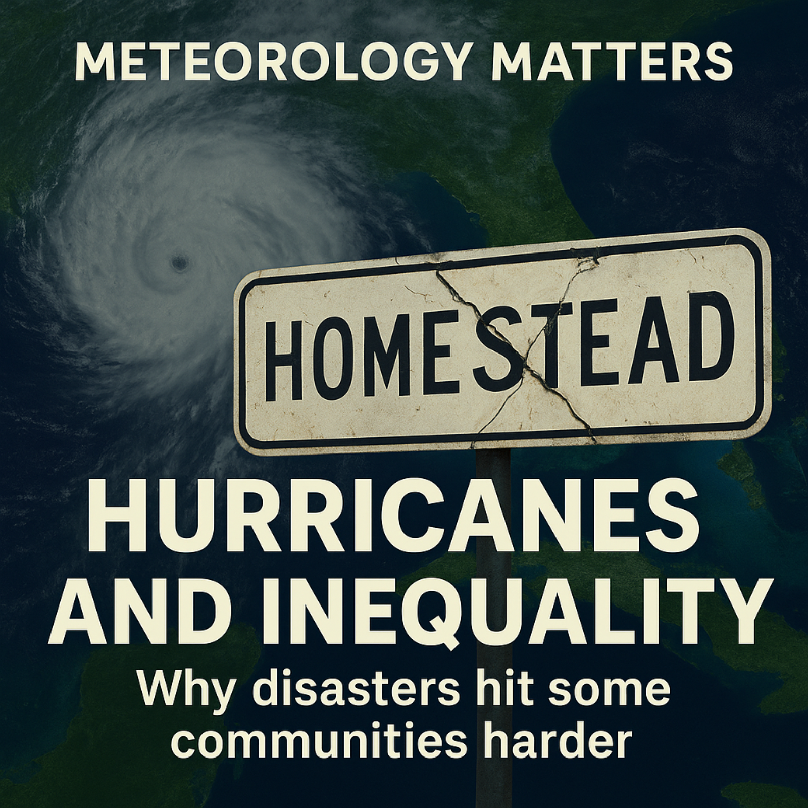
S2 Ep 147Hurricanes and Inequality: Racism in the Recovery
Hurricanes don’t just destroy buildings, they reshape communities. In this episode of Meteorology Matters, Rob Jones dives into how storms like Andrew, Katrina, and Ian left behind more than physical damage. From South Florida’s racial and ethnic divides, to gentrification in New Orleans, to today’s booming coastal housing markets, we explore how disasters deepen inequality. Who bounces back and who gets left behind?Keywords Hurricane Andrew, Hurricane Katrina, Hurricane Ian, disaster inequality, Florida hurricanes, climate change, housing markets, gentrification, natural disasters, Miami history, racial inequality, hurricane recovery, insurance crisis
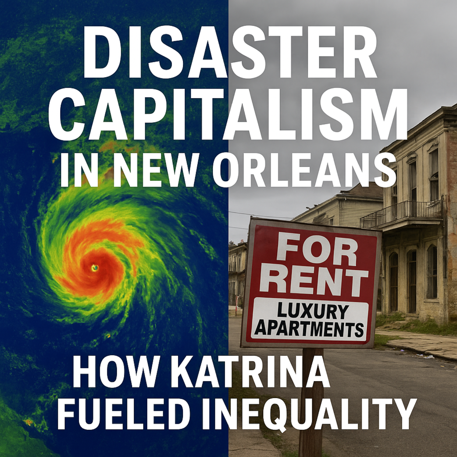
S2 Ep 146Disaster Capitalism in New Orleans: Whitewashed Urban Transformation after Hurricane Katrina
In this episode of Meteorology Matters, we dive into how Hurricane Katrina reshaped New Orleans, not just physically, but politically and economically. We uncover how “disaster capitalism” and neoliberal urban policies turned the city into a laboratory for privatization, gentrification, and displacement. From skyrocketing rents and the demolition of public housing to the cultural erasure of long-time Black residents, New Orleans became a model for how crises can accelerate inequality in American cities.🔑 Keywords: Hurricane Katrina, New Orleans recovery, neoliberal urban policy, disaster capitalism, housing crisis, gentrification, inequality, post-Katrina, public housing, urban planning, disaster recovery, racial inequality.
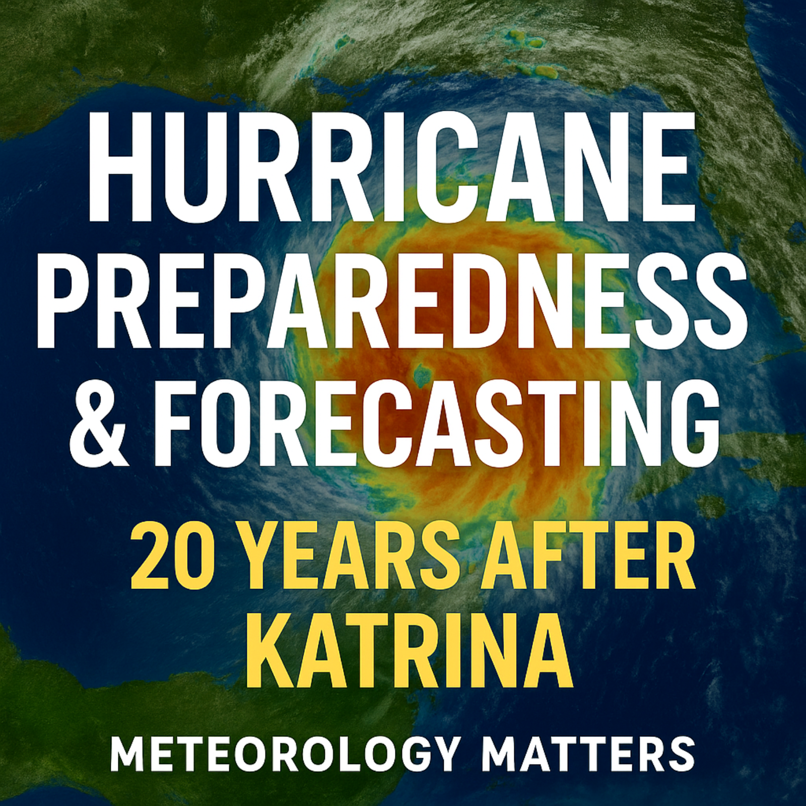
S2 Ep 145Hurricane Preparedness & Forecasting 20 Years After Katrina
🌪️ Hurricane Preparedness & Forecasting 20 Years After KatrinaEpisode Description:It’s been 20 years since Hurricane Katrina reshaped the Gulf Coast — and the way we forecast and prepare for hurricanes. In this episode of Meteorology Matters, Rob Jones breaks down how forecasting has improved, where the biggest vulnerabilities remain, and why climate change is making storms more dangerous.You’ll discover:How new satellites and models have cut hurricane track errors by 50% since KatrinaWhy storm surge — not wind — remains the deadliest hurricane threatThe hidden risks in New Orleans’ levee system, still only rated for a Category 3 stormHow rapidly intensifying storms are reducing evacuation timeWhy budget cuts to FEMA and NOAA could stall future forecasting progressWhether you live on the Gulf Coast, the East Coast, or inland, these insights could help you understand the real risks of hurricanes in a warming world — and why preparation matters more than ever.👉 Listen now on Apple Podcasts, Spotify, YouTube, or your favorite app. Don’t forget to follow, rate, and share to help others stay weather-ready.
S2 Ep 144The Enduring Lessons of Hurricane Katrina and the Current State of U.S. Disaster Preparedness
The Enduring Lessons of Hurricane Katrina and the Current State of U.S. Disaster PreparednessDate: August 25, 2025Twenty years after Hurricane Katrina, its lessons remain profoundly relevant, highlighting systemic failures in national preparedness, coordination, and the critical role of federal agencies. While significant strides have been made in hurricane science and forecasting since 2005, particularly through federally funded initiatives, these gains and the overall U.S. disaster response capability are now critically at risk. Current administrative actions, including budget cuts, leadership inexperience, and a proposed reduction in FEMA's role, threaten to roll back two decades of progress, leaving the nation more vulnerable to increasingly intense and frequent climate-driven disasters. Experts and FEMA staff alike warn that the country is regressing to a "pre-Katrina era" of unpreparedness, with potentially catastrophic consequences.I. Hurricane Katrina: A Catalog of Systemic Failures (2005 Perspective)Hurricane Katrina, making landfall on August 29, 2005, as a Category 3 hurricane near the Louisiana-Mississippi border, was "an extraordinarily powerful and deadly hurricane that carved a wide swath of catastrophic damage and inflicted large loss of life." It became "the costliest and one of the five deadliest hurricanes to ever strike the United States," with a revised death toll of nearly 1,400 and an inflation-adjusted damage estimate of $186.3 billion (NHC, NPR). The federal response was "widely seen as a failure" (Yale Climate Connections), exposing deep-seated flaws across multiple domains.A. Core Failures Identified in "Katrina - Lessons Learned" Report:The Bush administration's "Lessons Learned" report identified 17 critical challenges, underscoring the inadequacy of the existing system for catastrophic threats. B. The Vulnerability of New Orleans:New Orleans was uniquely vulnerable due to its geography (half the city at or below sea level), loss of protective wetlands, and an inadequate levee system that "many scientists thought were too low" (NPR). A 2004 disaster simulation, "Hurricane Pam," predicted "thousands of deaths and that the entire city would be flooded," but federal agencies did not grasp the seriousness (NPR). The catastrophic levee failures, rather than just the storm's intensity, were the primary cause of devastation, overwhelming even more robust defenses in some areas due to "water levels over 27 feet" (Georgia Tech).C. Social and Economic Inequalities:Katrina "exposed and deepened existing social and economic inequalities." Lower-income Black neighborhoods, due to "years of segregation, disinvestment, and discriminatory housing policies," were "uniquely vulnerable" with residents often lacking "access to reliable transportation, making evacuation difficult or impossible." (Georgia Tech)II. Progress Since Katrina: Hurricane Science and ForecastingIn the two decades since Katrina, "hurricane scientists have made great strides toward understanding how climate change influences tropical cyclones, at the same time as they have vastly improved hurricane forecasting" (OPB).III. Current State of Vulnerability: Backsliding Towards a "Pre-Katrina Era" (2025 Perspective)Despite the scientific progress, disaster experts and FEMA staff warn that the U.S. is facing a severe regression in its disaster preparedness and response capabilities, reminiscent of the conditions that exacerbated the Katrina disaster.
S2 Ep 143Alligator Alcatraz (Auschwitz) Concentration Camp Environmental Issues and Everglades Jetport History
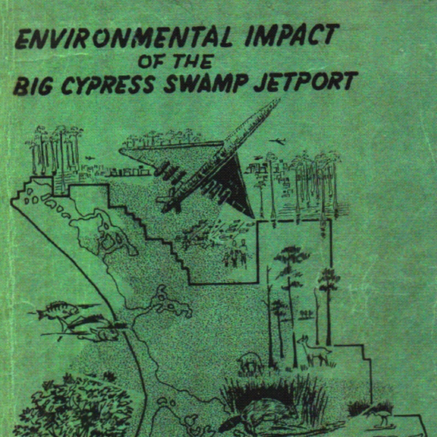
A federal judge in Miami has ordered the state of Florida to dismantle the "Alligator Alcatraz" immigrant detention facility in the Florida Everglades within 60 days, citing severe and irreparable environmental harm. This ruling, a significant victory for environmentalists and the Miccosukee Tribe of Indians, prohibits further expansion and mandates the removal of specific infrastructure. The facility, built on the site of a thwarted 1960s jetport, was fast-tracked without required environmental assessments, leading to habitat loss, increased mortality for endangered species, and disruption to a federally protected ecosystem. Florida Governor Ron DeSantis and the Trump administration have vowed to appeal the decision, maintaining the facility's minimal environmental impact. The ruling highlights a recurring conflict between development and environmental preservation in the Big Cypress region, emphasizing the importance of environmental laws like NEPA, CWA, and ESA.Order to Dismantle: U.S. District Judge Kathleen Williams has ordered Florida to clear out the "Alligator Alcatraz" facility within 60 days. This includes the removal of fencing, lighting, generators, and waste receptacles.Irreparable Harm: Judge Williams cited expert testimony that the project "creates irreparable harm in the form of habitat loss and increased mortality to endangered species in the area" (Washington Post).Lack of Environmental Assessment: A key finding was that an environmental assessment was required before the site was erected, but "the Defendants chose not to do so." Williams stated there was "no process" for evaluating environmental risks (Washington Post, Axios Miami).Protected Species Threatened: The facility is located on federally protected land critical for several endangered species, including:Florida panther (Puma concolor coryi): The project is in the Primary Zone of the Panther Focus Area, with four known panther dens within 12 km. New lighting alone has reduced panther habitat by 2,000 acres (Washington Post, The Wildlife Society, Axios Miami).Everglade snail kite, wood storks (Washington Post).Habitat Destruction and Fragmentation:Paving over at least 20 adjacent acres of wetlands (Washington Post).Installation of approximately 28,000 feet of barbed wire fencing, which "fragments habitats and acts as barriers to wildlife movement" (The Wildlife Society).Light Pollution: The site is a designated International Dark Sky Park, but industrial, stadium-style lights are on 24/7, visible from over 15 miles away, disrupting nocturnal species (The Wildlife Society, Washington Post).Water Contamination and Pollution:Concerns about runoff and wastewater discharge harming the Everglades (Axios Miami).Drinking and bathing water is trucked in, and sewage, trash, and wastewater trucked out (Washington Post).3. Location and Historical ContextBig Cypress National Preserve: The facility is located deep within Big Cypress National Preserve, near the border with Everglades National Park (Washington Post, The Wildlife Society, Sierra Club).Dade-Collier Training and Transition Airport (TNT): The detention center repurposes an old airstrip, which was originally part of a 1960s plan for the "world's largest airport" – the Miami Jetport (Washington Post, Axios Miami, The Wildlife Society).
S2 Ep 142Erin: Big Hurricane, Big Waves, Big Rip Current Risk
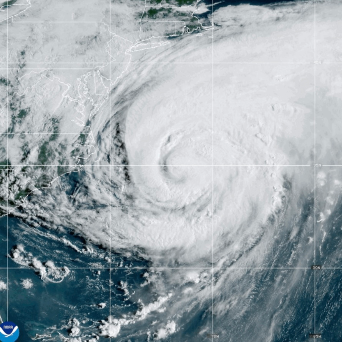
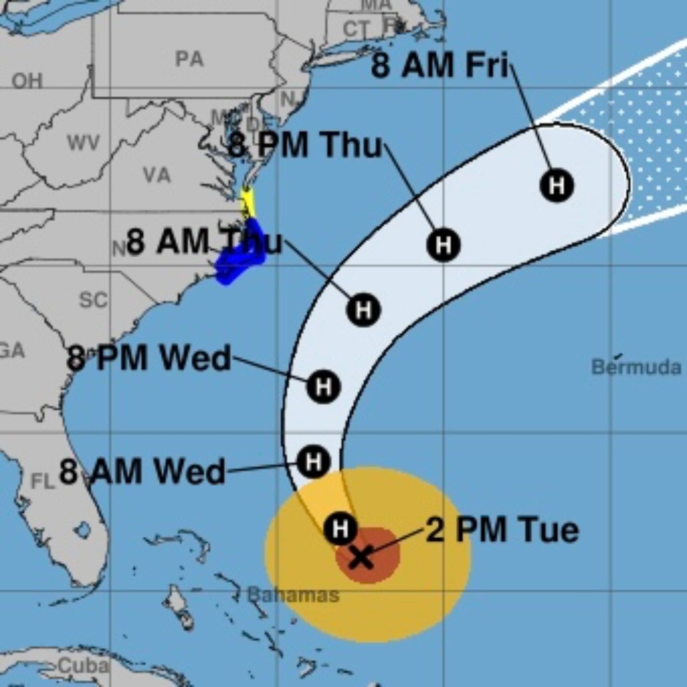
Date: August 21, 2025Current Status and Impacts of Hurricane Erin with Climate Context and Future OutlookHurricane Erin, a massive and dangerous Category 2 storm, is currently making its closest approach to the U.S. East Coast after 10 days of churning across the Atlantic. While its trajectory keeps the center offshore, its immense size (a "sprawling 1,000 miles wide," with a tropical-storm-force wind field extending 325 miles from its center) is causing widespread and significant coastal impacts from Florida to Newfoundland, Canada, and will affect Western Europe as a post-tropical cyclone. The storm's rapid intensification from Category 1 to Category 5 within 24 hours (an increase of nearly 85 mph) is highlighted as a direct consequence of human-caused climate change, linking warmer ocean temperatures to increased storm intensity and potential damage. Evacuation orders are in place for parts of North Carolina's Outer Banks, and 15 U.S. states are under various hazardous coastal alerts. Beyond Erin, a quiet period for tropical development is anticipated for the next 10-14 days in the Atlantic, though the latter half of September may see above-average activity.I. Current Status and Forecast of Hurricane ErinClosest Approach and Movement: Erin has made its "closest approach to the North Carolina coast" and is now moving north-northeastward at 15 kt. It is expected to "continue to accelerate and turn east-northeastward by Friday as it becomes increasingly embedded within the mid-latitude westerlies," eventually reaching a peak forward speed of about 35 kt in 72 hours.Life-Threatening Surf and Rip Currents: This is a "Key Message" from the NHC, stating Erin "will continue to produce life-threatening surf and rip currents along the beaches of the Bahamas, much of the east coast of the U.S., Bermuda, and Atlantic Canada during the next several days." Beachgoers are cautioned against swimming, and many East Coast beaches will be closed to swimmers through Friday.Coastal Flooding and Erosion:North Carolina Outer Banks: "Storm surge flooding and tropical storm conditions will continue." The surge, accompanied by large waves, will lead to "significant beach erosion and overwash, making some roads impassable." Evacuation orders remain for Hatteras and Ocracoke islands. Up to 4 feet of storm surge and waves up to 20 feet are expected.Virginia and Maryland: "Moderate to major coastal flooding is expected," particularly during high tides on Thursday evening, with potential for "numerous road closures and the inundation of homes and businesses near the shore." Waves of 10-14 feet are anticipated.Chesapeake Bay Area: "Higher than normal water levels of up to 3 feet may inundate areas along the shores of the lower Chesapeake Bay, with up to a half foot of flooding along the tidal Potomac River."Delaware and New Jersey: 1 to 2 feet of water may inundate coastal and bayside communities, making roads impassable. "Dangerous surf will slam the coastline."New York and New England: High-surf advisories and coastal flood warnings are in effect.
S2 Ep 141Hurricane Erin & Atlantic Update: Size Matters
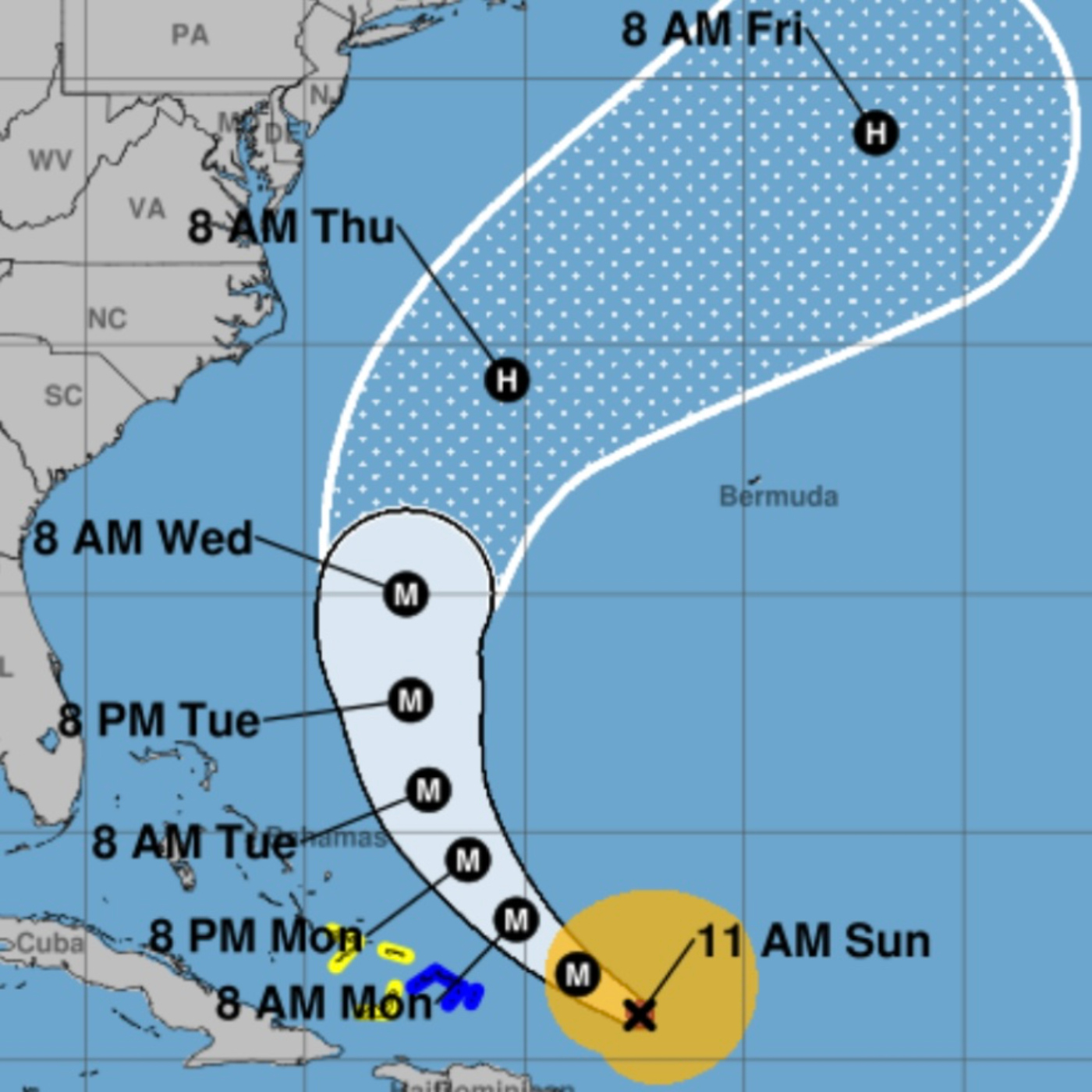
Detailed Briefing: Hurricane Erin and Active Atlantic Tropical Systems (August 19, 2025)This briefing summarizes the current status and forecast for Hurricane Erin, along with updates on two other developing tropical waves in the Atlantic, based on information from the National Hurricane Center (NHC) and other meteorological sources as of August 19, 2025.1. Hurricane Erin: Current Status and Forecast ImpactsHurricane Erin, currently a Category 2 hurricane, is located a couple of hundred miles northeast of the Southeast Bahamas. While its top winds have weakened, the storm has "dramatically [grown] in size" and is expected to "grow even larger this week," potentially becoming "one of the largest major (Category 3 or stronger) hurricanes on record." This expansion significantly increases its impact potential, as "the increase in the diameter of the system more than makes up for the decrease in wind speed in terms of the amount of energy that the storm puts into the ocean water."1.1. 1.2. Significant Coastal Dangers and Warnings:Rip Currents and Surf: "Life-threatening surf and rip currents" are expected along the beaches of the Bahamas, much of the U.S. East Coast, Bermuda, and Atlantic Canada for the next several days. Rescues have "already been a series of rescues at the beach in North Carolina."3. Key Takeaways and RecommendationsHurricane Erin poses a significant coastal threat to a wide stretch of the U.S. East Coast, Bermuda, and Atlantic Canada due to its expanding size and associated dangerous waves, high surf, and rip currents.Coastal North Carolina, particularly the Outer Banks, is at immediate risk for tropical storm conditions, storm surge flooding, and significant beach erosion starting Wednesday night. Mandatory evacuations are in effect for some low-lying areas.Even far from Erin's core, life-threatening rip currents and hazardous surf conditions are widespread along the East Coast. Beachgoers must heed local warnings and lifeguard advice.Monitor the progress of Erin closely, especially residents along the U.S. Mid-Atlantic and southern New England coasts, and Bermuda, as strong winds are possible Thursday and Friday.Two other tropical waves are active in the Atlantic, with the westernmost system having a medium chance of development and approaching the northern Leeward Islands by Friday. While long-range forecasts are uncertain, continued monitoring is essential.Stay informed through official sources such as the National Hurricane Center (NHC) and local emergency management offices. Follow all local instructions for safety.
S2 Ep 140Hurricane Erin Update & Rapid Intensification Explained
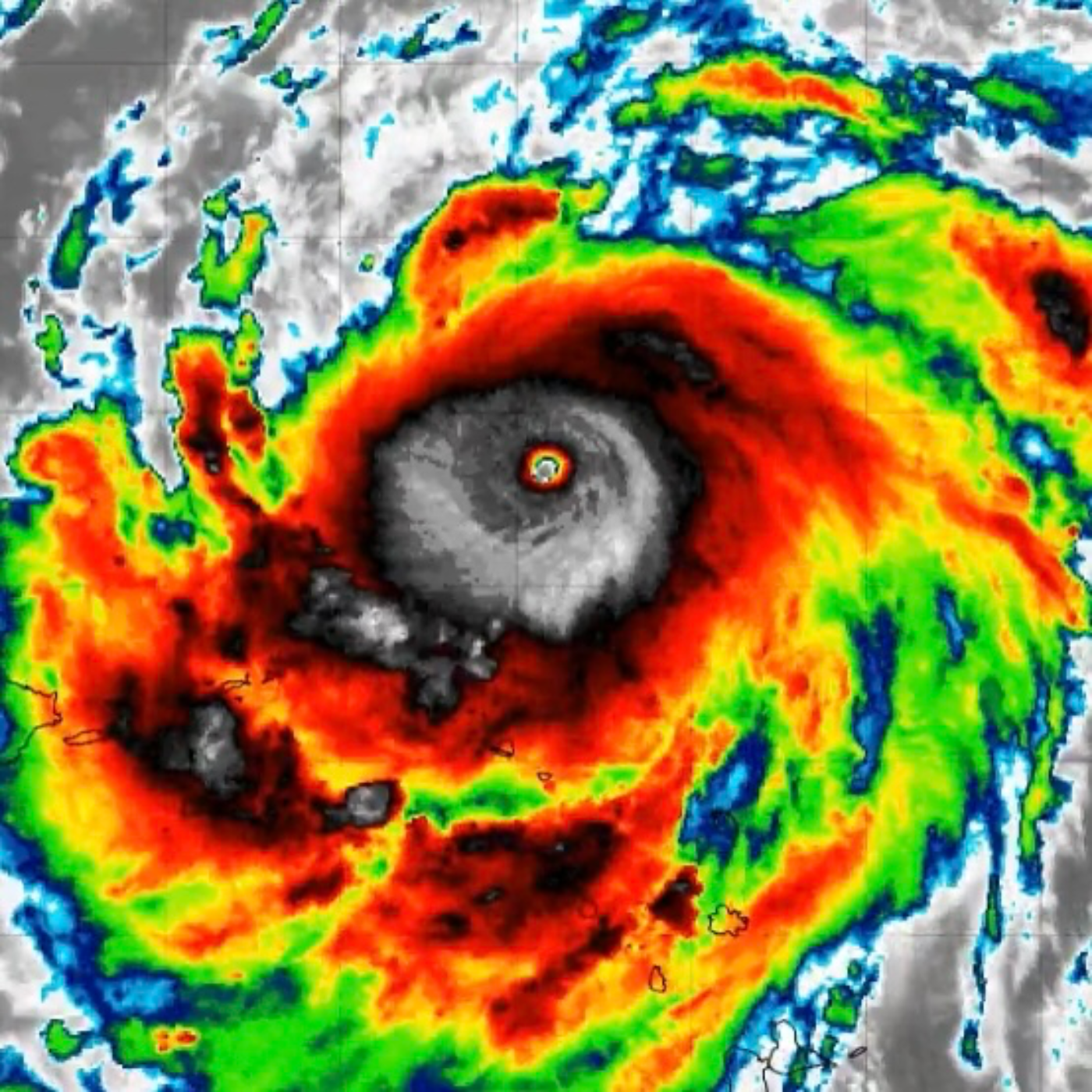
August 17, 1025: Hurricane Erin, recently a Category 5 storm, underwent one of the fastest intensifications ever observed, reaching the second lowest pressure ever recorded for an August hurricane after Hurricane Allen in 1980. While the storm is fortunate to be on a path that avoids direct land impact, its powerful energy will still significantly affect coastal areas.Key Facts about Hurricane Erin:Intensification & Current Status: Erin rapidly intensified to a Category 5, then weakened to a Category 3 due to an "eyewall replacement cycle" which expanded its size. It is forecast to intensify again as it moves north, east of the Bahamas, and will continue to grow in circulation diameter.Offshore Track: The storm is tracking west 150 miles offshore of Puerto Rico, will turn north before reaching the Bahamas, and will pass between North Carolina and Bermuda before heading out to sea. This path is "extremely fortunate" in avoiding direct land impact.Widespread Coastal Impacts: Despite being offshore, Erin will put "a tremendous amount of energy into the ocean," affecting all coastlines from the Caribbean to Canada, including the Bahamas and the U.S. East Coast.Wave & Current Impacts: A larger diameter storm "will move more water and make stronger currents that impact the coast." Beach conditions will be affected in Florida and the Southeast on Tuesday, peaking in the Mid-Atlantic and New England on Wednesday and Thursday.Rip Current Warning: Florida, particularly from Palm Beach County north to the Georgia border, will experience noticeable effects, including the "possibility of rip currents." The rule for rip currents is to "swim parallel to the beach."Fringe Winds: Eastern North Carolina, the Virginia Tidewater, and the Delmarva Peninsula are most likely to experience "fringe effects from Erin’s winds about Wednesday," though "nothing severe is expected."Next African System: Computer models show a disturbance in the eastern Atlantic potentially developing into a "disruptive system" approaching the Caribbean islands by late week. Key Themes and Facts on Rapid Intensification:Definition of Rapid Intensification: The National Hurricane Center defines rapid intensification (RI) as an increase in wind speed by 35 mph (46 kph) in 24 hours.Doubling of Extreme Intensification: In the last 20 years (2001-2020), 8.1% of Atlantic tropical cyclones intensified from a Category 1 or weaker to a major hurricane (Category 3 or greater) within 24 hours. This rate was only 3.2% from 1971 to 1990. For a 36-hour window, the likelihood has "more than doubled" in the modern era (10.3%) compared to the historical era (4.23%).Role of Ocean Warming:Primary Fuel: "With warmer oceans serving as fuel, Atlantic hurricanes are now more than twice as likely as before to rapidly intensify..." Oceans "have been setting heat records monthly since April" with "90% of the excess warming that humans have caused to the planet going into our oceans."Scientific Consensus: "As anthropogenic emissions have warmed the planet, the world's oceans have warmed at the surface, where average temperatures have increased ~0.88 °C from 1850–1900 to 2011–2020. The rate at which ocean surfaces have warmed has also accelerated, with 0.60 °C of this warming occurring since 1980." This "simultaneous increases in both extreme SSTs and maximum TC intensification rates suggests that human-caused warming has already had a measurable impact on the speed with which TCs strengthen."
S2 Ep 139Hurricane Erin Goes Cat-5: Wind Force Explained
Hurricane Erin, the first Atlantic hurricane of 2025, has undergone an "unusually rapid intensification," rocketing from a tropical storm to a "catastrophic Category 5 hurricane" in less than 24 hours. While its center is not expected to make a direct landfall on the U.S. mainland, it poses significant threats of heavy rainfall, flash flooding, landslides, life-threatening surf, and rip currents in the Caribbean and along the U.S. East Coast. The exponential nature of hurricane damage potential underscores the severity of even small increases in wind speed.Key Themes and Most Important Ideas/Facts1. Unprecedented and Rapid Intensification:Speed of Intensification: Hurricane Erin "exploded in strength to a Category 5 storm in the Caribbean on Saturday, rapidly powering up from a tropical storm in a single day." (AP News) It ramped up from a tropical storm to a Category 5 in a "mere 24 hours," with maximum sustained winds more than doubling to 160 mph (255 kph). (AP News)Magnitude of Wind Increase: Mike Brennen, director of the National Hurricane Center, stated Erin raced from 100 mph (160 kph) to 160 mph (257 kph) in "a mere nine hours." (AP News) This represents a "70-kt increase since 24 h ago" as reported by Air Force Reserve Hurricane Hunter aircraft. (NHC Forecast Discussion)Historical Significance: Erin is noted as "only the fifth Category 5 hurricane on record to form this early in the hurricane season and the only Category 5 observed outside the Gulf or Caribbean this early in the year." (USA Today)Factors Contributing to Intensification: The rapid intensification was attributed to "Warm water ahead of Erin as it moved west, a lack of wind shear and its position far enough away from any land to interfere." (USA Today)Peak Intensity: The NHC forecast predicts Erin to reach a "peak intensity of 145 kt" (165 mph) before potential weakening due to environmental factors like increasing northwesterly shear and possible dry air entrainment. (NHC Forecast Discussion)2. Projected Path and Geographic Impacts:Current Location and Movement: As of 11:20 AM AST on Saturday, August 16, 2025, Erin was located approximately "105 miles (170 kilometers) north of Anguilla" and "about 235 miles east-northeast of San Juan, Puerto Rico." (NHC Public Advisory Update; Fox 35 Orlando) It is moving "W or 280 degrees at 17 mph (28 km/h)." (NHC Public Advisory Update)Forecast Track: The storm's center is "expected to move just north of the northern Leeward Islands, the Virgin Islands, and Puerto Rico over the weekend." (NHC Public Advisory; Fox 35 Orlando) A turn toward the west-northwest is expected tonight, with a decrease in forward speed, and a turn toward the north expected early next week. (NHC Public Advisory; Fox 35 Orlando)No Direct U.S. Landfall: "The hurricane is not expected to make a direct hit on the United States," (USA Today; Fox 35 Orlando) with forecasts indicating it "will turn north and stay well east of the U.S. coastline." (Fox 35 Orlando)Expansion of Storm Size: Forecasts indicate that "by the middle of next week, Erin is forecast to at least double or triple in size, which will result in rough ocean conditions over the western Atlantic." (NHC Forecast Discussion; USA Today)

S2 Ep 138NASA Says Screw YOU Earth… I’m Going to Space
The Trump administration is enacting significant policy changes across environmental regulation and space exploration, characterized by a consistent effort to dismantle climate-focused initiatives and streamline regulations, particularly benefiting the commercial space industry. These actions are drawing strong criticism from environmental advocates and scientists, who accuse the administration of climate denial and undermining crucial researchThe Trump administration's actions reflect a deliberate strategy to prioritize economic growth and industry expansion, particularly in the commercial space sector, by significantly reducing environmental oversight and dismantling climate-related research and regulatory frameworks. This approach is highly contentious, facing strong opposition from the scientific community and environmental groups who warn of severe and irreversible consequences for public health and the environment. The administration's rhetoric and policies consistently dismiss established climate science, marking a stark departure from previous environmental policies.
S2 Ep 137Need for Air Conditioning Grows in Order to Survive Extreme Heat
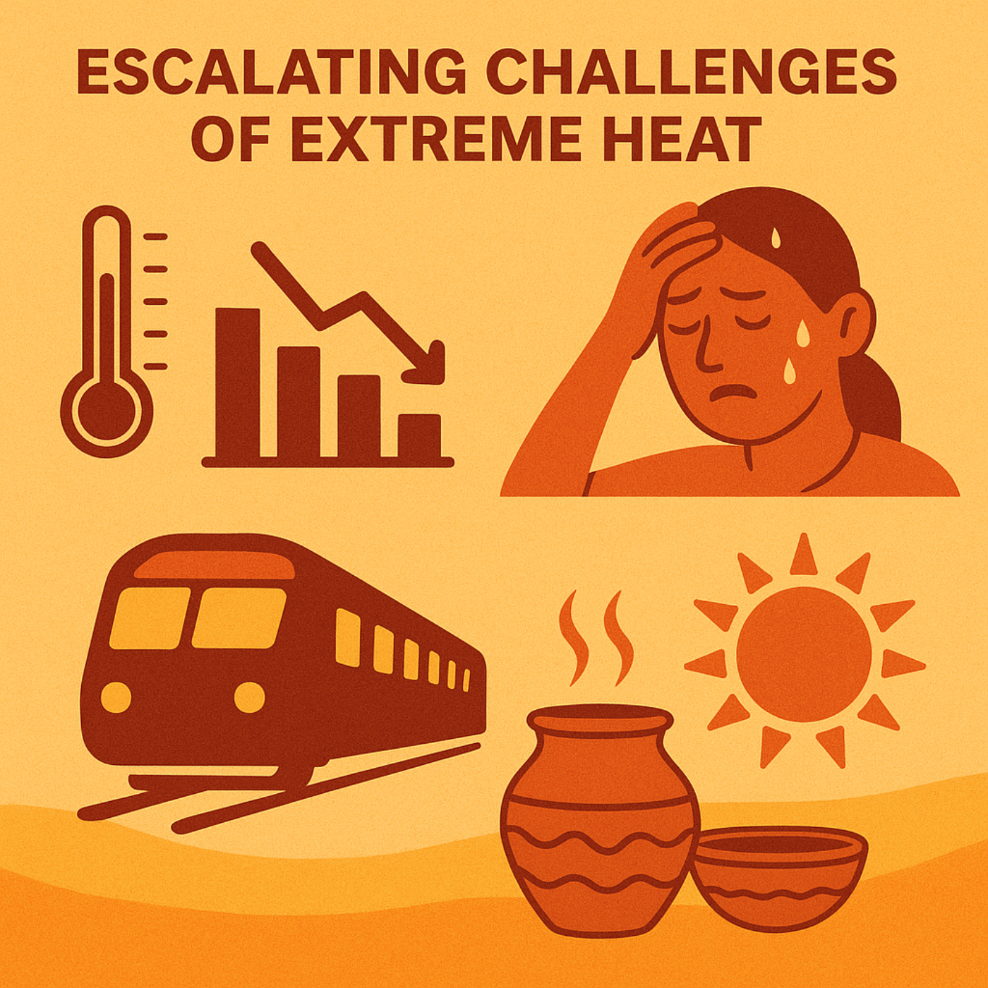
Meteorology Matters discusses the escalating challenges posed by extreme heat and potential mitigating strategies. We include the underestimated health burden beyond mortality, the significant economic and infrastructure strain, and the re-emergence of ancient, sustainable cooling technologies. We highlight a critical need for expanded public health interventions and a re-evaluation of current cooling paradigms, particularly in regions with limited access to conventional air conditioning.A. Underestimated and Broad Health Impacts of Extreme Heat:While fatalities due to extreme heat are well-documented, new research reveals a broader, less understood impact on morbidity (rates of disease and poor health). This is a critical shift in understanding the full scope of heat's consequences.Beyond Mortality: "While scientists have spent decades covering how extreme heat and cold lead to death, new research using data from California emergency departments shows that the heat may be making us sicker too." (Washington Post)Increased Emergency Department Visits: A study in Science Advances, tracking 11 years of data from California, found that "emergency room visits steadily increased as temperatures did — particularly among young children." (Washington Post)Diverse Illnesses: As temperatures rose, more people visited emergency rooms for "illnesses including those linked to poison, respiratory symptoms and nervous system problems." (Washington Post)Vulnerable Populations:Deaths increased in both cold and hot temperatures, "especially among older adults." (Washington Post)"Data also showed that children under 5 visited emergency rooms at a higher rate than any other age group." (Washington Post)Individuals with "preexisting conditions are more at risk in hot weather." (Washington Post)"Tip of the Iceberg": Carlos Gould, lead author of the Science Advances paper, states that "deaths are just the tip of the iceberg when it comes to temperature’s effects on society." He adds, "Hot days can worsen our health far before they lead to deaths…And it can be a large range of things that we get sick from." (Washington Post)Indirect Effects and Complex Interactions: The mechanisms linking heat to certain illnesses (e.g., poison-related) may not be clear, suggesting "a very complex interaction between heat and people’s behavior that causes this rise." (Washington Post) Other factors like wildfires, often associated with hot days, can also influence health outcomes.B. Economic and Infrastructure Strain Due to Insufficient Cooling:Extreme heat poses a significant economic liability and strains existing infrastructure, particularly evident in regions with low air conditioning penetration.Economic Disparity in Cooling Access: There is a stark "AC gap between Europe and America." In Europe, "you wake up after a night of tossing and turning. You’re sticky, uncomfortable, and already dreading the commute. Jammed on a crowded train, you suffer through a heavy delay as your city’s transport infrastructure struggles in the face of extreme temperatures." In contrast, the U.S. generally offers cool, comfortable environments. (Fortune)Infrastructure Weaknesses: European transport infrastructure "struggles in the face of extreme temperatures," leading to delays and discomfort. (Fortune) The "grid isn’t up to the job" of supporting widespread AC use. (Fortune)Productivity Loss: While not explicitly detailed as an economic impact, the Washington Post article mentions that illnesses can "reduce our productivity.

S2 Ep 136Florida & Louisiana Lead Flesh-eating Bacteria Deaths
There has been an unusual and concerning surge in Vibrio vulnificus infections and deaths across the southeastern United States, especially in Florida. This bacterium, commonly known as "flesh-eating bacteria," thrives in warm, brackish seawater and can cause severe, rapidly progressing illness, including necrotizing fasciitis, and has a high fatality rate. While infections are generally rare, experts describe the current situation as "certainly not normal" and are investigating potential contributing factors, including the impacts of recent and forecasted hurricane seasons and environmental indicators like plankton and chlorophyll concentrations. Public health officials are emphasizing preventative measures and immediate medical attention for suspected infections, especially for high-risk people Current Toll (as of August 7-8, 2025):Florida: 16 cases and 5 deaths reported this year.A second death in Bay County was reported within the past three weeks, bringing the state total to five.Confirmed cases are spread across various counties including Bay, Escambia, St. Johns, Santa Rosa, Broward, Duval, Hillsborough, Lee, Manatee, Okaloosa, and Walton.Louisiana: 17 cases and 4 deaths reported this year, exceeding previous annual averages.North Carolina: 7 cases and 1 death reported this year so far.Mississippi: 3 cases reported this year so far.In total, at least 10 deaths have been attributed to Vibrio vulnificus across these states this year.Historical Context (Florida Cases & Deaths):2024: 82 cases, 19 deaths (exacerbated by Hurricane Helene).2023: 46 cases, 11 deaths.2022: 74 cases, 17 deaths (unusual increase due to Hurricane Ian).The current 16 cases and 5 deaths in Florida for 2025, while lower than recent full-year totals, are significant given it's "early on in the summer."Fatality Rate: Approximately 1 in 5 (20%) people infected with Vibrio vulnificus die, with bloodstream infections being fatal about 50% of the time.III. Main Themes and Important IdeasA. Nature of Vibrio vulnificus and Infection Routes:Vibrio vulnificus is a naturally occurring "halophilic" bacterium, meaning it requires salt, and thrives in warm, brackish seawater. Most infections occur between May and October when water temperatures are warmest.Primary infection routes:Exposure of open wounds: The bacteria can enter the body through cuts, scrapes, or broken skin exposed to warm salt or brackish water. The Florida Department of Health explicitly states, "Water and wounds do not mix. Do not enter the water if you have fresh cuts or scrapes."Consumption of contaminated seafood: Eating raw shellfish, particularly oysters, is a common source of infection.B. Severity of Illness and Symptoms:While severe illness is rare, Vibrio vulnificus can cause rapid destruction of tissue under the skin, known as necrotizing fasciitis, leading to death within days if untreated.Symptoms: Rash, high fever, chills, vomiting, nausea, cramping, abdominal pain, skin breakdown, and ulcers. For wound infections, visible signs can appear within hours, including redness, swelling, painful "bull's-eye" blisters.Systemic Infection (Sepsis): The bacterium can invade the bloodstream, causing a severe and life-threatening illness with symptoms like fever, chills, decreased blood pressure (septic shock), and blistering skin lesions.

S2 Ep 135National Weather Service Hiring While Fake Science is Being Pushed
Recent reports highlight significant disruptions and policy shifts across several key federal agencies, including the National Weather Service (NWS), Federal Emergency Management Agency (FEMA), and Environmental Protection Agency (EPA), under the current Trump administration. These changes, characterized by deep federal cuts, staffing reductions, and attempts to alter climate science narratives, have raised serious concerns about public safety, environmental protection, and the integrity of scientific information. While some efforts are underway to restore staffing, the long-term implications of these policies are a major concern.Severe Staffing Cuts and Under-resourcing in Critical Public Safety Agencies:National Weather Service (NWS): The NWS experienced "sweeping cuts" earlier this year, losing "more than 500 people" due to the Trump administration's efforts to reshape the federal workforce. This resulted in a total of "more than 550 people" fewer staff since the administration began.The Bay Area NWS office in Monterey, for instance, lost a meteorologist, an administrative support assistant, and a facilities technician. The Fremont-based Center Weather Service Unit in Oakland was left with a "single full-time meteorologist" after a forecaster retired, operating with two prior vacant positions.These cuts led to NWS offices being "no longer able to operate overnight" and some curtailing "daily launches of weather balloons that send back critical data to power forecasts and forecast models."Current employees are working "additional hours with additional responsibilities" to maintain 24/7 operations, facing "pretty daunting" stress, especially for those like the "lone wolf" meteorologist in the Bay Area.There is now a plan to hire "hundreds of new employees," with 450 "critical positions" identified, potentially filling up to 770 empty positions. The NWS has been granted direct hiring authority and meteorologists are now classified as "necessary for public safety," exempting them from future hiring freezes. However, the process of filling these roles typically "takes months."Federal Emergency Management Agency (FEMA): FEMA has "lost thousands of staff to layoffs, retirements and resignations since Trump took office." This understaffing was acutely felt after the Texas floods in July 2025.Most calls to the federal aid hotline in the week after the Texas floods "went unanswered" because the Department of Homeland Security (DHS) "let funding lapse" for call center staffing agreements.Internal FEMA logs show that from July 6-10, FEMA answered only "just over 15,000 of the approximately 55,000 calls" from disaster survivors. On July 7th, only "10% of the more than 15,000 calls" were answered.The funding lapse was attributed to an "administrative bottleneck created by the Trump administration," where Homeland Security Secretary Kristi Noem "personally signs off on all funding requests for more than $100,000," a change from previous administrations.Systematic Undermining of Climate Science and Environmental Protections:Altering Climate Reports and Data: The Trump administration is actively seeking to "update" the US's premier climate crisis reports, known as National Climate Assessment (NCA) reports.
S2 Ep 134Hurricane Hype? Season Awakens in the Atlantic
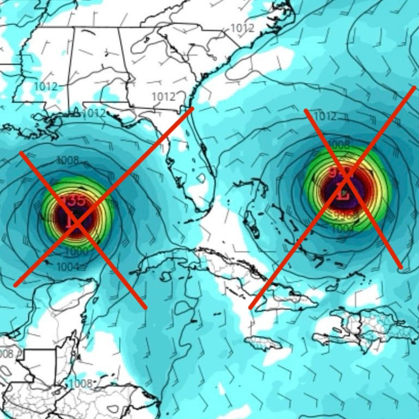
As we head through August, it is typical for hurricane season to awaken in the Atlantic Ocean and the models are starting to hint at changes afoot. Elevated Tropical Activity: The Atlantic basin is entering a period of increased tropical activity, consistent with a "backloaded" hurricane season. Conditions are becoming more favorable for development, with warm ocean temperatures and a "La Niña light" influence.Primary Threat: A large, ill-defined tropical disturbance has just moved off the coast of Africa and is the main system of concern. It has a high probability of developing into at least a tropical storm, and there's a "good chance we’ll see Hurricane Erin out of this."Uncertain Track: The long-term track of the African disturbance is highly uncertain beyond next weekend. While many forecast models show it turning north offshore of the East Coast, some scenarios suggest a westward track potentially impacting the northeastern Caribbean or even the U.S. coast. It is too early to focus on any one location for impacts.Beware of Social Media Hype: Long-range (10-15 day) model forecasts, particularly the GFS model which "loves to spin up a storm... and bring it straight for Florida or straight for the United States," are unreliable and should be disregarded. "Online posts showing an extreme storm impacting some part of the coast are only there to get clicks."Other Systems:Tropical Storm Dexter: Has become a non-tropical system and is moving away from the U.S., posing no threat to land.Invest 96L (Central Atlantic): Odds of development have been lowered to "low range" and it is expected to turn out to sea, posing no threat to land.System offshore Carolinas: Absorbed by a cold front, posing no threat.Preparedness: Now is the time for coastal residents to review hurricane preparations.1. Current Atlantic Tropical OverviewThe Atlantic hurricane season is showing signs of increased activity as anticipated, moving towards a "backloaded" season where more significant development is expected later in August and into September. Bryan Norcross of Fox Weather notes, "The Atlantic basin really across the board is becoming more favorable for development."Colorado State University (CSU) and NOAA Outlooks: Both CSU and NOAA have released updated forecasts that indicate an above-normal season.CSU predicts "16 named storms. Eight of them become hurricanes and three Category Three and above."NOAA's similar forecast ranges from "13 to 19 named storms, 6 to 10 hurricanes, and 3 to 5 being Hurricanes of Category Three and above."The reasoning for these forecasts remains consistent: warmer-than-normal Atlantic water temperatures ("a slight plus") and a "La Niña Light" condition ("more conducive for storm development") are balanced by "upper level winds over the Caribbean have been very hostile" ("a double minus"). This balance leads to a forecast "slightly above normal."
S2 Ep 133Thousands of Delayed Hurricane Deaths: Toll far Greater than Official Counts
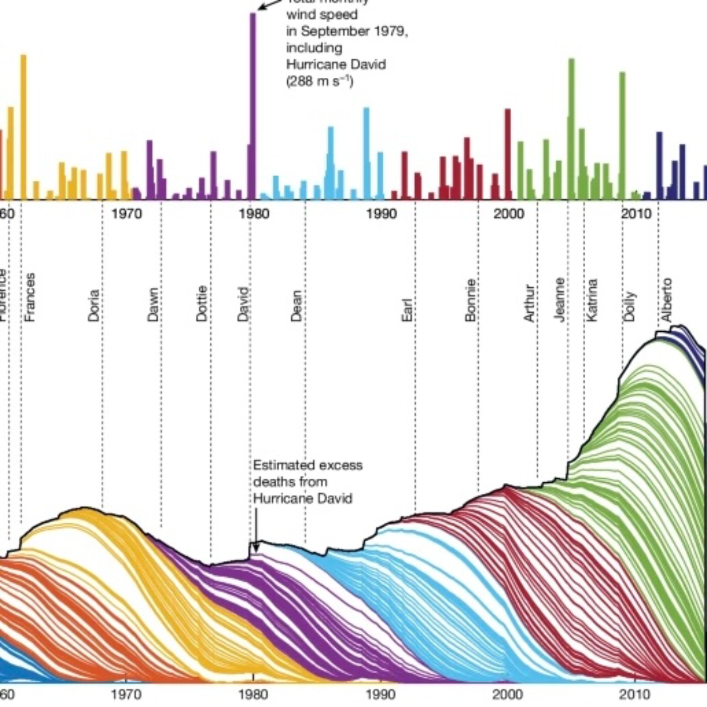
13% of Floridian Deaths can be attributed to hurricanes and tropical storms? Recent research from both South Korea and the United States reveals a significant and largely underestimated public health burden associated with tropical cyclones (hurricanes/typhoons). Beyond the immediate, direct deaths typically reported, these studies demonstrate a substantial "excess mortality" that can persist for weeks, months, and even years after a storm. This hidden death toll disproportionately affects vulnerable populations, including the elderly, those with lower socioeconomic status, and racial/ethnic minorities. The findings highlight the critical need for expanded public health preparedness and policy measures that account for the long-term, indirect impacts of these increasingly intense natural disasters.Significant and Underestimated Excess Mortality:Beyond Direct Deaths: Official government statistics typically focus on immediate, direct deaths (e.g., drowning, trauma). However, studies show that the true mortality burden is far greater due to indirect causes."The true mortality burden related to cyclone exposure may exceed officially reported death tolls, which usually focus on direct injury-related deaths." (Han et al., Korea)"Official government statistics record only the number of individuals killed during these storms... Usually, these direct deaths, which average 24 per storm in official estimates, occur through drowning or some other type of trauma. But the new analysis... reveals a larger, hidden death toll in hurricanes’ aftermath." (Young & Hsiang, US - Stanford)Quantitative Estimates:South Korea: An average of 150 excess all-cause deaths were estimated for each tropical cyclone during the 2 weeks post-exposure between 2002 and 2023. Daily average increases were 0.084 in all-cause mortality and 0.075 in non-accidental mortality in cyclone-exposed regions.United States (Short-Term): For 179 tropical cyclones between 1988–2019, there were 3,112 excess deaths after hurricane-force winds and 15,590 excess deaths after gale to violent storm-force winds in counties with >95% probability of excess deaths. Hurricane Katrina in 2005 was the deadliest, with 1,491 excess deaths.United States (Long-Term): A groundbreaking analysis of 501 tropical cyclones from 1930–2015 estimates that an average U.S. tropical cyclone indirectly causes 7,000 to 11,000 excess deaths, persisting for nearly 15 years after the storm. Total estimated deaths since 1930 range from 3.6 million to 5.2 million nationwide, vastly exceeding the official total of ~10,000 direct deaths."A big storm will hit, and there’s all these cascades of effects where cities are rebuilding or households are displaced or social networks are broken. These cascades have serious consequences for public health." (Solomon Hsiang, US - Stanford)"This burden is 300–480 times greater than government (NOAA) estimates of 24 deaths per storm on average (22 without Hurricane Katrina) and 11,937 total TC deaths during 1950–2015." (Young & Hsiang, US - Nature)

S2 Ep 132First Meteorologist Scheduled to Blast into Space
Meteorologist in SpaceDeborah Martorell, a 54-year-old Puerto Rican meteorologist and journalist with over 30 years of experience, is set to become the "first meteorologist in the world (between men and women) to visit space." Her lifelong dream of becoming an astronaut, which began in childhood and was often "taken as a joke or saw me as this immature girl who wants to be an astronaut," is now becoming a reality.Key Details of Martorell's Mission:Launch Provider: Blue Origin, on its New Shepard suborbital vehicle.Mission Name: NS-34.Target Launch Date: Sunday, August 3rd, with a window opening at 8:30 a.m. EDT (1230 GMT; 7:30 a.m. local Texas time).Launch Site: Blue Origin's West Texas spaceport, near Van Horn.Crew: Martorell will be part of a six-person crew for the NS-34 mission, which includes crypto billionaire Justin Sun, real estate investor Arvinder (Arvi) Singh Bahal, Turkish businessman and photographer Gökhan Erdem, Englishman Lionel Pitchford, and American entrepreneur James (J.D.) Russell. J.D. Russell is flying for the second time.Mission Duration: Each New Shepard mission lasts "10 to 12 minutes, from liftoff to the parachute-aided touchdown of the vehicle's capsule." Passengers will experience "a few minutes of weightlessness and get to see Earth against the blackness of space."Symbolism: The NS-34 mission patch features the "shape of Puerto Rico symbolizes Deborah Martorell’s home" and the "sun in the center symbolizes H.E. Justin Sun, Deborah Martorell’s meteorology background, and new adventures for the whole crew." Martorell views her journey as symbolic for Puerto Rico, stating, "This is a great responsibility and I never lose sight of the fact that I carry with me the dreams of thousands of Puerto Rican boys and girls who, like me, dream of becoming astronauts.”Scientific Contribution: Martorell will carry a scientific experiment and a "gravity indicator that will be designed by the students of the Technology Club of the Dr. Carlos González de Aguada High School." She also intends to involve non-profit organizations she has collaborated with throughout her career.Martorell's Background and Preparation:Education & Career: Martorell began her career as a journalist after studying communication and journalism at the University of Puerto Rico, Río Piedras Campus. She transitioned into meteorology after covering Hurricane Georges and Tropical Storm Jeanne in 1997, leading her to major in climate coverage at the University of Mississippi. She has since served as chief meteorologist and science reporter for TeleOnce and Uno Radio Group for over 30 years.Awards and Recognition: Her reporting on environmental and space topics has earned her "eight Emmy Awards and two Awards of Excellence in Science Reporting from the American Meteorological Society."Aerospace Training: Her aerospace training was conducted by the "PoSSUM Scientist-Astronaut Project of the International Institute of Astronautical Sciences," an international non-profit suborbital research program. She decided to take these classes as her daughters entered adulthood.

S2 Ep 131Dismantling the EPA, FEMA, and NOAA Hurts the American People
Review of recent Trump Administration actions impacting the Environmental Protection Agency (EPA), Federal Emergency Management Agency (FEMA), and National Oceanic and Atmospheric Administration (NOAA), with a focus on deregulation, scientific research, and disaster preparedness.In July 2025, the Trump administration has taken significant steps to dismantle environmental regulations and reduce federal involvement in climate science and disaster response. Key actions include:Elimination of the EPA's Scientific Research Arm: The EPA is proceeding with firing hundreds of scientists and eliminating its Office of Research and Development (ORD), which provides independent research underpinning agency policies and regulations.Proposed Rescission of EPA's "Endangerment Finding": The EPA has proposed to revoke the 2009 "endangerment finding," which legally allows the agency to regulate greenhouse gases under the Clean Air Act. This move aims to eliminate a wide range of climate regulations on vehicles, power plants, and oil and gas emissions.Uncertainty and Cuts to FEMA: The administration is sending "shifting signals" regarding the future of FEMA, with calls to eliminate or remake the agency. FEMA has already suspended the $882 million Building Resilient Infrastructure and Communities (BRIC) program, leading to lawsuits from states and concerns about their ability to manage increasing disaster costs.Proposed Closure of Key NOAA Climate Observatories: The proposed 2026 budget for NOAA would end climate research at the agency, specifically targeting the closure of the Mauna Loa Observatory and three other critical monitoring stations. These observatories are crucial for tracking greenhouse gas concentrations and providing long-term climate data.These actions are driven by a stated desire to reduce regulatory burdens on industries so they can profit while the people suffer, increase economic growth while the environment suffers, and a belief that federal agencies like the EPA and FEMA are inefficient, which is not true. Expect devastating impacts on public health, the environment, and the nation's ability to understand and respond to climate change and natural disasters.
S2 Ep 130100° - Florida’s Largest West Coast City Records Hottest Day Ever
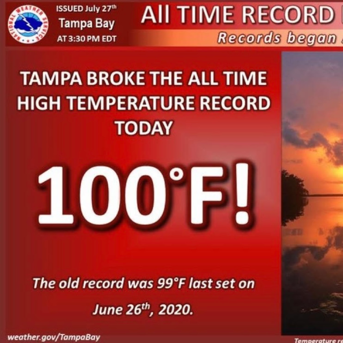
Pre-1890:Prior to 1890: Recordkeeping for temperatures in Tampa, Florida, begins.1890:1890: Temperature records for Tampa, Florida, officially start.1892:September 1892: Temperature records for Plant City, Florida, officially start.1895:Since 1895: Florida's average June temperature has been 79.9 degrees.Early 1900s:Since 1902: Records for temperatures at Page Field in Fort Myers begin.Since 1911: Records for temperatures in Sarasota begin.July 1914: Temperature records for St. Petersburg, Florida, officially start.1931:June 29, 1931: Monticello, Florida, records the hottest temperature ever in Florida at 109 degrees.2016:August 2016: EPA publishes "What Climate Change Means for Florida," highlighting that the Florida peninsula has warmed more than one degree (F) in the last century.2020:June 26, 2020: Tampa, Florida, last set its previous record high temperature of 99 degrees Fahrenheit.2023:July 2023: The Gulf of Mexico experiences record-breaking warm water temperatures, with a sensor in Manatee Bay recording 101.1 degrees on July 24, potentially breaking the global record for sea surface temperature.June 2024: Florida's average temperature was 82.6 degrees, ranking as the 3rd hottest June on record.2025:June 2025: Florida experiences its 12th hottest June on record, with an average temperature of 81.8 degrees. Tampa's average June temperature over the past 10 years (including June 2025) has been 83.7 degrees, compared to an average of 81.3 degrees since 1890.July 27, 2025, 3:30 p.m. EDT: Tampa, Florida, soars to 100 degrees, breaking the city’s all-time record high temperature since recordkeeping began in 1890. This also breaks the old record of 99 degrees F set on June 26, 2020. This is the first time in recorded history Tampa has hit 100 degrees. The observation was taken at the airport, where the National Weather Service Tampa office is located (Ruskin, Florida).July 27, 2025, 6:34 p.m. EDT (Updated 9:22 p.m. EDT): Forbes publishes "Tampa Hits 100 Degrees For The First Time In Recorded History."Friday (August 1, 2025): Heat relief for the Southeast is expected to arrive as a cold front slowly advances into the region, bringing cooler temperatures and an increased chance of rai
S2 Ep 129Can Sharks be Used to Forecast Hurricanes?
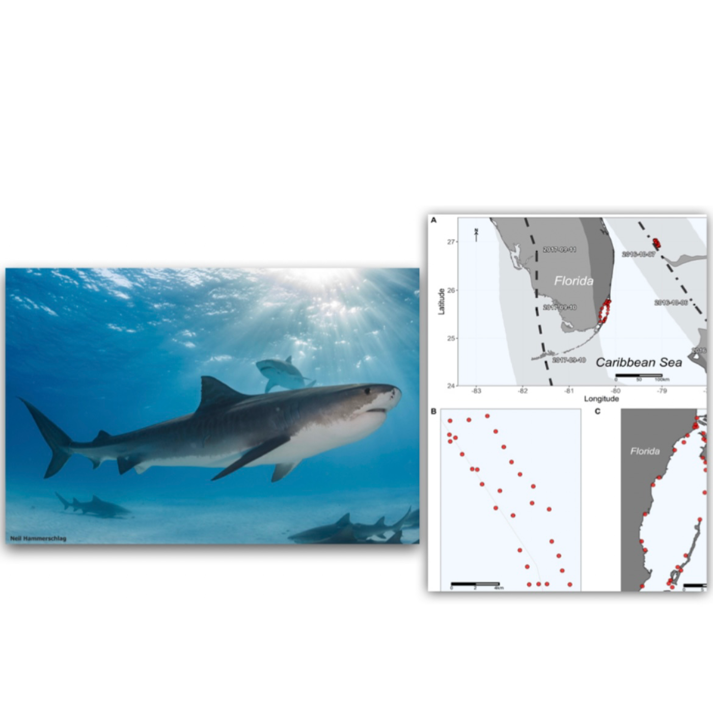
Recent studies from the University of Miami Rosenstiel School of Marine and Atmospheric Science and ongoing research by the University of Delaware and Rutgers University are shedding new light on how large sharks respond to hurricanes and their potential utility in predicting these powerful storms. While some shark species flee from approaching hurricanes, others, like tiger sharks, exhibit unexpected behavior, even increasing in number after a storm passes, likely due to increased scavenging opportunities. This newfound understanding of shark behavior, coupled with the development of "mobile marine monitors" using tagged sharks, offers a promising, albeit complementary, method for gathering crucial oceanographic data to improve hurricane forecasting, especially as climate change is expected to increase storm intensity.II. Shark Behavior During HurricanesSharks possess unique biological capabilities that allow them to detect and react to approaching storms, though their responses vary significantly by species.A. Shark Sensory Abilities for Storm DetectionBarometric Pressure Changes: Sharks can "feel changes in atmospheric pressure through a sensitive inner ear and organ unique to many fish called lateral lines" ("Are sharks scared of hurricanes?", p. 6). The lateral line system is a "tube of sensory cells used to detect pressure changes in the surrounding waters" ("Sharks Can Sense Storms", p. 4). This allows them to anticipate a storm well before its arrival.Water Condition Changes: Hurricanes cause "massive waves (as high as 60 feet!) and powerful surges of underwater currents (as deep as 300 feet!), not to mention changes in oxygen levels and salinity (or saltiness) as the ocean’s deep and surface waters mix—all of which can be deadly for marine life" ("Sharks Can Sense Storms", p. 3). Sharks must respond quickly to these changing conditions to survive.B. Species-Specific ResponsesFleeing Behavior: Some shark species exhibit a clear avoidance response to hurricanes.Nurse, Bull, and Hammerhead Sharks: These species "fled the area before the storm arrived" when Hurricane Irma approached Biscayne Bay, Florida, in 2017 ("Are sharks scared of hurricanes?", p. 6). This "fleeing behavior...wasn't surprising" to researchers ("Are sharks scared of hurricanes?", p. 7). Juvenile blacktip sharks have also been observed moving to deeper waters before tropical storms and hurricanes ("Sharks Can Sense Storms", p. 5)."Swarming" or Remaining Behavior: Conversely, some larger, more robust species remain in storm-affected areas, and their numbers may even increase afterward.Tiger Sharks: During Hurricane Matthew (a Category 5 storm in 2016), "the Tiger sharks didn't flinch." The study showed that "during the storm, the number of sharks remained steady." Even more surprisingly, "In the days after landfall, the number of Tiger sharks doubled" ("Are sharks scared of hurricanes?", p. 5).Scavenging Opportunities: Experts hypothesize that this doubling was due to "the increase of scavenging opportunities from the storm killing marine life" ("Are sharks scared of hurricanes?", p. 5). This is the "opposite of what happened in previous studies involving small sharks" ("Are sharks scared of hurricanes?", p. 5).Unanswered Questions: Researchers are still exploring whether "some shark species are attracted to areas recently hit by a hurricane?" and if "they can track the storm with their lateral lines and inner ear?" ("Are sharks scared of hurricanes?", p. 7).
S2 Ep 128NOAA's Atlas 15 Rainfall Prediction Project Halted by Trump
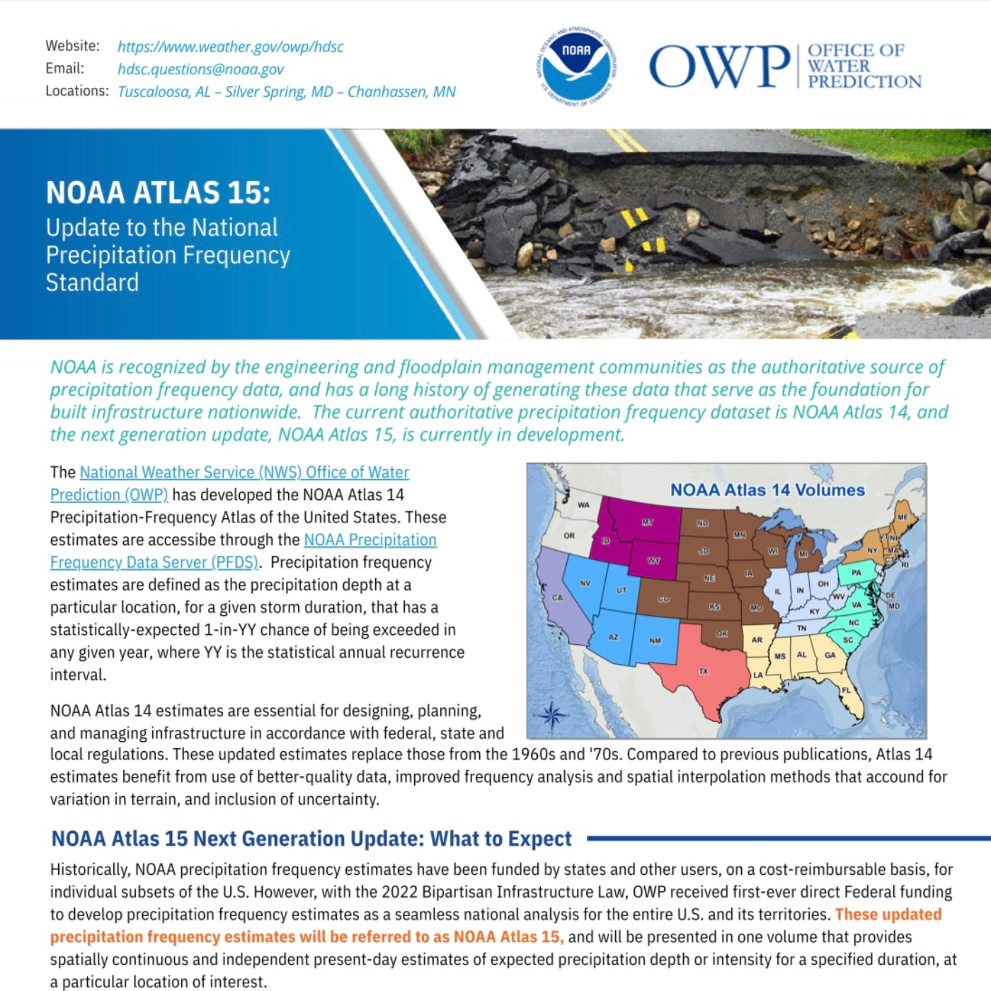
2024:NOAA Atlas 15 Pilot Release (Montana): On September 26, 2024, NOAA releases the NOAA Atlas 15 Pilot data for the state of Montana. This pilot aims to collect early feedback and demonstrate the nature of Atlas 15 data. It covers a subset of storm durations (1 hour to 10 days) and exceedance probabilities (50% to 1%) in two volumes and is intended for comparison and feedback, not formal peer review.Public Review Period for NOAA Atlas 15 Pilot (Montana) Closes: The public review period for the NOAA Atlas 15 Pilot over Montana is closed, with feedback informing the expansion of the Pilot.Ed Clark's Retirement: Ed Clark, former director of the National Water Center, retires at the end of April.Spring 2025:Commerce Secretary Howard Lutnick Orders Review: Commerce Secretary Howard Lutnick orders a review of NOAA Atlas 15 Volume 2, which focuses on climate projections, indefinitely suspending work on this crucial component.July 16, 2025:Washington Post Article Published: The Washington Post publishes an exclusive article detailing the suspension of work on NOAA Atlas 15 Volume 2 by the Trump administration.Recent Flood Events: In the first 15 days of July, the National Weather Service reports twice the usual number of flash floods, including a deluge in Central Texas (130+ fatalities) and heavy rains in the Northeast (2 fatalities in New Jersey, submerged NYC subway stations).2025:Preliminary CONUS Estimates for NOAA Atlas 15: Preliminary estimates for NOAA Atlas 15, covering the contiguous U.S. (lower 48 states), are scheduled to be released for public peer review and feedback.NOAA Atlas 15 Volume 1 (historical observations) Data Public Release (on track): Preliminary data for Volume 1, based on historical observations, is still on track to be made public by the end of this year.April 2025 (Publication Date):"Validating the IMERG remote sensing precipitation data for extremes analysis using the new hybrid depth duration frequency model" Study Published: This study, authored by Kenneth Okechukwu Ekpetere, is published in Remote Sensing Applications: Society and Environment, Volume 38.
S2 Ep 127What’s Up with the Atlantic Cold Blob?
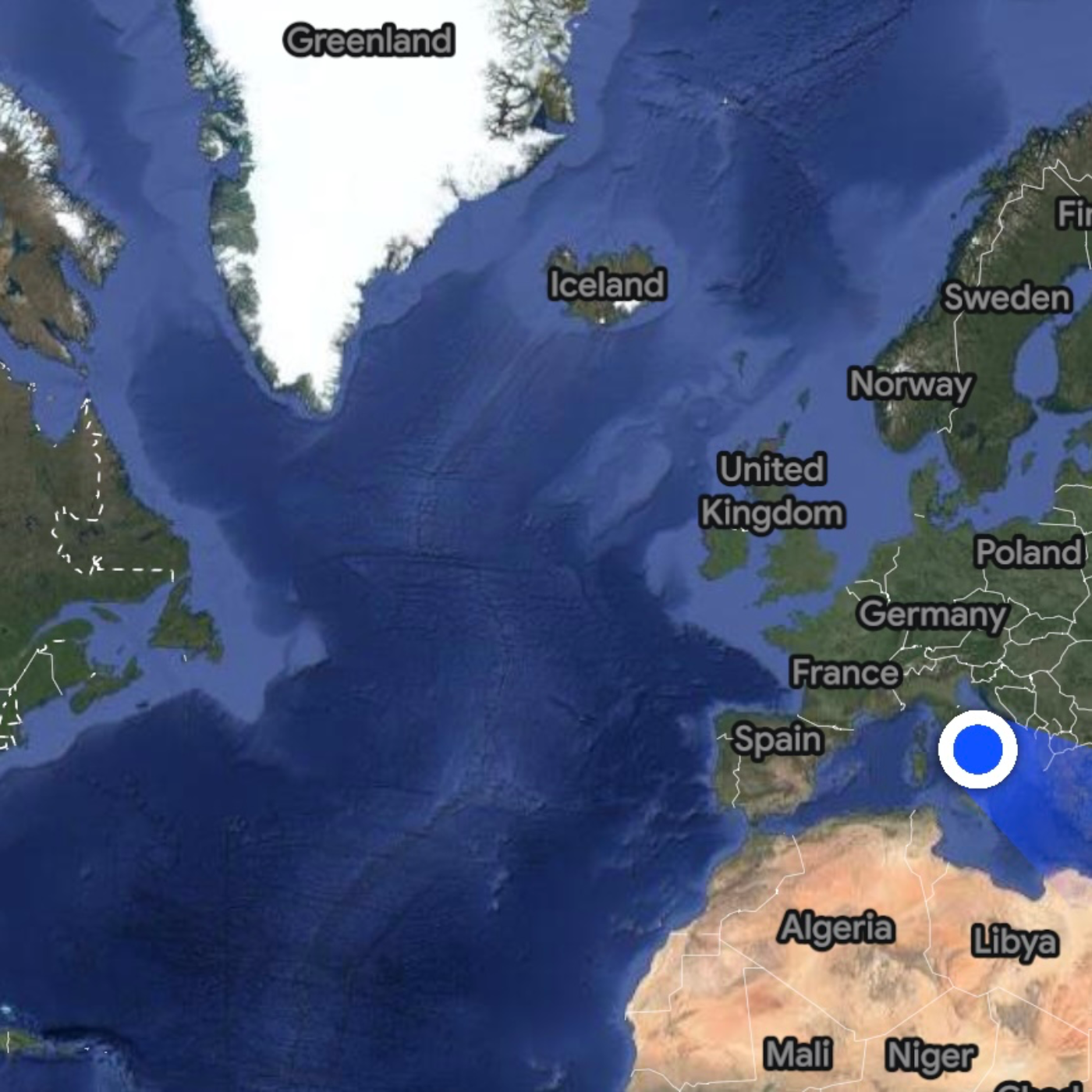
A persistent "cold blob" in the subpolar North Atlantic, south of Greenland, has defied global warming trends for over a century, cooling by up to 0.3 degrees Celsius while surrounding waters warm. Recent research confirms this anomaly is primarily driven by a weakening of the Atlantic Meridional Overturning Circulation (AMOC), a vital system of ocean currents that regulates global climate. The slowdown is attributed to freshwater influx from melting Greenland ice, reducing water density and heat transport. Critically, new research suggests that an "Atlantification" process in the Arctic, specifically the Barents Sea, is creating a "back-up system" for dense water formation, potentially adding resilience to the AMOC and making a full collapse less likely than previously feared.

S2 Ep 126111 Deaths and 171 Missing: Why Were Flash Flood Warnings Ineffective in Texas?
The devastating flash floods that swept through the Texas Hill Country on July 4, 2025, resulted in over 111 confirmed deaths and more than 170 missing persons, primarily in Kerr County. This disaster has brought to light critical failures in emergency warning systems, long-standing debates over funding for such infrastructure, and a significant political reluctance to accept accountability. While some areas like Comfort successfully utilized siren systems to prevent casualties, Kerr County, despite being in "Flash Flood Alley" and having a history of deadly floods, lacked effective public warning infrastructure due to cost concerns and political inaction. The incident has sparked a contentious debate over budget cuts to weather forecasting agencies and the overall approach to disaster preparedness in Texas.High Death Toll: As of July 8, 2025, at least 111 people were confirmed dead, with over 170 still missing, predominantly in Kerr County. "Of those, 75 were in Kerr County," and as of Monday morning, July 7, the number had risen to "at least 90 people had died in the flooding." (The Texas Tribune)Youth Casualties: A tragic aspect of the disaster is the high number of child victims, with at least 30 children among the dead in Kerr County. "The victims include many from Camp Mystic, a Christian summer camp for girls, where 27 campers and staff members were killed." (Texas Floods: Accountability and Aftermath)Rapid Onset: The floodwaters rose with extreme speed, particularly in Kerrville, where the Guadalupe River rose "from 1 to more than 34 feet in height" between 2 a.m. and 7 a.m. on Friday. (The Texas Tribune) Some residents reported the water rising "10 feet beyond its banks" in an hour. (In deadly Texas floods, one town had what some didn't)Inadequate Warning Systems in Kerr CountyLack of Sirens: Unlike the nearby town of Comfort, which successfully used a "wailing warning siren" system and reported no deaths, Kerr County lacked a siren system despite years of debate. (In deadly Texas floods, one town had what some didn't) Kerr County Judge Rob Kelly stated, "Kerr County does not have a warning system in place along the river." (Timeline: When the warnings began)Previous Debates and Cost Concerns: Discussions about implementing a flood warning system in Kerr County date back to at least 2016, following a deadly flood in Hays County in 2015. Proposals for systems costing around $1 million were rejected as "too expensive." (In deadly Texas floods, one town had what some didn't; Officials Feared Flood Risk) "Taxpayers won’t pay for it," said Kerr County Judge Rob Kelly. (Officials Feared Flood Risk)Reliance on Cell Phone Alerts: Kerr County relied on Wireless Emergency Alerts (WEAs) sent to cell phones. However, these alerts were often ineffective due to "spotty cellphone service," phones being off, or individuals being asleep. "The girls at the summer camp weren’t allowed to bring them [cell phones]." (In deadly Texas floods, one town had what some didn't) Many residents also became "desensitized to too many weather warnings." (Timeline: When the warnings began)Failed Legislation: House Bill 13, which aimed to establish a statewide plan for improving disaster response, including a grant program for emergency communication equipment and new infrastructure like radio towers, "failed in the Texas Senate." (The Texas Tribune) This bill's initial "$500 million cost drew heavy criticism from fellow Republicans." (The Texas Tribune)

S2 Ep 125Disastrous Texas Flood: Communication vs Weather Forecast
Devastating flash floods, fueled by extraordinary rainfall, struck the Texas Hill Country on July 4-5, 2025, resulting in at least 37 confirmed deaths, including 14 children with many people still missing. The floods caused widespread destruction, particularly around the Guadalupe River in Kerr County, and prompted a massive search and rescue operation. A central point of contention has emerged regarding the adequacy of weather forecasts and public warnings, with state and local officials criticizing the National Weather Service (NWS) for a "botched forecast" particularly by the Texas Division of Emergency Management Chief W. Tim Kidd and a perceived lack of urgency, while the NWS defends its actions amidst ongoing staffing and funding concerns. The event highlights the extreme vulnerability of the "flash flood alley" region and raises questions about preparedness for increasingly intense weather events in a warming climateKey Facts and FiguresFatalities: At least 37 people confirmed dead across Texas, including 14 children.32 deaths recovered in Kerr County (18 adults, 14 children).At least 3 deaths in Travis County.2 deaths in Burnet County (including a firefighter).Missing Persons: As of July 5, 2025, authorities had not released a definitive number of missing beyond "more than two dozen children" from Camp Mystic and "many others." Some reports cited around 25 missing girls from Camp Mystic.Impacted Area: Primarily the Texas Hill Country, especially Kerr County, Ingram, and areas along the Guadalupe River. Austin and San Antonio regions also experienced heavy rains.Rainfall Amounts:Widespread 10-15 total inches in Kerr County late Thursday into Friday morning.Localized LCRA rainfall totals exceeded 18 inches in some places.One rain gauge in Mason County reported over 18 inches within 24 hours."Four months of rainfall came down in only four hours" in some areas.Estimates of "more than 12 inches (30 centimeters) of rain fell in the Texas Hill Country over a span of several hours early Friday."Approximately "1.8 trillion gallons of rain fell over Texas Hill Country and the Edwards Plateau on Friday morning."River Levels: The Guadalupe River in Kerrville rose over 30 feet in less than two hours early Friday. In Hunt, it surged from seven feet to 29 feet in only a few hours—its second-greatest height on record.Time of Flood: The raging storm hit Camp Mystic "just after midnight Friday," catching many residents, campers, and officials by surprise.Rescues: Approximately 850 people had been rescued by July 5.Camps Affected: Camp Mystic (Christian summer camp), where most of the dead were recovered, and another camp "just up the road."Federal Funding and Staffing Concerns at NWS: Underlying the criticism of NWS forecasts are concerns about federal budget cuts and staffing shortages impacting the agency's capabilities.The warning coordination meteorologist (WCM) position at the local NWS office (critical for outreach and training) has been vacant since April due to an early retirement package.Five other vacancies exist in the local NWS office (another management role, two meteorologists, a hydrologist, and an electronic technician).All five living directors of the NWS warned in May that Trump's cuts "leave the nation’s official weather forecasting entity at a significant deficit...Our worst nightmare is that weather forecast offices will be so understaffed that there will be needless loss of life."
S2 Ep 124Hurricane Forecasts Jeopardized by SSMIS Satellite Data Termination
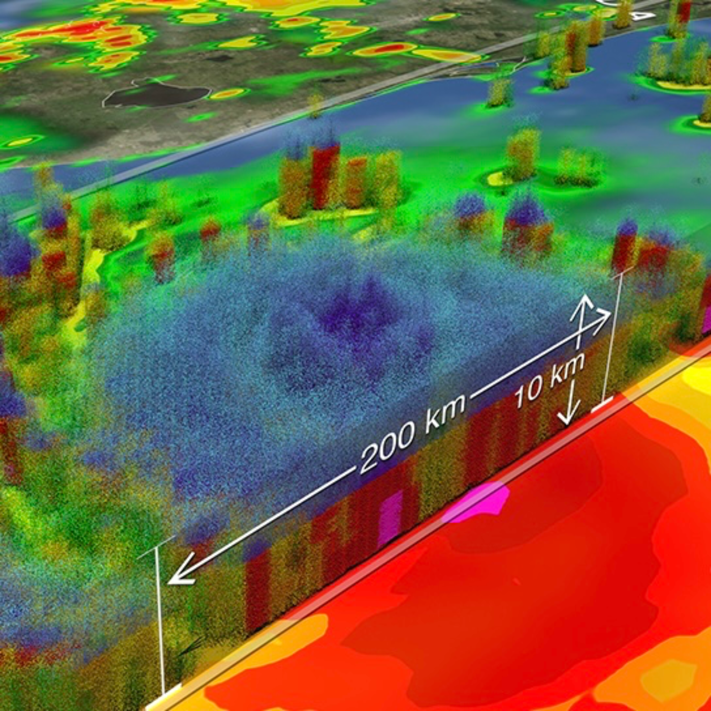
Critical Hurricane Forecast and Sea Ice Monitoring Tool Abruptly TerminatedDate: June 26, 2025 Abrupt Termination: The DoD will permanently terminate the processing and transmission of microwave data from its three weather satellites by no later than June 30, 2025. This decision was formalized on June 25, 2025, and communicated to users, including NOAA and the National Hurricane Center, on June 24 and 25, 2025, respectively.Severe Impact on Hurricane Forecasts: The discontinuation of SSMIS data will "severely impede and degrade hurricane forecasts for this season and beyond," affecting millions of Americans in hurricane-prone regions. This data is critical for understanding storm structure, estimating intensity, and accurately positioning storm centers, particularly when direct observations are scarce.Increased Risk of "Sunrise Surprise": Without SSMIS microwave data, forecasters face an "increased risk of a ‘sunrise surprise,’ the realization from first-light images that a system had become much better organized overnight, but it wasn’t recognized because structural details are so hard to discern from [infrared satellite]."Impact on Sea Ice Products: The SSMIS data is also essential for several sea ice products, including the "Near-Real-Time NOAA/NSIDC Climate Data Record of Passive Microwave Sea Ice Concentration" and the "Sea Ice Index." These products will cease processing after June 30, 2025, leading to a "gap in data availability."Rationale Unclear, Security Concerns Suspected: While the exact rationale for the abrupt termination is "not immediately clear," the decision "appears to have stemmed from Department of Defense security concerns."Alternative Data Sources Being Explored/Recommended (with caveats):AMSR2: For sea ice products, the AMSR2 instrument is recommended as an alternative, noting it has "better resolution than SSMIS and therefore provides more detailed information." However, AMSR2 data are "prototype and not yet fully intercalibrated with older data," which means "users will notice differences in sea ice extents."WSF-M: The DoD successfully launched a follow-on weather satellite, Weather System Follow-on Microwave (WSF-M), in April 2024. However, data from WSF-M is "not currently available to forecasters and it’s not clear if or when data access will be permitted."SSMIS Data Proven Critical for Model Simulation: A 2003 study on Hurricane Danny demonstrated that assimilating SSM/I (predecessor to SSMIS) data significantly improved hurricane simulations by "increas[ing] the moisture content over most of the Gulf of Mexico, but also strengthen[ing] the low-level cyclonic circulation, giving a better convergence field and reduced model spin-up time."
S2 Ep 123The Mind of an Autistic Meteorologist
The Empathizing-Systemizing (E-S) Theory and its RelevanceThe E-S theory is a central framework discussed in both sources, hypothesizing that individuals possess varying degrees of "empathizing" and "systemizing" cognitive styles.Systemizing: Defined as "(1) the drive to create and analyze psychological sets of logical rules, or “systems,” related to and constructed around things that occur in the world, and (2) the ability to intuit how systems work in the physical world." (Bolton et al., 2018). It involves identifying "lawful regularities in physical and other systems" and understanding cause-and-effect relationships ("if I do X, A changes to B. If Z occurs, P changes to Q"). There are six main types of systems: abstract, mechanical, natural, collectible, motoric, and social.Autism Spectrum Conditions (ASC): Individuals with ASC are hypothesized to be "inherently stronger at “systemizing” than they are empathizing" (Bolton et al., 2018). This manifests as a natural drive to "seek truth—a concept defined here as 'precise, reliable, consistent, or lawful patterns or structure in [some kind of] data' through psychological system-building." (Bolton et al., 2018). The concept of "hyper-systemizing" attempts to explain repetitive behaviors and a disinterest in socializing often observed in ASC, as "the social world, driven by emotions, is far less lawful than domains that include spinning objects or record keeping." (Bolton et al., 2018).II. Psychological Profile of MeteorologistsThe Bolton et al. (2018) study provides the first examination of meteorologists' personality and mental health relative to other physical scientists (engineers and physicists).Empathizing and Systemizing: Meteorologists in the study sample were found to be "higher in empathizing and systemizing" compared to engineers and physicists. While they were "the strongest systemizers" when compared to the combined group, they also showed the "highest group tendency for empathic expression." (Bolton et al., 2018). This suggests a unique "balancing of the E-S cognitive profiles within meteorologists," which is sensible given the profession's "orientation toward public service." (Bolton et al., 2018).Autistic Traits: Engineers and physicists reported "significantly higher autistic trait amounts" than meteorologists. Meteorologists scored comparably on the Autism Spectrum Quotient (AQ) to other STEM groups in previous research, but were lower than the engineers and physicists in this specific sample.III. Weather Salience in Autism Spectrum ConditionsBolton et al. (2020) introduce and explore the concept of "weather salience" in autistic individuals.Definition of Weather Salience: "the degree to which individuals attribute psychological value or importance to the weather and the extent to which they are attuned to their atmospheric environments" (Stewart 2009, quoted in Bolton et al., 2020).Key Findings:Increased Weather Salience in Autism: Initial findings suggest that "enhanced weather salience exists among autistic individuals relative to those without the condition" (Bolton et al., 2020). While statistically non-significant in most studies, autistic participants consistently showed higher weather salience scores.
S2 Ep 122Evidence Shows Global Warming Signals May Have Been Measured Slightly Earlier than Some Previously Thought
Meteorology Matters discusses a study indicating that human influence on global climate, specifically stratospheric cooling, could have been detected as early as 1885, preceding the widespread use of automobiles. Researchers conducted an experiment using modern climate models and hypothetical 1860 measurement capabilities to identify this early "human fingerprint" on atmospheric temperatures. The study highlights that stratospheric cooling is a strong indicator due to its clear response to CO2 increases and minimal natural variability, making detection easier than with surface temperatures. The authors of the study emphasize the importance of continued observation of the upper atmosphere for monitoring climate change, especially given current budget cuts impacting climate research.

S2 Ep 1212024 Presidential Election Numbers Not Adding Up as Legal Challenge Proceeds in Court
Meteorology Matters discusses an ongoing lawsuit in Rockland County, New York, challenging the accuracy of the 2024 Presidential and Senate election results, particularly concerning alleged missing votes for Kamala Harris and Diane Sare. The lawsuit, brought by SMART Legislation, seeks a full hand recount due to statistical anomalies and voter affidavits claiming uncounted ballots. A significant point of contention is the "de minimis" software updates to voting machines, which critics argue were untested and lacked transparency. One source further alleges a complex conspiracy involving Eaton, Palantir, and Starlink, claiming these entities manipulated election data remotely and erased digital footprints, suggesting a "vote-flipping algorithm" was in play that resulted in statistically improbable outcomes favoring Donald Trump. While the lawsuit will not overturn the national results, it aims to expose systemic flaws and influence future election integrity policies.
S2 Ep 120Waste from Miami Nuclear Power Plant Still Leaking into Drinking Water Supply
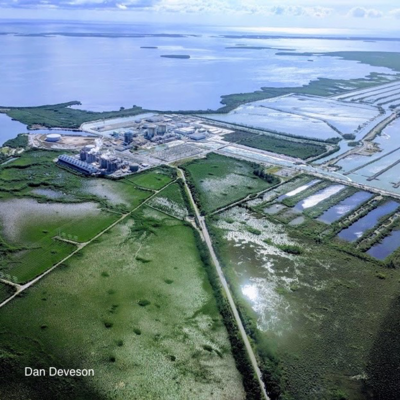
Environmental and safety concerns surrounding the Turkey Point nuclear power plant in Miami-Dade County, Florida, particularly its aging infrastructure and cooling canal system. A central issue highlighted is the hypersaline plume originating from the plant's cooling canals, which is threatening Miami's primary drinking water aquifer and the surrounding ecosystem. Environmental groups, such as Miami Waterkeeper, express alarm over the Nuclear Regulatory Commission's decision to extend the plant's operating license given its age and vulnerability to climate change impacts like hurricanes, sea-level rise, and extreme heat. While Florida Power & Light (FPL), the plant's owner, asserts the facility's safety and efforts to mitigate the plume, experts and activists suggest alternative cooling methods, like cooling towers, as more effective solutions to prevent further contamination and environmental damage.
S2 Ep 119Google DeepMind AI Hurricane Forecast Model Could be a Good Thing… If it Works in Realtime
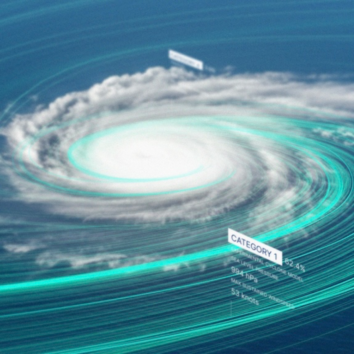
Google DeepMind and Google Research's new initiative, Weather Lab, which aims to improve tropical cyclone prediction using artificial intelligence (AI). This platform features an experimental AI model that predicts various aspects of cyclones, including formation, track, intensity, size, and shape, up to 15 days in advance, with 50 possible scenarios. The article highlights the model's superior accuracy compared to traditional physics-based methods for both track and intensity predictions. Furthermore, it explains the collaborative efforts with organizations like the U.S. National Hurricane Center (NHC) to validate and integrate these AI-powered forecasts into official warnings and disaster preparedness. The text also emphasizes that Weather Lab is a research tool, and its predictions are experimental, advising users to refer to official meteorological agencies for critical information.
S2 Ep 118Another American Weather Website Being Shut Down
Effective Shutdown of Climate.gov: The website is likely to cease publishing new content imminently. The "entire content production staff at climate.gov (including me) were let go from our government contract on 31 May," stated an anonymous former contractor. This signifies a de facto shutdown of new information dissemination.Targeted Elimination of Staff: The dismissals were highly specific, with former program manager Rebecca Lindsey describing a situation where a demand came "from above" to "rewrite parts of the contract to remove the team’s funding." Tom Di Liberto, a former NOAA spokesperson, noted, "They only fired a handful of people, and it just so happened to be the entire content team for climate.gov. I mean, that’s a clear signal."Political Motivation and Suppression of Science: The consensus among former staff is that the actions were politically motivated and aimed at restricting public access to climate information. Lindsey believed it was a "very deliberate, targeted attack," and stated that the administration is engaging in a "slow and quiet way of trying to keep science agencies from providing information to the American public about climate." Di Liberto explicitly states, "It’s clear that the administration does not accept climate science, so it’s certainly concerning."Loss of a Trusted, Non-Partisan Source: Climate.gov was recognized as an "extremely well-trusted source for climate information." Lindsey emphasized that the content was "specifically designed to be politically neutral, and faithful to the current state of the sciences," and that they "operated exactly how you would want an independent, non-partisan communications group to operate."Vulnerability to Misinformation and Propaganda: A significant concern among the fired staff is the potential for the administration to "co-opt climate.gov to publish its own anti-science content." Lindsey feared a "sinister possibility" of the administration providing "a content team from the Heartland Institute, leveraging our audience, our brand, our millions of people that we reach on social media every month. That’s the worst-case scenario." The contractor also worried about the site turning into "a propaganda website for this administration." The absence of staff to "pushback on misinformation" on social media accounts further compounds this risk.
S2 Ep 117Florida Waters Reach 98°, Dangerous Hurricane Fuel
Timeline of Main Events1950-2016: Florida experiences an increase of approximately 25 extreme rain events annually.1970-2020: Tide gauge observations are recorded to estimate sea-level rise rates for the eastern Gulf Coast.1982-Present (implied up to Nov 2024): Storm tracks in the Atlantic basin are recorded in the International Best Track Archive for Climate Stewardship database.1985-Present (implied up to Nov 2024): Marine heat wave data becomes available and is recorded.1990s: Widespread marine heat waves spanning hundreds of miles begin to be recorded.2006-2015: Florida experiences a decade without a single hurricane strike.2017: Hurricane Harvey strengthens from a tropical depression into a Category 4 hurricane in two days before striking the Texas coast. This year also marks the beginning of an eight-year streak of major Gulf landfalls.2017: Hurricane Irma hits the Gulf Coast with ferocious intensity.2022: Hurricane Ian's wind speeds nearly double in roughly 22 hours before the storm makes landfall in Southwest Florida as a Category 4 hurricane, becoming the costliest hurricane in state history.2023: Hurricane Idalia ravages the Big Bend area of Florida with a 10-foot storm surge.2023: A severe coral bleaching event occurs in Florida, leading to significant coral mortality and prompting NOAA to extend their severity scale.2023: Daily average sea temperatures at Buoy Key, Florida, reach their highest May levels in documented history.2024: Atypical heat continues in the Caribbean throughout the year.October 2024: Hurricane Milton strengthens from a tropical storm to a Category 5 hurricane in 24 hours as it crosses the Gulf of Mexico northwest of the Yucatan Peninsula.October 2024: Hurricane Milton's historic rain floods inland neighborhoods in Pinellas and Hillsborough counties, including Clearwater and parts of North Tampa, with up to 17 inches of rain in five hours. Stormwater pumps fail in some areas.May 2025: More than 4,000 daily record high temperature reports occur across the United States, more than double the number of record lows.Early May 2025: A deadly Mid-Atlantic atmospheric river occurs, fueled by increased moisture from the marine heat wave.May 24, 2025: Sea temperatures near Buoy Key, Florida, reach 98 degrees Fahrenheit.May 25, 2025 (last weekend before May 29): Ocean temperatures near 98 degrees are recorded by a buoy in Everglades National Park.May 26, 2025 (last Sunday before May 29): Houston sets a new overall monthly record low overnight temperature of 82 degrees.May 27, 2025 (last Monday before May 29): Fort Lauderdale, Florida, records a low of 82 degrees, a record for May.May 29, 2025: Golf ball-size hail pummel Austin, Texas.May 30, 2025 (Last Thursday before May 31): Tampa experiences an 80-degree low temperature, its hottest May morning on record (since 1890). Downpours are expected from Louisiana to Georgia.

S2 Ep 116Scientists Trying to Save America’s Weather Forecasts with 100 Hour Live Stream Event
CHECK IT OUT HERE…https://youtube.com/@wclivestreamResponse to Funding Cuts and Policy Changes: The primary driver for the scientists' actions is the substantial cuts to federal agencies like the National Oceanic and Atmospheric Administration (NOAA), NASA, and the Department of Energy, as well as the withholding of research funding to academia by the Trump administration. The CNN article explicitly states this effort is a "response to policy moves" and seen as a form of "resistance to the administration’s changes." The livestream website highlights that the community has been "thwarted in our mission of serving the public due to substantial cuts and firings.""The Scientist-iest" Resistance: Rather than traditional forms of protest, scientists are engaging the public through a multi-day livestream of presentations about their work. Climate scientist Kate Marvel describes this approach as potentially "The scientist-iest thing we could do," emphasizing that it makes sense given their expertise. The goal is to demonstrate the value and impact of their research on the American public.The Weather & Climate Livestream: This is the central initiative discussed in both sources. It is a 100-hour continuous livestream featuring climate and weather specialists giving 15-minute talks about their work.Timing: It runs from Wednesday, May 28th at 1 p.m. ET to Sunday, June 1st at 5:30 p.m. ET.Goal: To call attention to the impacts of the cuts and demonstrate how their science benefits the public. Marc Alessi of the Union of Concerned Scientists states, "If the American public tunes in, they watch our science talks, they will see how our science benefits the public."Format: Includes individual talks, panel discussions (including terminated NOAA employees and former National Weather Service directors), and AMAs (Ask Me Anything) with scientists. Notable participants mentioned include Kate Marvel, Paul Markowski, Ben Santer, Kerry Emanuel, and others.Content: The livestream will cover a wide range of topics, including agriculture and climate, hurricanes, ocean heat, the water cycle, air quality, drought, floods, measuring CO2, sea level rise, tornadoes, and more, linking them to federal agencies responsible for these areas (EPA, NOAA, NASA, USDA, UCAR SciEd, USGS).
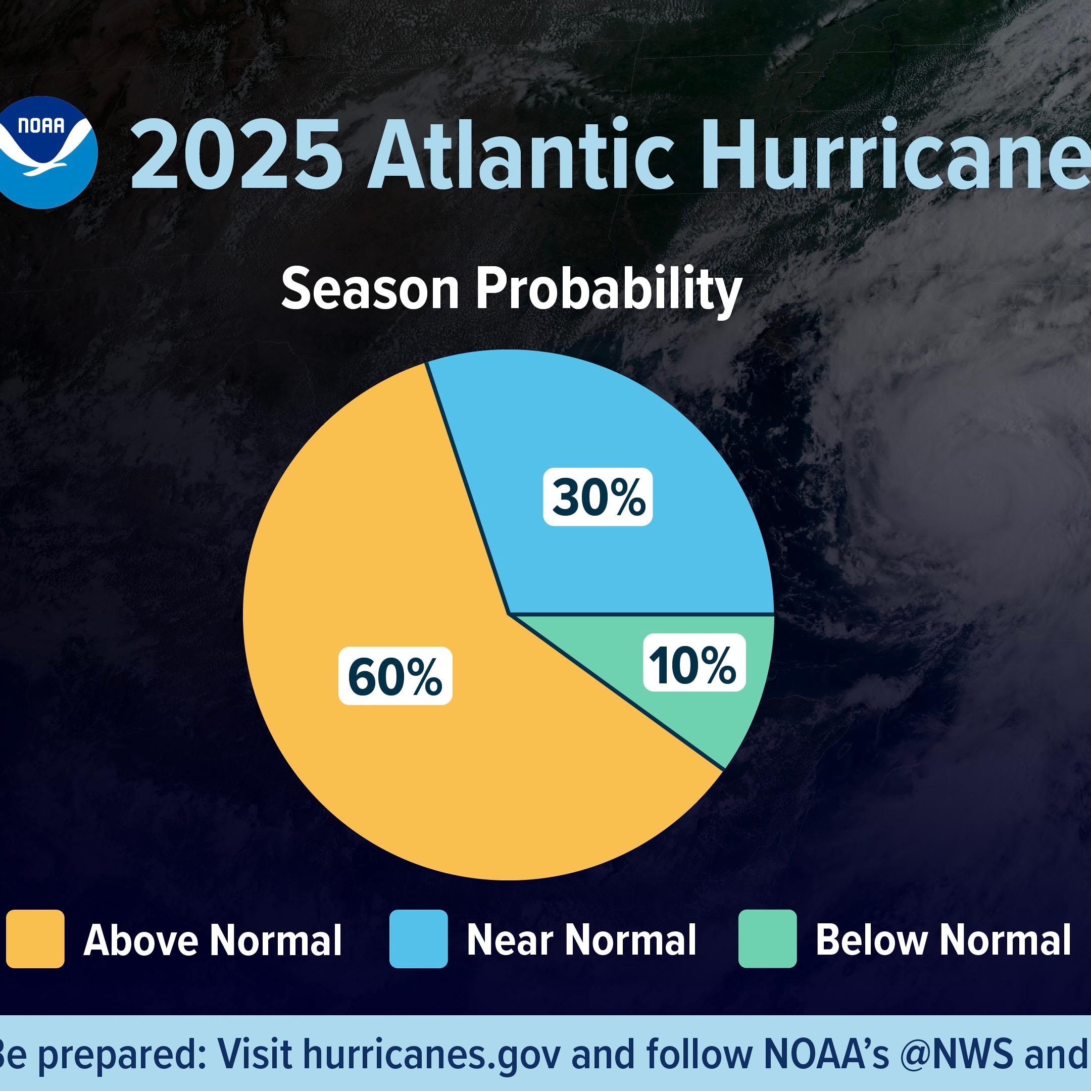
S2 Ep 1152025 Hurricane Season Forecast: Above Normal Activity Likely
Above-Normal Season Predicted:NOAA's official outlook predicts an above-normal hurricane season for the Atlantic Basin.NOAA states a "60% chance of an above-normal season, and a 30% chance of a near-normal season."Fox Weather notes that Colorado State University (CSU) also projected an above-average season in their April outlook, with specific numbers slightly higher than historical averages (17 named storms, 9 hurricanes, 4 major hurricanes).NOAA's Specific Forecast Ranges:NOAA's annual outlook predicts a range of activity:13 to 19 total named storms (winds of 39 mph or higher).6 to 10 hurricanes (winds of 74 mph or higher).3 to 5 major hurricanes (category 3, 4 or 5; with winds of 111 mph or higher).NOAA expresses "70% confidence in these ranges."This contrasts with CSU's approach of providing specific numbers, as mentioned by Fox Weather.Comparison to Average Season:An average Atlantic season sees "14 named storms, seven hurricanes and three major hurricanes," according to Fox Weather.NOAA's predicted ranges for 2025 (13-19 named storms, 6-10 hurricanes, 3-5 major hurricanes) are generally at or above these average numbers.Influencing Factors for the Outlook:ENSO-Neutral Conditions: Both sources emphasize the current ENSO-neutral phase (neither El Niño nor La Niña). Fox Weather notes that "ENSO-neutral years are notoriously difficult to predict," but NOAA states that "continued ENSO-neutral conditions" are a factor contributing to the expected above-normal season, alongside other elements.Warmer Than Average Ocean Temperatures: This is cited as a significant factor. NOAA explicitly states, "Above-average Atlantic Ocean temperatures set the stage." The NOAA press release notes "warmer than average ocean temperatures" and "high-heat content in the ocean" which "provides more energy to fuel storm development."Weaker Wind Shear: NOAA forecasts "weak wind shear," which "allow the storms to develop without disruption."West African Monsoon: NOAA mentions the "potential for higher activity from the West African Monsoon," which is "a primary starting point for Atlantic hurricanes" and can produce "tropical waves that seed some of the strongest and most long-lived Atlantic storms."Unusual Cooler Tropical Waters Compared to 2024 (Fox Weather): Fox Weather notes that tropical waters in the Main Development Region are "approximately 2 degrees Fahrenheit cooler than 2024 levels," although still "well above the long-term average." This introduces some uncertainty, though light trade winds could change this quickly.
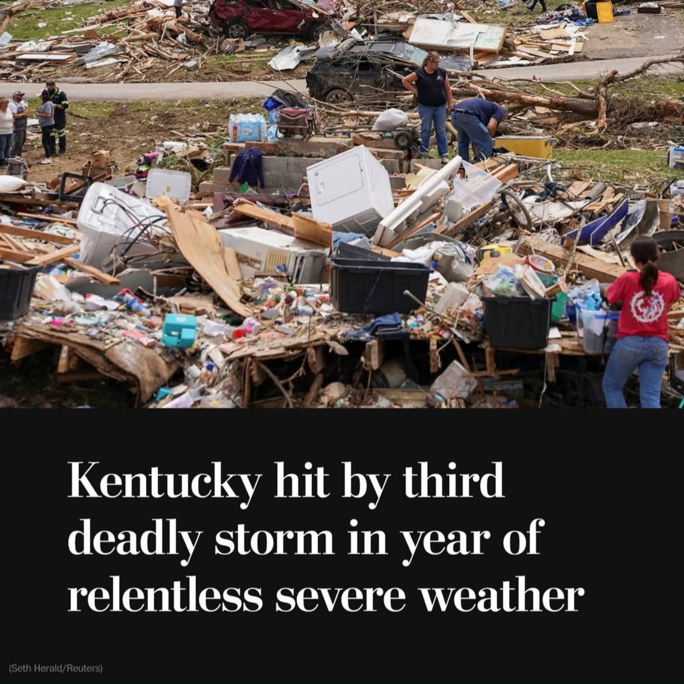
S2 Ep 114Kentucky Tornado Outbreak Amid Staffing Shortages as Severe Weather Season Continues
May 2025 (Earlier in the month): Five former directors of the National Weather Service write a "letter to the American people" expressing concern about staffing shortages and reduced resources, such as weather balloon deployments.May 15, 2025: USA TODAY publishes an article highlighting that National Weather Service offices are short-staffed following Trump administration cuts, with some offices no longer operating 24/7. The article also mentions offers for current employees to transfer to fill 155 vacant positions, including 76 meteorologist positions.May 16, 2025 (Thursday): The National Weather Service office in Jackson, Kentucky, recognizing the threat of a major severe weather outbreak, decides to fully staff the overnight shift despite being short-staffed.May 17, 2025 (Friday): A severe weather system sweeps through the central U.S., including Missouri and Kentucky.Afternoon Rush Hour (St. Louis): The path of destruction from a likely tornado begins on a major thoroughfare in St. Louis before moving east.Friday (Throughout the day): A tornado strikes several rural areas in Scott County, Missouri, killing two people and injuring several others.Friday (Throughout the day): Five people die and 38 are injured in the St. Louis area. Over 5,000 homes in the city are affected.Friday (Overnight into Saturday): A devastating tornado impacts Laurel County, Kentucky, at 11:49 p.m.May 17, 2025 (Saturday):Morning: As of Saturday morning, at least 21 people have died across Missouri and Kentucky (14 in Kentucky, 7 in Missouri). The death toll is expected to rise.Saturday: Rescue teams continue searching for survivors in damaged areas.Saturday (Throughout the day): City inspectors in St. Louis begin condemning unsafe structures.Saturday evening: Kentucky Governor Andy Beshear confirms at least 18 deaths in Kentucky and speaks at a press conference in London, Kentucky.Saturday evening: St. Louis Mayor Cara Spencer confirms five deaths in the city, over 30 injuries, and approximately 5,000 impacted buildings.Saturday night (9 p.m. to 6 a.m. Sunday): A curfew is in effect in St. Louis due to downed power lines and to protect property.May 18, 2025 (Sunday):As of Sunday, the death toll from the recent storms across multiple states exceeds two dozen.Sunday: In London, Kentucky, people whose houses were destroyed work to salvage belongings and put up tarps. Zach Wilson describes the scene at his parents' ruined home.Sunday: St. Louis Fire Chief Dennis Jenkerson warns residents to prepare for approaching weather.Sunday: The National Weather Service warns of a "multitude of hazardous weather" expected over the next several days.Sunday: City inspectors continue to assess damaged areas in St. Louis and condemn unsafe structures.Sunday: Authorities confirm two storm-related deaths in the Virginia suburbs of Washington, D.C., caused by falling trees.Sunday: The NWS Employees Union confirms that short staffing at the Jackson, Kentucky office did not affect tornado warnings for the deadly storms.Week of May 19, 2025:More severe storms are expected to roll across the central U.S.Thunderstorms are expected to develop in the afternoon and persist into the evening across parts of the Plains into the Ozarks.Another storm system is expected to pick up to the west, with strong tornadoes in the forecast for parts of the Plains by Sunday.
S2 Ep 113NOAA & NWS Hiring - Firing Chaos as Hurricane Season Approaches
January 2025: A government-wide hiring freeze begins in the United States, impacting the National Oceanic and Atmospheric Administration (NOAA) and its subsidiary, the National Weather Service (NWS).February 2025: Approximately 250 NWS employees are fired or take buyouts as part of staffing cuts.Sometime between February and May 2025: An additional 300 NWS employees depart the agency, bringing the total number of recent departures and firings to an estimated 500 out of a staff that numbered over 4,200 before President Trump's second term.Early May 2025: Five former NWS chiefs issue an open letter warning that the Trump administration's cuts could lead to "a needless loss of life" and that offices are so thinly staffed some roles will have to be filled on a part-time basis.Prior to May 14, 2025: NOAA and NWS internal documents reveal a range of open positions across the country. NOAA managers send emails pleading with employees to pursue reassignments, even if they amount to demotions, to fill these gaps. Notices are sent to employees offering to pay moving expenses for staff willing to transfer to critically understaffed offices.May 14, 2025:POLITICO first reports on Wednesday morning that NOAA posted 155 job openings at the NWS.House Democrats on the Science, Space and Technology Committee, including Rep. Zoe Lofgren and Rep. Gabe Amo, raise alarms about the staffing shortages at the NWS, warning the U.S. is ill-prepared for disasters ahead of hurricane season.At a Capitol Hill event, Rep. Zoe Lofgren states that NOAA managers are "frantically trying to fill the gaps" and there appears to be a "panic level" to undo the damage to the weather service. Tom DiLiberto, a former NOAA official, speaks at the event, expressing concern about readiness for hurricane season and highlighting the shuttering of NOAA's database of billion-dollar disasters.The Washington Post reports on the NOAA's scramble to fill forecasting jobs, noting the 155 vacancies and that some offices have stopped operating 24 hours a day due to thin staffing. The article mentions offices in California, Kansas, Kentucky, Wyoming, Michigan, Oregon, and Alaska are affected or expected to be affected by overnight closures.The Independent reports on the situation, citing CNN's report of 155 jobs the NWS is trying to fill and The Washington Post's report about offering moving expenses. The article also mentions NOAA is retiring its tool to track billion-dollar weather and climate disasters. Dr. Andrew Hazelton, a former Hurricane Hunter who lost his job in the recent layoffs, comments on the situation.May 27, 2025 (Deadline): The NWS is seeking to fill the 155 job vacancies by this date.June 1, 2025 (Official Start): The Atlantic hurricane season officially begins. Offices in Fairbanks, Alaska, are expected to have overnight closures starting on this date due to vacancies.Ongoing in 2025: NOAA staff is expected to fall by 20 percent due to retirements, deferred resignation programs, firings, and a forthcoming reduction-in-force.

S2 Ep 112Energy Star & LIHEAP Help Americans, Trump Wants them Eliminated
The Trump administration is targeting the Environmental Protection Agency's (EPA) Energy Star program for elimination as part of a broader reorganization and deregulatory effort focused on air pollution offices. This move is viewed as a significant step away from the previous administration's focus on climate change and energy efficiency. The Energy Star program, a voluntary labeling initiative for energy-efficient products, has been widely successful in saving consumers money on energy bills and reducing greenhouse gas emissions. Its potential demise raises concerns about consumer choice, the ability to identify efficient products, and the future of energy efficiency efforts in the United States. Targeting of the Energy Star Program:The core issue is the EPA's plan to eliminate its Energy Star offices as part of a reorganization. This was first reported by CNN and confirmed through agency documents reviewed by the Associated Press.The EPA's stated rationale is "delivering organizational improvements to the personnel structure that will directly benefit the American people and better advance the agency's core mission, while Powering the Great American Comeback." (AP/NPR)The plan advances President Trump's "sharp turn away from the prior administration's focus on climate change." (AP/NPR)Trump's proposed budget specifically asks Congress to eliminate the EPA's entire Atmospheric Protection Program, which houses the Energy Star offices, describing the program as "an overreach of Government authority that imposes unnecessary and radical climate change regulations on businesses and stifles economic growth." (AP/NPR)Success and Popularity of Energy Star:The program is "extraordinarily popular, saves American families about $450 annually and may go away very soon." (The Washington Post)An estimated 90 percent of the public is aware of the Energy Star label. (The New York Times, The Washington Post)Since its start in 1992, the program has reduced energy costs by "more than $500 billion and prevented about 4 billion metric tons of planet-warming greenhouse gas emissions." (AP/NPR, The Washington Post, Canary Media)For every dollar the federal government spends on the program, consumers save an estimated $350. (Canary Media)Energy Star has enjoyed bipartisan support until recently. (Steven Nadel, ACEEE, AP/NPR)It has motivated manufacturers to improve the efficiency of their appliances, with Energy Star-certified appliances now dominating many market segments (e.g., 96% of dishwashers). (The Washington Post)Impact of Energy Star's Potential Elimination:Losing Energy Star will make it "harder for consumers to have trustworthy information about products' energy use." (Sarah Gleeson, Project Drawdown, AP/NPR)Consumers will "have to pay more and work harder to identify which appliances will use the least energy and save the most money." (The Washington Post)Broader "All-Out War on Energy Efficiency":The targeting of Energy Star is part of a wider assault on American energy efficiency efforts. (Canary Media)Other programs under threat include the Low Income Home Energy Assistance Program (LIHEAP), which provides financial support to vulnerable households for utility costs and weatherization. The administration has fired staff and proposed eliminating the program. (Canary Media)The administration is also targeting efficiency standards for appliances, building codes, and federal buildings, arguing they result in more expensive and less effective products and deny consumer choice. (AP/NPR, Canary Media)
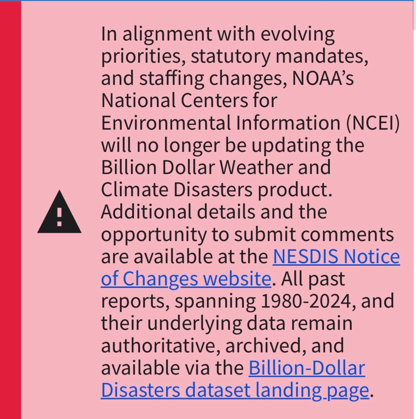
S2 Ep 111NOAA Extreme Weather Database Shutdown after 45 Years
Administration Actions on Climate Science and DataDate: May 9, 2025Recent actions by the Trump administration have significantly impacted climate science and data collection efforts in the United States. The administration has dismissed a large number of scientists working on the congressionally mandated National Climate Assessment and ended the public database tracking the cost of billion-dollar weather and climate disasters. These actions are seen by critics as part of a broader effort to downplay the impacts of climate change and limit public access to relevant data, potentially hindering preparedness and understanding of climate risks.Key Themes and Important Ideas:Dismantling of Climate Assessment Infrastructure: The Trump administration dismissed nearly 400 scientists involved in the preparation of the 6th National Climate Assessment (NCA). This report, produced every four years and mandated by the Global Change Research Act of 1990, is crucial for informing federal, state, local, and private sector responses to climate change. The dismissal of such a large number of experts suggests the next NCA "may not be as extensive as the previous ones."Impacting Public Access to Climate Data: The National Oceanic and Atmospheric Administration (NOAA) has retired its "billion-dollar weather and climate disasters" database, which has tracked the cost of extreme weather events since 1980. This database was a unique resource, drawing on proprietary and non-public data sources. Its discontinuation makes it "next to impossible for the public to track the cost of extreme weather and climate events" and replicate damage trend analyses, hindering understanding of the increasing financial burden of these events.Broader Cuts to Climate-Related Programs and Agencies: The termination of the disaster database and the dismissal of scientists are part of broader staffing reductions and funding cuts within NOAA and other federal agencies involved in climate research. The administration's budget proposal for fiscal year 2026 includes a "24% cut" to NOAA's spending compared to 2025, with plans to potentially "eliminate its research division and clos[e] its weather and climate labs."Controversy and Concerns over Motivation: Critics view these actions as a deliberate effort by the Trump administration to undermine climate science and limit public awareness of its impacts. The article notes that the administration "has been laser-focused on killing programs and departments that are associated with 'climate,' whether they are actually tracking global warming and its e`ects or not."Efforts to Preserve and Disseminate Scientific Work: In response to the dismissal of scientists from the NCA, two scientific groups, the American Geophysical Union and the American Meteorological Society, have announced plans to publish a special collection of climate scientists' work. While not intended to replace the NCA, this collection aims to "ensure the scientists' work can be accessed."Supporting Quotes:On the dismissal of scientists from the NCA: "After the Trump administration dismissed nearly 400 scientists who compile the nation's major quadrennial report on the impacts of climate change in the U.S., two scienti!c groups announced a plan to publish a special collection focused on the subject to ensure the scientists' work can be accessed." (CBS News, "After Trump dismisses hundreds of scientists...")
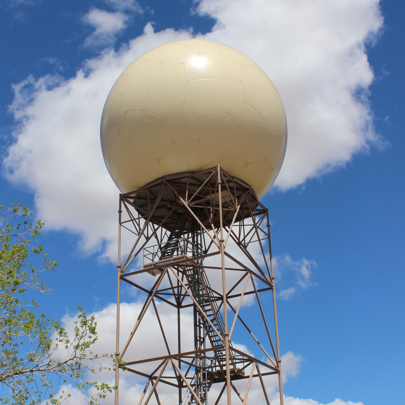
S2 Ep 110Terrorist Group Threatens to Destroy NOAA Weather Radar
What is a WSR-88D radar and what does it do?The WSR-88D, or Weather Surveillance Doppler Radar, is an advanced radar system used by the National Weather Service (NWS) to detect weather phenomena. It transmits a powerful beam of energy and listens for the scattered energy that bounces back from objects in the atmosphere, such as raindrops, snowflakes, hail, dust, birds, and even insects. By analyzing the returned signal's strength, the time it took to travel, and its phase shift, the radar can gather information about precipitation and wind speed. This allows meteorologists to track storms, identify potential hazards like tornadoes, and issue timely warnings. The WSR-88D system has been in operational use since the 1990s across the United States and its territories.How does the Doppler effect relate to the WSR-88D radar?The WSR-88D is a Doppler radar because it utilizes the Doppler effect. This effect, named after Christian Doppler, describes the change in frequency of a wave in relation to an observer who is moving relative to the wave source. In the case of the radar, the radar beam is the wave, and objects in the atmosphere (like raindrops) are the wave sources reflecting the signal. As these objects move towards or away from the radar, the phase (or frequency) of the reflected signal changes. The radar's computers measure this phase change and convert it into a velocity, indicating whether the object is moving towards or away from the radar and at what speed. This ability to "see" wind motion is crucial for detecting the rotation within thunderstorms that can lead to tornadoes.Is everything seen on a WSR-88D radar image actual precipitation?No, not everything displayed on a WSR-88D radar image represents precipitation. While the radar is designed to detect precipitation, it can also pick up signals from other objects. Common non-precipitation echoes include "ground clutter" from the earth's surface or buildings near the radar, "anomalous propagation" (AP) when the radar beam bends towards the ground, "sea return" from ocean waves, and returns from biological targets like migrating birds and insects. Aircraft also appear as "point targets." While automated systems attempt to filter out some of these non-precipitation echoes, especially in products like precipitation accumulation, awareness of the general weather situation helps users differentiate between precipitation and other targets.What recent security threats have been directed towards NWS weather radars?Recent internal emails from the National Oceanic and Atmospheric Administration's (NOAA) security office indicate that National Weather Service offices are on guard due to threats targeting Doppler weather radars. A group identified as Veterans on Patrol, described as an anti-government militia organization, views these radars as "weather weapons." This group has advocated for conducting "penetration drills" on radar sites to identify weaknesses for potential destruction. While the specific beliefs of the group regarding the radars' function as "weather weapons" are unclear, the threats are being taken seriously by NOAA, and law enforcement agencies like the FBI are reportedly aware and tracking the situation. These threats coincide with staffing shortages at the NWS, particularly concerning radar maintenance technicians.

S2 Ep 109Earth Day Under the Trump Regime
Frequently Asked Questions on Earth Day Amidst Trump Administration Policies1. What is the primary focus of Earth Day protests and activities in 2025, according to these sources? This year's Earth Day activities are largely focused on resisting the environmental policies and actions of the Trump administration, which are characterized as an assault on environmental protections and a "war on the planet." Organizers are uniting with pro-democracy and social justice groups to demand the right to live free and healthy lives, linking environmental concerns with issues like immigration and social welfare, all seen as under threat by the current administration's agenda.2. What are some of the specific environmental policy changes and actions undertaken by the Trump administration that are generating concern and prompting protests? The Trump administration has reportedly moved rapidly to dismantle federal offices overseeing clean air, drinking water, national parks, conservation, climate-smart farming, and environmental justice. This includes pushing through mass layoffs at key environmental agencies like the EPA, FEMA, the National Weather Service, and the Forest Service. Furthermore, the administration has rolled back regulatory standards for polluting industries, granted exemptions to air pollution standards for coal plants, halted clean energy projects like offshore wind farms, and taken steps to block state-level environmental regulations.3. How is the Trump administration impacting climate change efforts and international agreements like the Paris Agreement? The Trump administration is actively undermining climate change efforts by promoting fossil fuels, denying climate change as a serious emergency, and pulling the U.S. out of the Paris Agreement for a second time. It is also attempting to block states from enforcing their own climate-related laws and is reportedly dismantling programs that monitor carbon emissions and climate data. These actions are seen as exacerbating global warming and isolating the U.S. from the international community's efforts to combat climate change.4. Beyond policy changes, what other actions by the Trump administration are concerning environmental advocates? Environmental advocates are also concerned about the administration's alleged pressure on universities through research grant funding, the elimination of USAID and its international conservation programs, and the potential stripping of tax-exempt status from climate nonprofits. Additionally, the administration's reported dismissal of staff overseeing critical programs like the Low-Income Home Energy Assistance Program (LIHEAP) and cuts to foreign aid for starving children are raising alarms.5. What role does Elon Musk and Tesla play in the environmental concerns highlighted in these sources? Elon Musk, as a billionaire megadonor to Trump and a board member of Tesla, is facing scrutiny. Tesla has faced allegations of air and water pollution around its factories. Organizers view the "Trump/Musk regime" as a major threat to a safe planet. Furthermore, Musk's leadership of DOGE (Department of Government Efficiency) is associated with the rapid dismantling of government programs, including those related to environmental protection and foreign aid.

S2 Ep 108Pope Francis Manifesto on Earth Facing Danger
Laudato Si’ - On Care for Our Common HomeEvery person living on this planet, addressing Catholics, other Christian communities, other religions, scientists, philosophers, theologians, and civic groups.Purpose: To enter into dialogue with all people about our common home and the global environmental deterioration, highlighting the interconnectedness of ecological and social issues and calling for an "integral ecology."Key Themes and Most Important Ideas/Facts:The encyclical "Laudato Si’" is a comprehensive call to action regarding the environmental crisis, framing it as a profound moral and spiritual challenge. It moves beyond simply discussing environmental issues to explore the deep human roots of the crisis and propose solutions grounded in faith, ethics, and a renewed relationship with creation and one another.1. Our Common Home is Like a Sister and Mother:The encyclical begins by referencing St. Francis of Assisi's "Canticle of the Creatures," emphasizing a relationship of kinship with the Earth. The Earth is not merely an object for human use, but a living entity with whom we share our lives.Quote: "“Laudato si’, mi’ Signore” – “Praise be to you, my Lord”. In the words of this beautiful canticle, Saint Francis of Assisi reminds us that our common home is like a sister with whom we share our life and a beautiful mother who opens her arms to embrace us." (3)Key Idea: This perspective challenges the view of humanity as lords and masters entitled to exploit the Earth at will. (2)2. The Earth Cries Out Due to Human Harm:The current environmental crisis is directly attributed to "irresponsible use and abuse of the goods with which God has endowed her." This harm is seen as a reflection of "the violence present in our hearts, wounded by sin."Quote: "This sister now cries out to us because of the harm we have inflicted on her by our irre-sponsible use and abuse of the goods with which God has endowed her. We have come to see ourselves as her lords and masters, entitled to plunder her at will." (2)Key Idea: The symptoms of this sickness are evident in the soil, water, air, and all forms of life, leading the Earth to "groan in travail." (2)3. The Need for Dialogue and Global Consensus:Pope Francis calls for a global dialogue on our common home, addressing every person on the planet. He acknowledges that the concerns he raises echo the reflections of various experts and religious traditions.Key Idea: Addressing the profound environmental and social problems requires a global consensus, as unilateral actions are insufficient. (164)4. The Interconnectedness of Environmental and Social Issues (Integral Ecology):A central concept is "integral ecology," which recognizes the inseparable bond between concern for nature, justice for the poor, commitment to society, and interior peace. Environmental degradation and social inequality are seen as linked.5. Critique of the Technocratic Paradigm and Unlimited Growth:The encyclical critiques the dominant technocratic paradigm, which views reality as something to be manipulated and controlled for human benefit, often ignoring the inherent value of creation and leading to a false notion of unlimited growth.
S2 Ep 107Where Does Hurricane Debris Go? WaPo Tracked Some with AirTags
Hurricanes Helene and Milton (Fall 2024 - April 2025)Fall 2024:Hurricanes Helene and Milton Strike: Treasure Island, Florida, experiences two significant hurricanes within a short period. Hurricane Helene's storm surge causes waist-high flooding, and Hurricane Milton strikes two weeks later, compounding the damage.Massive Debris Generation: The 1.54-square-mile Treasure Island generates over 128,000 cubic yards of debris (approximately 2 million kitchen trash bags).Waste Piles Up: Furniture, appliances, and personal belongings are dumped onto the streets of Treasure Island.Air Tag Deployment: Reporters from The Washington Post place Apple Air Tags on 10 discarded items from businesses and residences to track their journey.Office Chair Disposal (Paradise Spa): Corey Mendel, owner of Paradise Spa, discards all items from his business due to Category 3 "black water" contamination. His Avis Acadia office chair is tagged with an Air Tag.Motorized Scooter Damage (Frank Andolino): Frank Andolino's 2022 Genuine Scooter RoughHouse 50 is inundated with corrosive seawater and deemed unusable. His insurance company agrees to replace it.Satellite Receiver Disposal (Isle of Palms Resident): A DirecTV Commercial HD Satellite Receiver is discarded by a resident on the Isle of Palms after being damaged by seawater. It is tagged with an Air Tag.Scooter Towed: The insurance company tows Frank Andolino's damaged scooter to a Copart auto auctions lot in Clewiston, Florida.Office Chair at Solid Waste Facility: After more than 40 days in the spa's parking lot, the Air Tag on Corey Mendel's office chair shows its arrival at the Pinellas County Solid Waste Disposal Complex on November 5, 2024.Scooter Auctioned: Frank Andolino's scooter is put up for auction at Copart and is eventually sold.Scooter at Trademark Metals Recycling: On November 1, 2024, Andolino's scooter moves west to Trademark Metals Recycling in Fort Myers.Satellite Receiver Pick-up: Around October 28, 2024 (approximately two weeks after tagging), the satellite receiver is picked up and delivered to the Treasure Island Community Center Park, a designated temporary dumping ground.Late 2024 - Early 2025:Intensive Debris Removal: Two professional hauling companies work around the clock for nearly 50 days to remove 7,000 truckloads of trash from Treasure Island.Processing at Solid Waste Complex: The Pinellas County Solid Waste Disposal Complex continues to accept normal municipal waste but states they did not knowingly accept storm debris.Scrap Metal Recycling: Trademark Metals Recycling experiences an uptick in business, processing hurricane-related scrap metal, including appliances and vehicles. Toxic materials are removed before shredding. Ferrous metals (including likely components of the scooter) are separated.Ferrous Metal to Nucor Steel Mill: The ferrous components from items like the scooter are trucked to the Nucor steel mill in Frostproof, Florida, where they are melted down to create rebar.Satellite Receiver Relocation: Four days after arriving at the Treasure Island Community Center Park, the satellite receiver is moved to Largo Recycled Aggregates, a collection facility owned by GFL Environmental Inc. The Air Tag's signal stops here.
S2 Ep 106Bloodbath Continues at NOAA and the National Weather Service
Bloodbath Continues at NOAA and the National Weather ServiceAmidst the ramping up of severe storm season in 2025, the National Weather Service is facing significant staff reductions due to federal buyouts, potentially leaving many forecast offices critically understaffed. This situation is compounded by proposed budget cuts to NOAA, which could eliminate its research division, jeopardizing the scientific foundation for weather forecasting and warnings. Experts warn that these cuts and staff shortages could severely undermine the accuracy and effectiveness of weather predictions, posing a threat to public safety and economic stability. The loss of research capabilities would hinder the development and maintenance of crucial technologies like Doppler radar and weather models. Consequently, both the operational capacity of the NWS and its long-term ability to provide reliable weather information are under threat. Organizations are urging action to prevent these potentially disastrous outcomes.
S2 Ep 105Australia’s Impacts from Severe Tropical Cyclone Errol
Tuesday, April 15, 2025:Night (AWST): Tropical Cyclone Errol forms to the north of Western Australia (WA).Wednesday, April 16, 2025:Early Thursday (AWST): Errol strengthens to a tropical cyclone in the Indian Ocean, according to the Joint Typhoon Warning Center (JTWC).8:00 AM AWST: Errol is a category two tropical cyclone located roughly 515 km to the north northwest of Broome, moving west.Wednesday Afternoon (AWST): Errol intensifies into a category three severe tropical cyclone. Its center has winds reaching 150 kilometers per hour.During the day (AWST): Satellite imagery shows Errol with an approximately 8 nautical mile wide eye surrounded by a solid central dense overcast. The eye temperature is a positive 15°C.By 2:00 PM AWST: Satellite data indicates a symmetrical eye, suggesting the storm is not encountering weakening factors.Afternoon/Evening (AWST): Errol undergoes an amazing period of extreme rapid intensification, intensifying 85 knots in the last 24 hours and more than 50 knots in the last 12 hours.Between approximately 7:41 AM and 8:05 AM UTC (equivalent to afternoon AWST): Microwave passes suggest Errol completed a rapid eyewall replacement cycle (ERC).By 15:00 UTC (11:00 PM AWST): JTWC's initial position assessment places Errol at 14.4S 118.9E, about 283 nautical miles northwest of Broome, Australia, with an initial intensity of 140 knots (approximately 161 mph). Significant wave height is 47 feet. Errol is moving southwestward at 4 knots. JTWC assesses that Errol has likely reached its peak intensity.19:27 UTC (Early Thursday morning AWST, April 17th): The Australian Bureau of Meteorology (BOM) issues Tropical Cyclone Technical Bulletin 1, identifying Severe Tropical Cyclone Errol (Category 4 equivalent based on 10-minute winds of 100 knots/185 km/h and 3-second gusts of 140 knots/260 km/h). Its location is 14.7S 118.8E, moving south at 4 knots. Central pressure is 946 hPa. BOM notes the eye is showing some weakening and cloud top warming to the northeast of the center, indicating peak intensity has likely been reached. They forecast weakening as Errol approaches the west Kimberley coast.Thursday, April 17, 2025:By Thursday Morning (AWST): Forecast models suggest Errol could briefly intensify into a category 4 system (Australian scale).Thursday (AWST): Errol is expected to make a left-hand (eastward) turn and start moving towards WA’s Kimberley coast.Throughout the day (AWST): Increasing vertical wind shear and dry air intrusion are expected to become less favorable for Errol to maintain its strength after it turns south.Friday, April 18, 2025:Errol is expected to weaken as it approaches the Kimberley coast.A tropical cyclone watch is expected to be issued for gale force winds to develop in 48 hours for the exposed islands of the Kimberley coast (Friday night or early Saturday).Isolated heavy rainfall could develop between Kuri Bay and Broome overnight and persist during Saturday morning as Errol moves closer.Saturday, April 19, 2025:Errol is most likely to make landfall as a tropical low (below tropical cyclone strength) this weekend, potentially on Saturday morning near Cape Leveque or Cockatoo Island.Damaging winds could extend southwards from Beagle Bay to Broome depending on the track

S2 Ep 104The Abrego Garcia Constitutional Crisis
Timeline of EventsApproximately 2019: Abrego Garcia is arrested while looking for work at a Home Depot in Maryland. An immigration judge initially orders his deportation.Later Immigration Proceedings (Date unspecified): An immigration judge ultimately determines that Abrego Garcia should not be deported to El Salvador due to potential persecution, issuing a "withholding from removal" order.Recently Before March 15, 2025: Federal immigration agents pull over Abrego Garcia, falsely accuse him of MS-13 membership, and incorrectly tell him his protected status has changed.March 15, 2025: Kilmar Armando Abrego Garcia is deported to El Salvador and sent to the Centro de Confinamiento del Terrorismo (CECOT), a notorious Salvadoran prison, along with scores of other migrants (Salvadoran and Venezuelan). The Trump administration later acknowledges this deportation was initially an error.Sometime After March 15, 2025: Abrego Garcia's family sues the U.S. government, claiming wrongful deportation.Week of April 7-11, 2025 (Implied): A federal district court judge (Paula Xinis) orders the Trump administration to "facilitate" Abrego Garcia's return to the U.S.Week of April 7-11, 2025 (Implied): A federal appeals court agrees with Judge Xinis, likening Abrego Garcia's removal to a kidnapping.Week of April 7-11, 2025 (Implied): The Supreme Court weighs in, endorsing the view that the administration needs to "facilitate" Abrego Garcia's return but stops short of ordering it.Shortly Before April 14, 2025: President Trump, on Truth Social, claims that the fate of the deported migrants is in the hands of El Salvador's President Nayib Bukele, as they are in El Salvador's sole custody.Monday, April 14, 2025: President Trump holds an Oval Office news conference with El Salvador's President Nayib Bukele. Trump states he is "powerless" to seek Abrego Garcia's freedom, deferring to Attorney General Pam Bondi. Bondi states it's up to El Salvador to return him, and the U.S. would only "facilitate" by providing a plane if El Salvador agreed. Bukele calls Abrego Garcia a "terrorist" and dismisses the idea of returning him as "preposterous."Monday, April 14, 2025: Trump's advisor Stephen Miller claims on Fox News that the acknowledgment of wrongful deportation was by a "saboteur" and that Abrego Garcia was "rightfully sent to the right place."Monday, April 14, 2025: Secretary of State Marco Rubio, during the Oval Office meeting, states that no U.S. court has the right to conduct U.S. foreign policy.Monday, April 14, 2025: Senator Chris Van Hollen announces he will travel to El Salvador on Wednesday to check on Abrego Garcia and discuss his release.Tuesday, April 15, 2025: A hearing is held in Federal District Court in Maryland before Judge Paula Xinis. She scolds the Trump administration for not complying with the Supreme Court order and for "dragging its feet."Tuesday, April 15, 2025: Judge Xinis states her intention to force Trump officials to reveal their efforts to secure Abrego Garcia's return through written questions and depositions. She sets a fast schedule for this process, including allowing Abrego Garcia's lawyers to make document requests and depose administration officials.Tuesday, April 15, 2025: Justice Department lawyer Drew Ensign argues that the administration interprets "facilitate" to mean removing domestic obstacles to Abrego Garcia's return if he presents himself at a port of entry.
S2 Ep 103Florida Follows Trump: Changes Name of Gulf of Mexico to Display American Exceptionalism
Timeline of EventsPrior to March 24, 2025: Former President Donald Trump issues an executive order titled "Restoring Names That Honor American Greatness," which includes renaming the Gulf of Mexico to the Gulf of America and Denali back to Mount McKinley.By March 24, 2025: The Florida Legislature is considering a bill to change signage from "Gulf of Mexico" to "Gulf of America." Senator Joe Gruters' bill initially directs the Department of Transportation to rename the Tamiami Trail to the "Gulf of America Trail" and erect suitable markers. A staff report on March 10 indicates that the costs for complying with the bill's requirements for state and local governmental entities are unknown.Mid-March 2025 (Implied): The Republican-controlled Florida House and Senate pass bills (HB 575 and HB 549) to rename the Gulf of Mexico to the Gulf of America in state law and require state agencies and school districts to update "geographic materials" and instructional materials accordingly. Senator Gruters withdraws the provision to rename the Tamiami Trail after public outcry. He indicates that the changes in instructional materials will occur gradually as new materials are purchased.April 14, 2025: Florida Governor Ron DeSantis signs two bills (HB 575 and HB 549) into law. These bills officially rename the Gulf of Mexico to the Gulf of America in Florida state law and public school textbooks. The change will be reflected in new instructional materials purchased after July 1, 2025. Senators Nick DiCeglie and Joe Gruters attend the signing ceremony in the governor's office and express pride in following President Trump's leadership and emphasizing American greatness. Noticeably absent from the bill signing are members of the Florida House, reflecting ongoing tensions with the governor.After July 1, 2025: State agencies and school districts in Florida will begin adopting and acquiring new "geographic materials" and instructional materials (like textbooks and media center additions) that refer to the body of water as the Gulf of America.
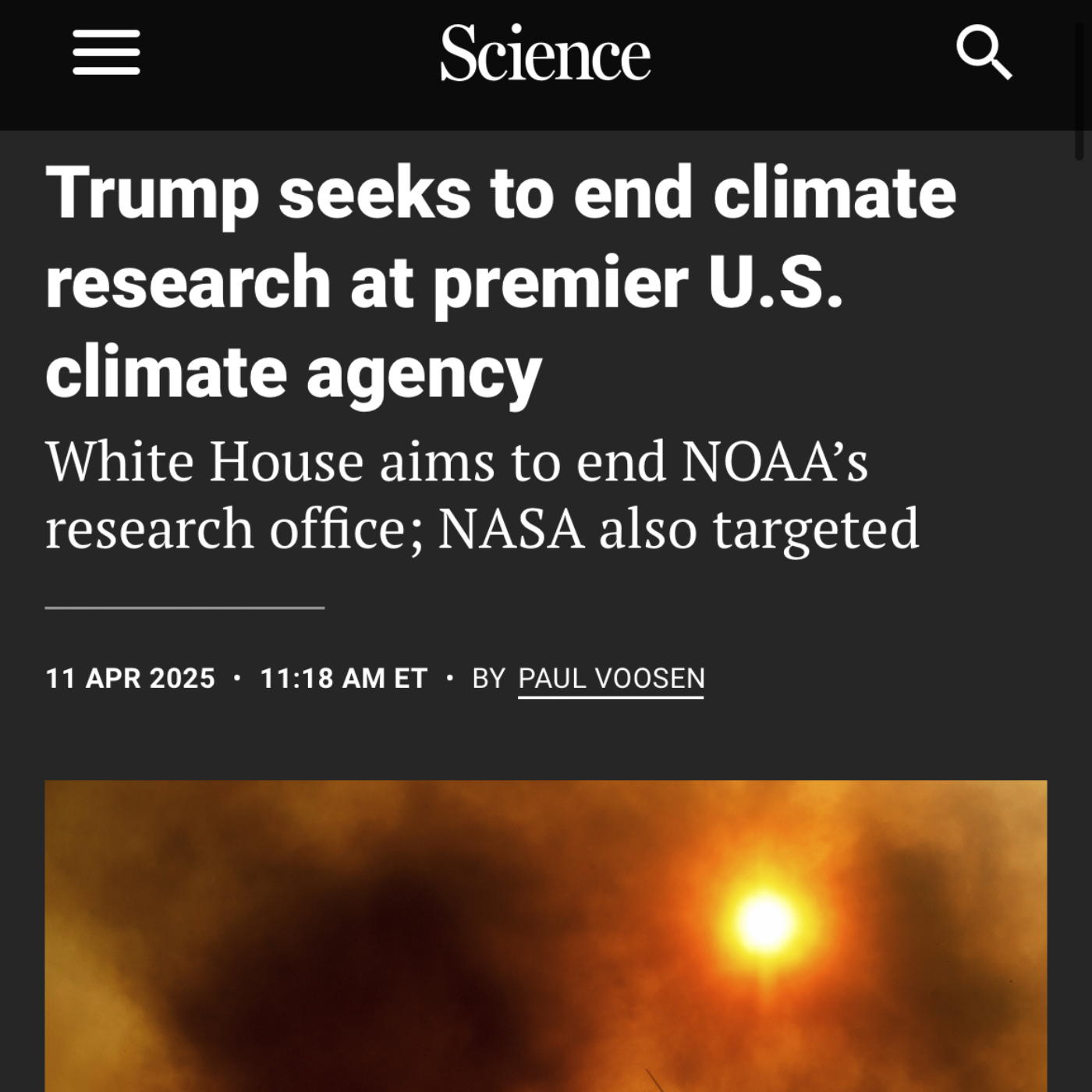
S2 Ep 102Climate Anxiety? Trump’s Solution: STOP Research
Timeline of Main EventsFebruary 2025: The Trump administration initially fires more than 800 probationary workers at NOAA.March 2025: A federal court blocks the Trump administration's initial firing of NOAA workers, and they are reinstated.March 2025 (Late): The Trump administration begins cutting and withholding federal grants for several major universities, starting with $400 million in funding pulled from Columbia University. This is followed by a pause of $175 million in funding to the University of Pennsylvania and a review of roughly $9 billion in federal grants and contracts to Harvard.April 8, 2025: News reports about President Trump's NASA pick and their hearing for a top spot within the agency emerge.April 9, 2025: The Trump administration announces it is cutting nearly $4 million in federal funding for climate change research at Princeton University, citing "exaggerated and implausible climate threats" and increased "climate anxiety." This cut impacts the Cooperative Institute for Modeling the Earth System, a collaboration between NOAA and Princeton.April 10, 2025: The Trump administration informs NOAA workers that they are being fired again, following an appeals court overturning the earlier ruling that had blocked the terminations. This affects hundreds of climate and weather specialists.April 11, 2025:News breaks about President Trump's preliminary budget proposal to Congress, known as a "passback," which would cut NASA's science budget by nearly half.Details emerge that the proposed NASA cuts would severely impact astrophysics, heliophysics, Earth science, and planetary science, potentially terminating missions like the next major space telescope (including the Nancy Grace Roman Space Telescope) and the Mars Sample Return mission. The Hubble and Webb telescopes would remain supported.An internal budget document reveals the Trump administration's aim to end nearly all climate research conducted by NOAA. This includes eliminating NOAA's climate research centers, cutting hundreds of federal and academic climate scientists, and slashing funding for the Office of Oceanic and Atmospheric Research (OAR).The proposed NOAA budget cuts would also impact competitive climate research grants, regional climate data collection, the National Oceanographic Partnership Program, college and aquaculture sea grant programs, the National Ocean Service, and the National Marine Fisheries Service.NOAA forecasters declare the end of La Niña.
S2 Ep 101American Brain Drain Amid Scientific Hostility & Slashed Spending
The recent changes in the US research and political landscape, particularly following the new administration of President Donald Trump, are having a profound negative impact on the US scientific and medical communities. Drastic cuts to research funding, widespread layoffs of federal scientists, immigration crackdowns, and concerns over academic freedom are leading to a significant exodus of talent from the United States. This briefing document outlines the main themes and important facts from the provided sources, highlighting the distress and uncertainty within these sectors and the increasing interest among US scientists and doctors in relocating to countries like Europe and Canada.Key Themes and Findings:1. Mass Exodus of Scientists Driven by Funding Cuts and Uncertainty:A Nature poll revealed that 75% of US scientists who responded (over 1,200 out of 1,600) are considering leaving the United States following the disruptions prompted by the Trump administration."More than 1,200 scientists who responded to a Nature poll — three-quarters of the total respondents — are considering leaving the United States following the disruptions prompted by Trump." (Nature News)This trend is particularly strong among early-career researchers, with a large majority of postgraduate researchers (548 out of 690) and PhD students (255 out of 340) considering leaving.The primary drivers for this consideration are slashed research funding due to a government-wide cost-cutting initiative led by Elon Musk, and the halting of broad swathes of federally funded science."Trump’s administration has slashed research funding and halted broad swathes of federally funded science, under a government-wide cost-cutting initiative led by billionaire Elon Musk." (Nature News)Tens of thousands of federal employees, including many scientists, have been fired and rehired following a court order, creating further instability and fear of future job losses.Researchers are experiencing uncertainty and disruption across all aspects of the US research enterprise due to immigration crackdowns and battles over academic freedom.

S2 Ep 100Trump Nazi Bullshit at EPA, FEMA & NOAA
outlines the critical situation surrounding the Federal Emergency Management Agency (FEMA) as the Trump administration actively pursues its dismantling. This development coincides with a significant increase in climate-related major disaster declarations in the United States, reaching a near-record high in 2024. The turmoil within FEMA, including stalled funding, hiring freezes, and a planned reduction in force, threatens the agency's ability to effectively respond to the growing frequency and intensity of natural disasters. Experts warn that shifting disaster response responsibilities primarily to states, while simultaneously weakening FEMA, could have severe consequences for communities across the nation.Main Themes and Important Ideas/Facts:1. Trump Administration's Intent to Eliminate or Fundamentally Reform FEMA:Homeland Security Secretary Kristi Noem has vowed to "eliminate FEMA," and top officials from FEMA and DHS have met to discuss options for shutting down the agency.There are discussions about moving more quickly to dismantle FEMA instead of following President Trump's executive order establishing a FEMA Review Council.President Trump stated his desire to "begin the process of fundamentally reforming and overhauling FEMA, or maybe getting rid of FEMA."An executive order has been signed outlining the desire to shift more disaster response and recovery responsibility to the states.2. Current Turmoil and Stalled Operations Within FEMA:FEMA is already in turmoil, with disaster assistance, grant money, and hiring largely stalled.Hurricane planning for the upcoming season has been paused: "March is typically when we’re finalizing hurricane plans. A lot of that got paused,” a FEMA official told CNN. “So, it’s already having an impact, which is that we’re not preparing.”A new hiring process requires direct approval from Secretary Noem's team for renewing the terms of many of the agency's workers, including those in public-facing roles critical for disaster response and recovery. These impacted positions include CORE, Reservists, Local Hires, and Temporary Fulltime Employees, which constitute roughly 74% of FEMA's workforce."I think their terms will be allowed to expire, and they won’t be renewed," a FEMA official stated.Over $100 billion in previously awarded grant money and disaster assistance was frozen due to a lack of guidance on adhering to Trump's executive orders restricting funding for immigration programs and sanctuary cities. While guidance has since been issued, concerns about disruptions persist.Nearly all FEMA payments outside of individual disaster assistance have been paused, impacting states, localities, and nonprofits, including fire departments and disaster recovery efforts.The firing of four FEMA employees, including the chief financial officer, for approving grant money to New York City to help shelter migrants has had a "chilling effect" on FEMA workers, with fears of job loss for misconstrued payments.A hiring freeze is in place, and Acting Administrator Cameron Hamilton submitted a plan to Secretary Noem for reducing FEMA's workforce, aiming to "reduce the agency’s staffing posture through unification of like-functions and with care that enhances our ability to deliver the mission, examines our geographic footprint, and rebalances federal and state roles in disaster preparedness, response and recovery."