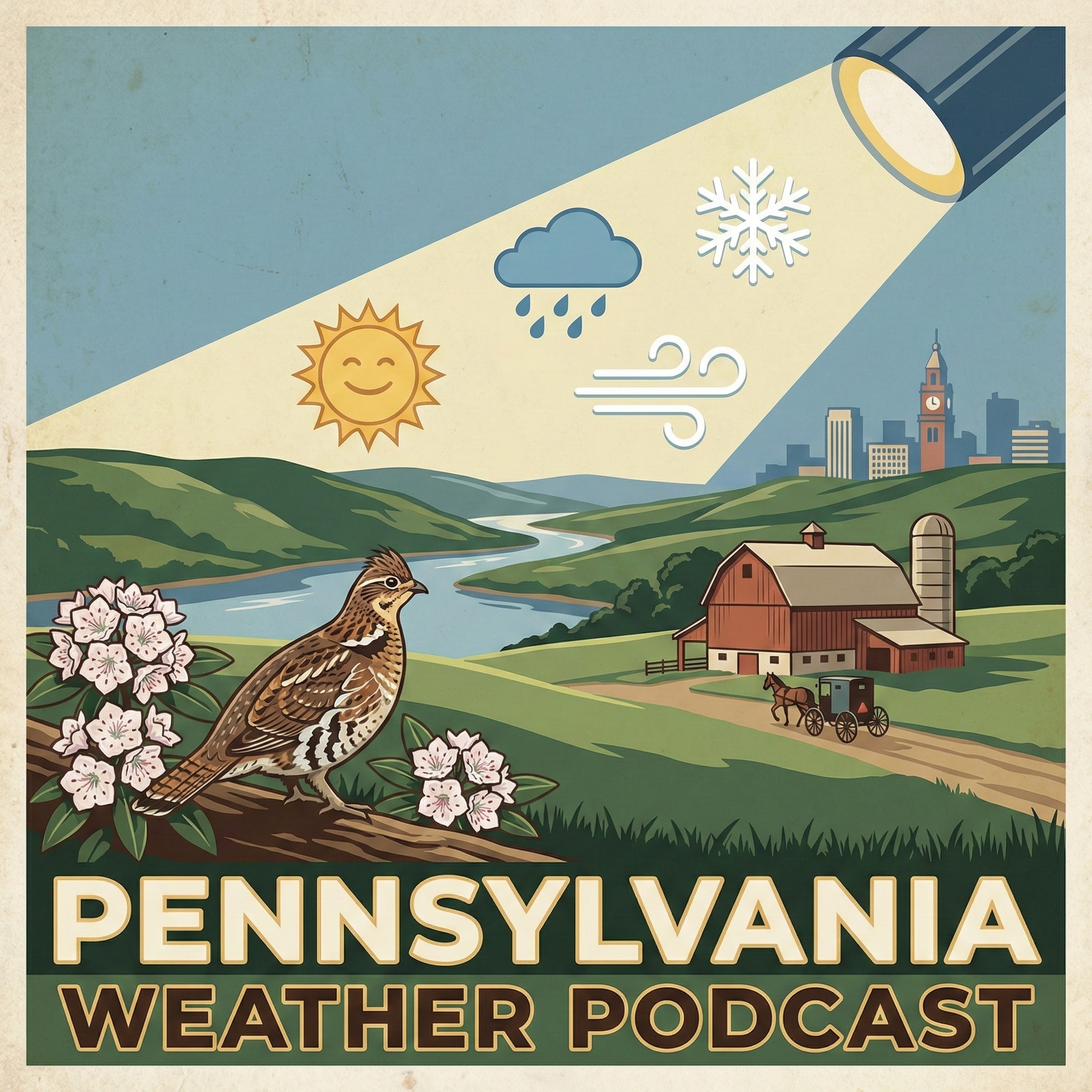
The Pennsylvania Weather Podcast
231 episodes — Page 5 of 5
Pennsylvania Weather March 3 Midday - Winter Weather Advisory
Good afternoon. Pennsylvania. I'm Jack O'Malley. Folks, winter just handed in its resignation letter. That fog clinging to your windshield right now? That's a warm front muscling its way north, sliding over cold air still hugging the ground. And where warm meets cold. Things get messy. In the next 24 hours. Up in Carbon and Monroe counties, that collision is producing freezing rain. A Winter Weather Advisory runs until 10 P.M. Tonight. Bridges and overpasses are slick. If you're driving the Poconos, slow down. That ice doesn't care about your four wheel drive. The rest of the state is wrapped in fog so thick you could lose your neighbor's house. Visibility drops to a quarter mile in spots. Rain spreads everywhere this evening, peaking between 7 and 10 P.M., then fading after midnight. Now let me walk you through the regions. Southeast PA sits around 39 degrees. Rain and fog tonight. And the temperature barely budges. Tomorrow climbs to 55 with maybe a stray shower. Over in Western PA, you're already warmer at 44 degrees. Rain wraps up by 2 A.M. and Wednesday pushes to 56. Central PA is the cool kid at 37 degrees. Fog and showers tonight, then tomorrow reaches 53. Here's where it gets exciting. Wednesday and Thursday bring more rain. And honestly, we need every drop. This has been one of the driest winters on record. Then Friday. Spring crashes the party. Low 60s in the southeast. Saturday? Upper 60s, flirting with 70 statewide. Sunday and Monday hold steady in the upper 60s. We're gaining two minutes of daylight every day now. Sunset's already pushed to 5:55. And tonight's full moon? Good luck spotting it behind all that fog. Charge your phone before you head out tonight. Fog and rain make for a slow commute. And you'll want that GPS sharp. For the extended outlook, check the latest forecast as confidence improves. Take care! That's your forecast — we'll be back tomorrow.
Pennsylvania Weather March 3 Evening - 37° Above Normal
Good evening. Pennsylvania. I'm Jack O'Malley. That fog you're seeing this morning? It's thick enough to hide a barn. Southeast Pennsylvania is sitting in a soupy 39 degrees after a light dusting overnight. Central Pennsylvania is waking up to 37 degrees. But if you're out near Pittsburgh, you're the warmest spot in the state at 44 degrees. In the next 24 hours. Keep your guard up this evening. Rain arrives statewide around 7 P.M. Central Pennsylvania gets hit hardest right at the start. Down in Southeast Pennsylvania, the heaviest downpours reach you by 9 P.M. Everything tapers off after 2 A.M., but most spots will see a quarter to half an inch of water. If you're driving through the Poconos. Carbon and Monroe Counties are under a Winter Weather Advisory until 10 P.M. Watch for black ice on bridges and overpasses — that rain could freeze on contact. Tomorrow brings a break with highs climbing into the mid-50s. But the real story is the warmth waiting in the wings. By Thursday. Western Pennsylvania surges to 69 degrees. Friday hits 71. Saturday could touch 75 degrees — nearly 37 degrees above normal for early March. It feels like spring arrived early. We're gaining almost three minutes of daylight every day now. The full moon tonight will be playing hide-and-seek behind all that rain. Grab that umbrella before you leave work. You'll need it tonight. For the extended outlook, check the latest forecast as confidence improves. Take care That's your forecast — we'll be back tomorrow.
3/3 Pennsylvania Weather 6 AM: 38° Above Normal
Good morning. Pennsylvania. I'm Aaron Jolly. Folks, if your windshield looked like a science experiment this morning. That's because it was. A warm front is pushing north across Pennsylvania right now, sliding over cold air still hugging the ground. Warm over cold equals a mess. And that's exactly what you've got. In the next 24 hours. Winter Weather Advisories stretch across the northern tier until 7 P.M. Tonight. Bradford. Lackawanna. Luzerne. Susquehanna. Wyoming counties. A light glaze of ice is possible. That's the kind of coating that turns sidewalks into skating rinks. Take it slow if you're driving up there. Now here's where it gets interesting. The state is running three completely different weather days right now. Over in Pittsburgh, you're already in the warm sector. Fifty three degrees this afternoon. Rain picks up around 4 P.M. and lows only dip to 44 tonight. Almost feels like April out there. Southeast PA tells a different story. Philly and the suburbs top out near 43 degrees. Rain builds through the evening and peaks around 9 P.M. Lows hold near 40. Not cold, just soggy. Central Pennsylvania drew the short straw. Highs struggle to hit 39 degrees. That damp wind makes it feel like 26 this morning. The kind of raw chill that cuts straight through a fleece. Rain and fog linger overnight with lows near 38. Looking ahead. Wednesday gives you a breather. Highs near 53 degrees statewide. Enjoy that window, because more rain rolls in Wednesday night. One to three inches possible through the weekend. And honestly? We need it. This has been one of the driest winters on record for Pennsylvania. But the real headline. A massive warm up is coming. Highs surge into the 60s by Saturday. Near 70 degrees Sunday. That's 38 degrees to 38 degrees above normal for early March. Spring equinox is two weeks out. And the atmosphere apparently got the memo early. Full moon tonight, by the way. You won't see it behind all those clouds, but it's up there rooting for us. For the extended outlook, check the latest forecast as confidence improves. That's your forecast — we'll be back tomorrow.
3/2 Pennsylvania Weather 6 AM: Special Weather Statement
Good morning. Pennsylvania. I'm Aaron Jolly. Folks, enjoy today. I mean it. Because an Arctic high parked over the Great Lakes is giving Pennsylvania one last quiet, cold morning. and then things get wild. In the next 24 hours. Right now you're stepping into 28 degrees under crystal clear skies. That high pressure is the bouncer keeping storms away. but its shift ends tonight. Down in Southeast PA. Philly and Lancaster wake up to 22 degrees. You'll climb to 35 this afternoon. Soak up that sunshine. Snow sneaks in after 1 A.M. Tonight, then flips to freezing rain by Tuesday morning. That commute is going to be ugly. Central Pennsylvania, you're at 23 degrees. Highs reach 36 today under thickening clouds. Your wintry mix arrives a bit later, after 3 A.M. Freezing rain is likely right when you're pouring that first cup of coffee Tuesday. Now head west. Pittsburgh and the surrounding valleys start at 22 but climb all the way to 44 degrees this afternoon. That's the warm side of this system. Rain rolls in after 1 A.M. Plain rain, no ice drama. Winter Weather Advisories kick in tonight for freezing rain across much of the state. Even a thin glaze turns roads into skating rinks. Give yourself extra time Tuesday morning. Now the plot twist. By Wednesday, temperatures rocket into the 50s. Thursday and Friday? We're talking 60s, maybe brushing 70 degrees. That's a 30 degrees swing in 48 hours. Rain comes with it, but your dry garden soil won't complain. In Sunrise hits at 6, 34 A.M. Today. We're gaining nearly three minutes of daylight every day now. Spring equinox is just 18 days out. Charge your phone tonight and keep your ice scraper within arm's reach. You'll need it before dawn. For the extended outlook, check the latest forecast as confidence improves. That's your forecast — we'll be back tomorrow.
3/1 Pennsylvania Weather 6 PM: 20° Above Normal
Good evening. Pennsylvania. I'm Aaron Jolly. Folks, that arctic front that blew through overnight? It left the door wide open for Canadian air to come pouring in. Right now you're sitting at 45 degrees under crystal clear skies. Feels decent. but that's the last of yesterday's warmth bleeding out. A massive high pressure dome is sliding in from the Upper Midwest. and it's dragging cold air south like a freight train. In the next 24 hours. Down in Southeast PA. Philly and the surrounding counties, you might catch a few rain and snow showers before 10 A.M. Nothing sticks. Just enough to make your windshield annoying. High tops out around 41 degrees. Then tonight, the bottom drops out. Skies clear and temps plunge to 20. That's a 20 degrees freefall in a few hours. Over in Pittsburgh, you skip the morning drama entirely. Pure sunshine, high near 40 degrees, north winds around 8 miles an hour. Tonight dips to 23 under partly cloudy skies. Central PA splits the difference. Sunny afternoon, 39 degrees, then clear skies overnight with lows near 21. Now Monday stays quiet but cold. Mid 30s to mid 40s statewide. Nothing exciting. Until late Monday night. A warm front tries to push north, but cold air is still hugging the ground. That collision means freezing rain, especially north of I-78 and through the mountains. Tuesday morning's commute could get ugly. By afternoon it flips to plain rain. Then the real plot twist. Wednesday through Saturday, temperatures launch 15 to 20 degrees above normal. We're talking 60s. Maybe low 70s by late week. The catch? Multiple rounds of rain. Some spots could pick up two to three inches by the weekend. Spring equinox is still 19 days away, but spring didn't get the memo. Charge your phone tonight. You'll want the alarm set early Tuesday for that ice check. For the extended outlook, check the latest forecast as confidence improves. That's your forecast — we'll be back tomorrow.
3/1 Pennsylvania Weather Noon: 20° Above Normal
Good afternoon. Pennsylvania. I'm Aaron Jolly. Folks, an arctic front crashed through overnight and left a gift behind. A big dome of Canadian high pressure sitting right on top of us. That's why you're stepping outside to blue skies and air that bites. Crisp. Clean. Cold. In the next 24 hours. Down in Southeast PA. Philly and the suburbs, you started the morning under clouds with a few rain and snow showers. Those are done now. Skies are clearing and you're sitting at 41 degrees. That's your high for the day, so don't expect a warm up. Tonight? The bottom drops out. Clear skies let all that heat escape. and you're waking up Monday to 20 degrees. Over in Western PA. Pittsburgh's been basking in sunshine all day. Highs right at 40 degrees with a north breeze around 9 miles an hour. Nothing dramatic. Tonight dips to 23 degrees under partly cloudy skies. Central PA, you're the quiet middle child today. Mostly sunny. Highs near 39 degrees. Light north winds. Tonight clears out and drops to 21 degrees. Now. The interesting part. Monday stays calm. but Monday night a warm front sneaks in. and Tuesday morning could get messy. We're talking freezing rain before it flips to plain rain. If you commute Tuesday, give yourself extra time. Then the real plot twist. Wednesday through the weekend, temperatures launch into the 50s, then the 60s. and possibly flirting with 70 by Thursday and Friday. That's 15 to 20 degrees above normal for early March. The catch? Rain tags along almost every day. Pick your tradeoff. One more thing worth celebrating. We're gaining over two minutes of daylight daily now. Sunrise at 6:35, sunset at 5:53. Spring equinox is just 19 days out. Charge up those rain boots for midweek. You'll need them. For the extended outlook, check the latest forecast as confidence improves. That's your forecast — we'll be back tomorrow.
3/1 Pennsylvania Weather 6 AM: Snow and Rain Starting 7 AM
Good morning. Pennsylvania. I'm Aaron Jolly. Folks, there's an arctic front sliding through the state right now. and it brought a friend. A quick little low pressure wave that's squeezing out rain and snow showers this morning. The good news? This thing is moving fast. Most of it clears out before you finish your second cup of coffee. In the next 24 hours. Down in Southeast PA, rain showers between 7 and 9 A.M. Might mix with a few stray snowflakes. Nothing sticks. Highs reach 41 degrees. but tonight. Tonight the bottom falls out. Skies clear and temperatures nosedive to 20 degrees. That damp chill from this morning turns into a bone dry freeze. Over in Western Pennsylvania, you might catch a brief snow flurry around 5 A.M. Blink and you'll miss it. Then sunshine takes over. Highs near 40 degrees. Tonight drops to 22 degrees. Hard freeze territory. Central PA sees rain and snow showers wrapping up before 8 A.M. Partly sunny skies follow with a high around 40 degrees. Lows tonight settle near 21 degrees. Now Monday stays quiet and cold. Mid 30s to low 40s statewide. but Monday night into Tuesday morning is where it gets tricky. Freezing rain becomes a real concern for the Tuesday commute. A light glaze of ice is possible before temperatures climb above freezing by afternoon. Keep that in mind when you set your alarm tomorrow night. The week ahead tells an incredible story. Tuesday's wintry mix flips to plain rain. Then Wednesday through Saturday. Winter just walks out the door. Highs soar into the 50s, 60s, even flirting with 70 degrees by Thursday. March coming in like a lion and immediately changing its mind. In One more thing. Sunrise hits at 6, 35 A.M., sunset at 5:53 P.M. We're gaining over two minutes of daylight every single day now. You can feel it. I'll be tracking that Tuesday ice threat closely tonight. That's your forecast — we'll be back tomorrow. For the extended outlook, check the latest forecast as confidence improves. Stay safe, stay prepared. and enjoy the day.
2/28 Pennsylvania Weather 6 PM: Clear Skies
Good evening. Pennsylvania. I'm Aaron Jolly. Folks, meteorological winter just went out with a wink. High pressure parked right over us today. and it brought a gift. You woke up to 26 degrees this morning. Right now? Fifty nine degrees. A 33 degrees swing in a single day. That's the kind of afternoon where your winter coat stays on the hook and you actually enjoy the walk to the mailbox. In the next 24 hours. Central PA grabbed the warmest air. Valleys hit 62 degrees with barely a breeze. Over in Western PA, you're sitting at 59 with a gentle northwest wind. Southeast PA came in a touch cooler at 52, but still. February has no business feeling this good. Now enjoy this evening. Because the plot twist arrives overnight. A weak low is spinning up along a stalled front to our south. Clouds roll in after midnight. Western PA picks up a chance of light snow between 1 and 6 A.M. We're talking maybe a coating to an inch on the grass. Nothing dramatic. Central and Southeast areas wake up to a rain and snow mix Sunday morning that fizzles out by midday. Sunday feels like a different season. Highs only reach 40 degrees. North winds gust to 15 miles an hour. That kind of raw, damp chill that makes you wonder if today actually happened. Sunday night lows drop to around 20 degrees. Looking ahead. Monday brings sunshine and highs in the mid 30s to low 40s. Tuesday gets messy with a wintry mix turning to rain. but the real story? Wednesday through Friday, temperatures surge into the 60s. By Friday we're flirting with 70 degrees. Spring is warming up in the bullpen. and the equinox is just two weeks out. I'll be tracking that Sunday snow tonight. Charge your phone and set the alarm a few minutes early if you're in Western PA. That's your forecast — we'll be back tomorrow. For the extended outlook, check the latest forecast as confidence improves. Stay safe, stay prepared. and enjoy the day.
2/28 Pennsylvania Weather Noon: Clear Skies
Good afternoon. Pennsylvania. I'm Aaron Jolly. What a way to close out February. You stepped out this morning to 26 degrees. Now we're sitting at 56 under brilliant sunshine. That's a 30-degree swing and a preview of what's coming. In the next 24 hours., A moisture-starved cold front is sliding through the state right now. It's bringing cooler air but almost no precipitation. That's why today stays sunny statewide. Central Pennsylvania tops out at 59 degrees. Western areas hit 58. Southeast Pennsylvania reaches 52 with a gentle southwest breeze. Tonight, the front stalls to our south and a weak low develops along it. That's your trigger for light precipitation after midnight. Western Pennsylvania could see snow between 1 and 6 A.M. — little to no accumulation expected. Central areas might catch a brief rain shower toward dawn. Southeast Pennsylvania stays mainly dry, though patchy fog could develop around midnight. Sunday brings the temperature crash. Highs only reach 40 degrees statewide. North winds pick up to 10 to 15 miles an hour. That's a 15 to 20 degrees drop from today. A rain and snow mix is possible Sunday morning, mainly north of I-80, before tapering off by midday. Sunday night turns downright cold with lows near 20 degrees. Monday stays chilly but dry. Then Tuesday. March comes in like a lion. A wintry mix changes to rain as milder air surges north. The big story? A spring preview arrives late week. By Thursday and Friday, highs could reach the upper 60s to near 70 degrees. The spring equinox is just 20 days away. and next week will feel like it's already here. That's your forecast — we'll be back tomorrow. For the extended outlook, check the latest forecast as confidence improves. Stay safe, stay prepared. and enjoy the day.
2/28 Pennsylvania Weather 6 AM: Special Weather Statement
Good morning. Maine. I'm DJ Huzz. Folks, if you're stepping outside right now and thinking spring is here. Enjoy that feeling. Because it's got an expiration date. In the next 24 hours. High pressure is sitting right on top of us like a warm blanket. That's why last night was calm, clear. and right around 30 degrees. Today? That high pressure gives us one last gift. Sunshine. Mild air. Temperatures that'll make you forget what month it's. Over in western Pennsylvania, you're already at 41 degrees. By this afternoon you'll touch 56. Some afternoon sun breaks through the clouds. Central PA starts at 32 under crystal clear skies and climbs all the way to 57. That's the warmest spot in the state today. Down in the southeast, patchy fog lingers before 8 A.M. Once that burns off, mostly sunny skies push you to 52. Now here's the plot twist. A cold front slides through tonight. It's dry, won't bring much weather on its own. but it's the opening act. A wave of low pressure develops along a stalled front and rolls in overnight. Western PA sees mixed rain and snow between midnight and 5 A.M. Sunday. Central and southeast PA get their turn Sunday afternoon with rain, snow. and gusts to 21 miles an hour. Then. Arctic air crashes the party. Sunday night lows plunge into the upper teens statewide. We're talking 18 in the west, 19 in the southeast, 20 in central PA. Your pipes will notice. Looking ahead. Monday stays locked in the low 30s. Tuesday brings a wintry mix changing to rain. but then something wild happens. Highs surge into the 60s by Thursday and Friday. Western PA could hit 69 degrees. That's a 50 degrees swing in five days. We're gaining two minutes of daylight daily now. Spring equinox is just 20 days out. Today feels like a preview. Charge your phone tonight. Tomorrow's storm updates are going to matter. That's your forecast — we'll be back tomorrow. For the extended outlook, check the latest forecast as confidence improves. Stay safe, stay prepared. and enjoy the day.
2/27 Pennsylvania Weather 6 PM: Clear Skies
Good morning. Maine. I'm DJ Huzz. That sunshine? It's not just nice to look at. It's actually rewriting the record books. We're closing out meteorological winter with a serious stretch of mild air. High pressure is parked right over the Commonwealth, acting like a shield against any storm systems trying to sneak in. In the next 24 hours. Right now, you're stepping out into 48 degrees under clear skies. That ridge of high pressure is doing its job, keeping things quiet and letting the sun warm us up efficiently. Western Pennsylvania is seeing the best of it today, topping out near 54 degrees. Central PA, you're right behind at 51. and the Southeast hits 50. It's one of those days where the jacket feels optional by afternoon. Overnight tonight, we cool down into the 30s under partly cloudy skies. Western PA stays the mildest, hovering around 40 degrees. Central and Southeast PA dip down to near freezing, between 30 and 32 degrees. If you've weekend plans. Saturday is the winner. Western PA could touch 57 degrees. Central hits 56. The Southeast reaches 55. It's perfect weather to get outside. but keep an eye on the clock. A cold front sneaks in late Saturday. Western PA sees a rain-snow mix after 1 A.M. Sunday. By Sunday morning, the temperature crash is real. Western PA drops to 40 degrees. Central falls to 42. The Southeast cools to 44. That's a fifteen-degree swing from Saturday's highs. Looking ahead. Monday brings a chill back, with highs in the 30s and a chance of snow. Tuesday features a wintry mix changing to rain. Then Wednesday and Thursday, we bounce right back into the 50s with rain. The spring equinox is just three weeks away. We're gaining over two minutes of daylight every single day. Sunrise this morning was 6:38. Sunset tonight is 5:51. Grab that extra layer for Sunday morning. That's your forecast — we'll be back tomorrow. For the extended outlook, check the latest forecast as confidence improves. Stay safe, stay prepared. and enjoy the day.
2/27 Pennsylvania Weather 6 PM: Clear Skies
Good morning. Maine. I'm DJ Huzz. Folks, if you stepped outside today and thought. This feels too good for February, you're not wrong. A big dome of high pressure parked over the Ohio Valley has been pumping mild air right across the state. That's why Philly hit 50 degrees. Pittsburgh climbed to 54. and central PA landed right around 51. Sunshine everywhere. The whole state agreeing on something for once. In the next 24 hours. Tonight stays calm. Clear skies, light winds, lows settling near 30 degrees in the southeast. Out west around Pittsburgh, you'll only dip to 40. Valley fog could sneak in near Harrisburg by dawn, so keep that in mind if you're an early riser. Saturday? Even better. Highs push into the mid 50s statewide. Spots along the Maryland border might flirt with 60 degrees. Soak up every minute of it, because Sunday. The script flips. An Alberta Clipper drops in Sunday morning. Light snow and rain mix across northern counties. Maybe a coating to an inch near the New York border. Nothing dramatic. but the cold air riding behind it? That's the real headline. Sunday's highs barely crack the low 40s. A 15 degrees nosedive from Saturday. Now the week ahead tells quite a story. Monday locks in cold and dry, highs stuck in the low 30s. Tuesday morning gets tricky. Moisture overruns that cold air, bringing a wintry mix. Snow, freezing rain, the works. Especially dicey on elevated roads during the morning commute. By afternoon, temperatures climb enough to flip everything to plain rain. Wednesday stays damp near 50 degrees. Then Thursday and Friday? A jaw dropping warm up. Upper 50s to mid 60s. Early March acting like mid April. Charge your phone tonight and enjoy this mild evening. You earned it after that blizzard last weekend. That's your forecast — we'll be back tomorrow. For the extended outlook, check the latest forecast as confidence improves. Stay safe, stay prepared. and enjoy the day.
2/27 Pennsylvania Weather 6 AM: Freezing Fog Advisory
Good morning. Maine. I'm DJ Huzz. That crisp 30-degree start might have you reaching for a heavy coat this morning. but hang tight. Sunshine is putting in serious work today. We're looking at a gorgeous late-February day across the Commonwealth. In the next 24 hours. If you're in Lancaster County, heads up early. A Freezing Fog Advisory is in effect until 9 A.M. Visibility could drop to a quarter mile or less. Watch for black ice on roads and sidewalks until the sun burns through. Western Pennsylvania wins the warmth award today. Pittsburgh and points west climb to 55 degrees under sunny skies. Central Pennsylvania hits 51 degrees with just a light south breeze. Southeast Pennsylvania reaches 47 degrees, still plenty pleasant for late February. Tonight, skies stay mostly clear. Lows dip to 29 degrees in the southeast, 33 degrees central. and 39 degrees out west. Saturday keeps the winning streak alive. Western PA nudges up to 58 degrees. Central areas hit 56. The southeast reaches 53. All under mostly sunny skies. Perfect weather for getting outside. But An Alberta clipper races through Saturday night into Sunday. Western Pennsylvania could see a half-inch to an inch of snow early Sunday morning. Central areas might catch a few snow showers. Southeast Pennsylvania stays mostly dry, just a slight chance of a rain-snow mix. Sunday turns noticeably colder statewide. Highs only reach the upper 30s to low 40s. Gusty northwest winds make it feel even chillier. Looking ahead to next week. Monday brings another chance of light snow, especially across central and western areas. Tuesday into Wednesday looks wetter, with rain likely. Then a significant warm-up arrives late week. Highs could surge into the 60s by Thursday. We're gaining nearly three minutes of daylight each day now. The spring equinox is just three weeks away. That's your forecast — we'll be back tomorrow. For the extended outlook, check the latest forecast as confidence improves. Stay safe, stay prepared. and enjoy the day.
Cloudy | Pennsylvania Weather 6 AM
Good morning! I'm Aaron Jolly. And welcome to the Pennsylvania Weather Podcast. It's Thursday, February 26th. Folks, that dusting overnight? Two tenths of an inch. Just enough to make you scrape the windshield and mutter something unkind. We're sitting at 33 degrees right now. Winter's got one more card to play today.. But the hand it's holding is weak. Down in Southeast PA, Philly, Lancaster, the Delaware Valley, your morning starts quiet. Clouds muscle in by midday. Then between noon and 5 P.M., a low pressure system sneaks south of the region. That brings a messy rain snow mix. Nothing major, but enough to make the afternoon commute slippery. High of 40 degrees. Tonight those skies clear fast and you drop to 24. That damp chill will bite. Over in Pittsburgh, completely different movie playing. Mostly sunny all day. High near 41 degrees. No precipitation. No drama. Just a pleasant late February afternoon. Tonight, clear skies, low of 24. Central PA splits the difference. Partly sunny with a slight chance of snow showers between noon and 4 P.M. High of 41. Mostly clear tonight, low around 25. Now the good stuff. Friday and Saturday feel like someone accidentally flipped the calendar to April. Highs climb into the upper 40s and mid 50s statewide. Pittsburgh could touch 56 Saturday. Let that sink in. Fifty six degrees in February. Don't get too comfortable. A cold front crashes the party Saturday night. Rain and snow showers roll through, then Sunday snaps back to reality. Early next week, we're watching a system that could bring more wintry weather Monday into Tuesday. Highs retreat to the 20s and 30s. One bright spot that nobody can take away. We're gaining over two minutes of daylight every single day. Sunrise at 15 degrees:40, sunset at 5:50. Spring equinox is three weeks out. Charge up those phones tonight. Cold batteries and cold mornings don't mix. That's your forecast — we'll be back tomorrow.
Special Weather Statement | Pennsylvania Weather 6 PM
Good evening! I'm Aaron Jolly. And welcome to the Pennsylvania Weather Podcast. It's Wednesday, February 25th. Folks, today was the calm before the chaos.. And I hope you enjoyed every minute of it. Southeast PA soaked up mostly sunny skies and 45 degrees. Central Pennsylvania actually won the day, topping out at 48 with a gentle southwest breeze. Pittsburgh landed at 46, though that west wind had some teeth. Gusts near 21 miles an hour, enough to rattle the recycling bins. Tonight the warmth drains out fast. Pittsburgh drops to 24 degrees. Central PA settles around 29. Southeast holds on to 33 under partly cloudy skies. That's a twenty degree swing from afternoon to overnight out west. Toss an extra blanket on the bed if you're anywhere near the Alleghenies. Now Thursday gets interesting. A system slides just south of the state. And Southeast PA could see a rain snow mix rolling in between noon and 2 P.M. Central Pennsylvania picks up a slight chance of snow showers after 1 P.M. Pittsburgh? You dodge this one entirely. Dry skies, high of 42 degrees. Looking ahead, Friday and Saturday are the real gems. Sun returns Friday with highs pushing the mid 40s to low 50s. Saturday stretches to 51 or even 55 degrees across much of the state. That's ten degrees above normal for late February. The kind of afternoon where you leave the jacket in the car and don't regret it. But keep your snow shovel handy. A potentially significant storm system is taking shape for Monday into Tuesday. Accumulating snow is on the table statewide. Too early for totals, but I'll be tracking it closely. One more thing worth noting. Sunset hit 5:49 tonight. We're gaining over two minutes of daylight every single day now. Spring equinox is just three weeks out. I'll have the full storm breakdown tomorrow evening. That's your forecast — we'll be back tomorrow.
Winter Weather Advisory | Pennsylvania Weather Noon
Good afternoon! I'm Aaron Jolly. And welcome to the Pennsylvania Weather Podcast. It's Wednesday, February 25th. Folks, that dusting of snow overnight was winter's little reminder that it's still here. A quarter inch. Just enough to make your windshield annoying. And if you felt that 21 degrees low this morning.. Yeah, February's not done with us yet. Now the southeast got the worst of it. Snow likely before 9 A.M., then a sloppy rain and snow mix hanging around into early afternoon. Highs reach 45 degrees, but southwest gusts to 25 miles an hour make that damp air feel like it's chewing through your coat. Watch for slick spots on your commute home. Tonight settles to 32. Swing over to western PA and it's all about the wind. West gusts hitting 26 miles an hour under partly sunny skies. High of 46 degrees. Feels pleasant enough until the sun drops. Then temperatures nosedive to 24 tonight. That's a fast fall, so don't get fooled by the afternoon. Central Pennsylvania wins the day. Partly sunny, high of 48 degrees, gentle southwest winds near 10 miles an hour. Closest thing to comfortable we've had in a while. Tonight drops to 29 under mostly clear skies. Now the week ahead tells a great story. Thursday brings a slight chance of snow showers and highs only in the low 40s. Nothing dramatic. Then Friday and Saturday.. That's where it gets good. Saturday especially. Sunny skies, highs near 55 degrees. That's 10 above normal for late February. Your windows might actually come open for a few hours. But don't get too comfortable. Sunday night into Monday, a new system rolls in with snow and rain. March might just come in roaring. Spring is three weeks out. We're gaining two minutes of daylight every day. I can almost smell the mud season from here. That's your forecast — we'll be back tomorrow.
Special Weather Statement | Pennsylvania Weather 6 AM
Good morning! I'm Aaron Jolly. And welcome to the Pennsylvania Weather Podcast. It's Wednesday, February 25th. Folks, grab your coffee and your patience. A clipper system is sliding through right now, dropping snow during your morning commute. Timing couldn't be worse. Down in Southeast PA, snow falls from 5 A.M. through 11 A.M. The heaviest burst hits right around 7 A.M. Less than an inch total, but that's enough to make roads greasy. Temperatures start at 31 degrees around 5 A.M. South winds shift southwest around 7 A.M., gusting to 25 miles an hour. The good news? You'll hit 45 degrees by 4 P.M. Snow melts fast. Now push west. Western PA gets a quick snow chance around 5 A.M. The higher terrain is under a Winter Weather Advisory until 1 P.M.. Two to four inches up there. That wind chill bites early, but highs reach 46 degrees around 2 P.M. Winds gust to 15 miles an hour around noon, then swing from southwest to west around 1 P.M. Central PA splits the difference. Snow wraps up by 7 A.M. Winds shift south to southwest around 9 A.M. Then partly sunny skies carry you to a high of 48 degrees by 4 P.M. Not bad at all. Tonight clears out everywhere. Lows settle to 24 degrees out west. Central PA dips to 29. Southeast holds at 31. Thursday gets messy again. Rain and snow mixing, mainly south. Highs in the low 40s. But here's where it gets good. Friday and Saturday? Sunshine and fifties. We're gaining two minutes of daylight every day now. Spring equinox is three weeks out. Early next week though.. Another system could sneak in with wintry weather. We'll keep an eye on it. If you're driving this morning, slow down through those snow squalls. They're quick but sneaky. That's your forecast — we'll be back tomorrow. Stay warm out there!
Special Weather Statement | Pennsylvania Weather 6 PM
Good evening! I'm Aaron Jolly. And welcome to the Pennsylvania Weather Podcast for Tuesday, February 24th. Folks — if you stepped outside today and thought spring was sneaking in early, you're not imagining things. Pennsylvania is running **way above normal** for late February. And honestly? It's been a beautiful ride. But because changes are brewing. Right now, you're seeing temperatures that have no business being here in February. Down in Philadelphia, you've been flirting with the mid-50s today. That's **fifteen degrees above average**. Pittsburgh's sitting pretty in the low 50s too. Even up in Scranton and the Poconos, you're pushing into the upper 40s. Wicked warm for this time of year — ayuh, I know that's not a Pennsylvania expression, but it fits! Skies have been mostly cloudy across the state. And you'll want to keep that umbrella handy tonight. A weak system is sliding through, bringing scattered showers to the western half after midnight. Pittsburgh, Erie, you're first in line. Nothing heavy — we're talking maybe a quarter inch at most — but enough to slick up the roads for your Wednesday morning commute. Take it slow if you're driving before dawn. Here's your heads-up for the week ahead. Wednesday stays mild with highs in the upper 40s to low 50s statewide, but clouds hang tough. Thursday? That's when things get interesting. A stronger cold front barrels through. And you're looking at a **twenty-degree temperature crash** by Friday morning. We're talking highs barely cracking the low 30s, with wind chills making it feel like the teens. **That's the kind of cold that bites**, folks. There's even a chance of some snow showers Friday into Saturday, especially across the Laurel Highlands and up through the northern tier. Nothing major at this point, but I'll be watching it closely. So if you've got outdoor plans this week, Wednesday's your golden window. After that, Dress warmly — winter's reminding us it hasn't packed its bags just yet. Perfect weather for hitting a coffee shop in downtown State College or browsing the Reading Terminal Market in Philly while the cold moves in. That's your forecast — we'll be back tomorrow. Take care!
Winter Weather Advisory | Pennsylvania Weather Noon
Good afternoon! I'm Aaron Jolly. Welcome to the Pennsylvania Weather Podcast for Tuesday, February 24th. Folks, that little dusting overnight was just the appetizer. The main course rolls in tonight. Step outside right now and you're feeling 28 degrees under clearing skies. Looks innocent enough. Don't trust it. Southeast PA gets the calmest stretch. Mostly sunny, high near 33 degrees. Northwest winds at 5 to 15 miles an hour put a bite on your cheeks. Enjoy the quiet.. Because snow sneaks in after 1 AM tonight. It peaks around 4 AM. Less than half an inch. More of a nuisance than anything. Wednesday warms to 46 degrees as leftovers flip to rain. Now head west and the story gets spicier. Western Pennsylvania already sees a few snow showers this morning. Tonight snow starts after 8 PM and peaks around 3 AM. One to two inches likely. Crawford and southern Erie Counties, you'll want to pay attention. A Winter Weather Advisory kicks in at 7 PM tonight through 1 PM Wednesday. Two to five inches could pile up there. That's real accumulation. Wednesday still climbs to 46 degrees as things taper off. Central Pennsylvania splits the difference. Partly sunny today, high near 33 degrees. Snow arrives after midnight, peaks around 4 AM. Less than half an inch. Wednesday pushes to 47 degrees. Here's what the rest of the week looks like. Thursday brings another round of rain and snow statewide. Friday clears out with highs in the low to mid 40s. Then Saturday.. That's your gem. Mostly sunny, 48 to 56 degrees. The kind of February day that tricks you into thinking spring exists. Another system creeps in Sunday night into Monday. Oh. And we've gained over two minutes of daylight since yesterday. Small victories. I'll be tracking those snow totals all night. That's your forecast — we'll be back tomorrow. Take care!
Winter Storm Warning | Pennsylvania Weather 6 AM
Good morning! I'm Aaron Jolly. And welcome to the Pennsylvania Weather Podcast. It's Tuesday, February 24th. Folks, that inch of snow on your windshield this morning? That's just the appetizer. A clipper system is sliding in tonight. And it's aiming straight at your Wednesday commute. Let's start in Southeast PA. You're stepping out to 21 degrees at 7 A.M. Wind chills near 19 degrees. Feels like someone left the freezer open. Skies brighten by afternoon, pushing you to 33 degrees around 4 P.M. Enjoy the sunshine while you can.. Because snow sneaks in after 1 A.M. It peaks around 4 A.M. Just a dusting, maybe half an inch. Wednesday warms to 46 degrees, but you'll dodge snow before 10 A.M. And rain by noon. Now swing west. Pittsburgh and the surrounding hills wake up at 20 degrees around 5 A.M. You'll climb to 36 by 4 P.M. Under thickening clouds. This is where the clipper throws its hardest punch. Snow rolls in by 9 P.M., cranking up through 4 A.M. Two to three inches likely, especially north of I19 degrees. Wednesday hits 46 degrees, but snow and rain keep mixing in. Slippery stuff. Central PA, you're splitting the difference. Twenty degrees at 6 A.M., topping out at 33 by 5 P.M. Snow likely after midnight. Another half inch possible before Wednesday's 47 degree high. Don't retire that shovel yet. Snow showers linger into Thursday. Quick note on alerts. Winter Weather Advisories are up across the northern and western mountains tonight through Wednesday. I-80 and the ridges will be the worst of it. Slick roads, lousy visibility. Give yourself extra time. Looking ahead, Thursday brings another sloppy mix of rain and snow statewide. Friday dries out. Then Saturday.. Fifties. Actual fifties. Your porch might remember what warmth feels like. Sunday cools back down. Winter's still got a few cards left to play. Charge your phone tonight and scrape those wipers clean. You'll need them by dawn. That's your forecast — we'll be back tomorrow. Take care!
Blizzard Warning | Pennsylvania Weather 6 PM
Good evening! I'm Aaron Jolly. And welcome to the Pennsylvania Weather Podcast for Monday, February 23rd. Folks, that storm dumped five and a half inches on us yesterday.. And it's still not done talking. You're stepping outside to 30 degrees, snow everywhere. And northwest winds howling at 15 to 16 miles an hour. Wind chills? Single digits. Below zero in the mountains. The kind of cold that finds every zipper gap in your coat. Now let me walk you through where things stand tonight. Down in Southeast PA, you'll climb to 34 degrees by 5 P.M. Sounds almost pleasant until those gusts remind you otherwise. Tonight drops to 21. Over in Central PA, highs only hit 35 degrees. Winds shift from northwest to west around 2 P.M., but tomorrow morning still feels like 18 degrees. Ten inches already on the ground there. And out in Western PA, lake effect snow is squeezing out its last flurries. Highs barely touch 36 degrees with strong gusts. Tonight plunges to 18. Here's where it gets interesting. A clipper system slides in from the Great Lakes Tuesday night. One to three inches along and north of I-56 degrees. The Poconos and Laurel Highlands grab the most. Not a blockbuster, but enough to make your Wednesday morning commute slippery. You'll want to build in extra time. Then Thursday gets messy. Rain and snow mixing south of the Turnpike. Picture slushy, sloppy evening roads. But hang on through all of that.. Because Saturday finally delivers. Sunshine. Upper 40s. Maybe low 50s in spots. A genuine thaw after this brutal stretch. Tonight, keep those wind chills in mind if you're letting the dog out. Exposed skin and single digit wind chills aren't friends. I'll be tracking that clipper system all night. That's your forecast — we'll be back tomorrow. Take care!
Blizzard Warning | Pennsylvania Weather Noon
Good afternoon! I'm Aaron Jolly. Welcome to the Pennsylvania Weather Podcast for Monday, February 23rd. Folks, if you've been shoveling today.. You're not done yet. Five and a half inches have fallen in the last 24 hours. And this storm has one last act. Southeast Pennsylvania, you're taking the hardest punch right now. Heavy snow and blowing snow continue through 1 P.M. Another 10 to 14 inches are possible before this wraps up. Winds are gusting to 40 miles an hour out of the northwest. That turns snowflakes into sandpaper. Philadelphia, Lancaster, York.. Visibility is dropping fast near open fields. Roads that looked fine an hour ago? Not anymore. Even after the flakes quit, those gusts will sculpt fresh drifts all afternoon. Tonight, temperatures plummet to 23 degrees by 7 A.M. Tuesday. Wind chills drop to 19 degrees. That's frostbite territory if you're not covered up. Now slide west toward Pittsburgh. Snow's lighter here. A chance of flurries through 6 P.M. But Cambria and Somerset Counties could still pick up 2 to 4 inches. The real story is wind gusting to 28 miles an hour across the ridges. By 5 A.M., you're feeling 19 degrees with the wind chill. Brutal. Central Pennsylvania, you're catching a relative break. Slight chance of snow around 11 A.M. Highs near 36 degrees. But light snow sneaks back in after 7 P.M. Tonight. Less than an inch. Lows hit 20 degrees. Wind chill near 19 degrees by morning. Now the week ahead tells a wild story. Tuesday starts quiet and sunny. Low 30s. Then Wednesday.. Everything flips. A rain and snow mix pushes highs into the mid 40s. That's 15 degrees warmer than today. Thursday stays messy. Low 40s with more rain and snow. Friday finally clears out with sunshine and mid 40s. Then Saturday? Fifty one degrees. That's practically spring knocking on the door. We're gaining over two minutes of daylight every day now. Winter's grip is loosening.. But today it's still squeezing hard. Shovel carefully. Drive slower than you think you need to. That's your forecast — we'll be back tomorrow. Take care!
Blizzard Warning | Pennsylvania Weather 6 AM
Good morning! I'm Aaron Jolly. And welcome to the Pennsylvania Weather Podcast. It's Monday, February 23rd. Folks, if you looked outside and thought your yard moved to Alaska overnight.. You're not dreaming. Four and a half inches of snow in the last 24 hours. Two and a quarter of that dumped in just the last six hours. And it's still coming down. The southeast is taking the biggest punch. Philly, Lancaster, the Lehigh Valley.. You're staring down another 10 to 14 inches on top of what's already there. The heaviest band hit around 5 A.M. And heavy snow continues through 2 P.M. Winds gusting to 40 miles an hour are creating whiteout conditions. This is the kind of storm that swallows your mailbox. Tonight lows hit 23 degrees. Wind chill drops to 15 by 4 A.M. Now push west toward Pittsburgh. You're catching a lighter round. Another 1 to 3 inches, mostly in the Laurel Highlands. Snow wraps up by 6 P.M. Gusts reach 25 miles an hour, so blowing snow still cuts visibility. Tonight falls to 19 degrees, feeling closer to 19 degrees. Up through the middle of the state, snow tapers by 9 A.M. Maybe another inch. The real troublemaker is wind whipping loose snow across open roads. Highs barely scratch 39 degrees. Tonight plunges to 20. If you're shoveling today, pace yourself. This snow is concrete heavy. Your back isn't a snowplow. Tuesday brings a brief break with partly sunny skies. Then more snow sneaks in Tuesday night statewide. But here's the plot twist. By Wednesday, highs climb into the mid 40s. Rain mixes in. Thursday another system rolls through. And the weekend? Sunny skies and low 50s. Fifty degrees after all this. That's enough to make you weep into your hot chocolate. Right now though, if you don't have to drive, don't. Visibility is awful and roads are treacherous. I'll be tracking this storm all day. That's your forecast — we'll be back tomorrow. Take care!
Pennsylvania Weather: 02-22-2026
Good evening! I'm Aaron Jolly. And welcome to the Pennsylvania Weather Podcast. It's Sunday, February 22nd. And folks, this is the big one. A historic winter storm is hammering the state right now. Snow is already falling. And the worst is still ahead. Let me walk you through it. Down in Southeast PA, Philly, Lancaster, Berks County, you're under a Blizzard Warning. Snow cranks up to two inches an hour by 5 P.M. And doesn't quit until well after midnight. Totals? Twelve to twenty inches. Winds gusting to 45 miles an hour will create total whiteouts. You'll want to be home and staying put. This storm shuts roads down. Push west into Central PA. State College, Harrisburg, the Laurel Highlands. You're looking at six to twelve inches under a Winter Storm Warning. Peak intensity hits between 5 P.M. And 2 A.M. Northwest winds will pile snow into drifts overnight. Monday morning's commute? Brutal. Over in Western PA, Pittsburgh and Erie catch the lighter side. Three to six inches, with lake effect tacking on a few more near Erie. Gusts near 30 miles an hour will cut visibility on I-80 and I-90. Here's what matters tonight. Charge your phones now. Heavy wet snow plus 45 mile an hour gusts equals downed trees and power lines. If you're in the southeast, you could lose power. Have flashlights ready and fill a bathtub for flushing water. This isn't a drill. By Monday, snow tapers off around noon. But bitter cold rushes in behind it. Highs barely touch 20 degrees. Wind chills near zero. Now the week ahead tells quite a story. Tuesday brings a clipper with another one to three inches north of I-80. Wednesday turns slushy with a rain and snow mix. Thursday? Another system, rain changing to snow, especially in the Poconos. But here's the plot twist. By Saturday, sunshine returns with highs near 50 degrees. After tonight, that'll feel like July. Right now though, check on your neighbors. Especially the elderly ones. That's the Pennsylvania thing to do. That's your forecast — we'll be back tomorrow. Take care!
Pennsylvania Weather: 02-22-2026
Good afternoon! I'm Aaron Jolly. And welcome to the Pennsylvania Weather Podcast. It's Sunday, February 22nd. And folks, this is the big one. A potentially historic blizzard is bearing down on Pennsylvania right now. Light snow is already falling, but don't let that fool you. By this afternoon, snowfall rates jump to two inches per hour in the east. By tonight? Whiteout conditions. Howling winds. The kind of storm you'll tell your grandkids about. Southeast PA, you're ground zero. Philadelphia is staring down 14 to 20 inches of snow with wind gusts hitting 50 miles an hour. That's zero visibility. That's roads you can't drive on. A Blizzard Warning runs through Monday evening across Delaware, Chester, Montgomery. And Bucks Counties. If you're not home already, get there now. Power outages are likely tonight. Push west toward State College and Altoona. And it's a different beast but just as brutal. The ridges of Cambria and Somerset Counties could bury under 12 to 18 inches. Valleys still catch 6 to 12. Gusts near 40 miles an hour turn all that snow sideways. This one doesn't quit until Monday night. Pittsburgh, you're catching the lighter end. Three to six inches with gusts near 40 miles an hour. The ridges near Johnstown push closer to a foot. Wind driven drifts will still make roads treacherous tonight. Here's the timeline that matters. This afternoon the storm cranks up hard. Tonight is the worst of it. Travel becomes genuinely dangerous. Monday it tapers west to east, but Arctic air crashes in behind it. Wind chills drop to zero or below. The week ahead tells quite a story. Tuesday we dig out under bitter cold, highs barely cracking the 20s. Another quick shot of snow Tuesday night adds one to three inches. Wednesday finally warms into the mid 40s. Thursday brings a wintry mix. Then Saturday? Southeast PA could touch 50 degrees. Because Pennsylvania. Charge your phones. Fill your bathtubs. Keep your shovels close. This storm earns its place in the record books. That's your forecast — we'll be back tomorrow.
Pennsylvania Weather: 02-22-2026
Good morning! I'm Aaron Jolly, and welcome to the Pennsylvania Weather Podcast. It's Sunday, February 22nd, and folks, this is a big one. A potentially historic winter storm is bearing down on us right now. If you're in southeast Pennsylvania, you're looking at a blizzard. Not a figure of speech. Actual blizzard warnings are in effect. Let's start where the storm hits hardest. Philadelphia, Lancaster, the Lehigh Valley. Snow takes over by 10 A.M. And doesn't quit until Monday afternoon. You're talking 14 to 20 inches. Some spots could push two feet. Winds gust to 50 miles an hour tonight, creating total whiteouts. Wind chill drops to 16 degrees. This is a stay home storm. Don't plan to travel after noon. Power outages are likely, so grab those flashlights now. Drive west toward State College and Harrisburg. You've got 18 straight hours of snow starting at 5 A.M. Valleys pick up 3 to 7 inches. The Laurel Highlands? Double that. Gusts hit 40 miles an hour on the ridges. Cambria and Somerset Counties could wake up Monday under a foot of snow. Wind chill sits around 21 degrees. Brutal for shoveling. Pittsburgh, you dodge the worst. Still messy though. Two to five inches, enough to slick every road. Gusts reach 25 miles an hour. You'll warm to 38 degrees by 2 P.M., but watch for a flash freeze when winds flip northwest. Here's your week ahead. Monday brings lingering snow and dangerous gusts in the southeast. Tuesday gives us a brief sunny break, highs only in the low 30s. Wednesday drops another 1 to 3 inches, especially in the Poconos. Thursday turns milder with rain and snow mix. By Saturday, highs climb near 48 degrees in the east, 56 out west. Sunshine finally returns. One quick thing. If this podcast helps you plan your day, share it with a neighbor. Especially today. Check on the elderly folks nearby. Have food and water ready. And remember, we're gaining almost 3 minutes of daylight every day now. Winter's throwing everything it's got, but spring is closing in. That's your forecast — we'll be back tomorrow.
Pennsylvania Weather: 02-21-2026
Good evening! I'm Aaron Jolly, and welcome to the Pennsylvania Weather Podcast. It's Saturday, February 21st. Folks, enjoy tonight. Seriously. Step outside, take a breath of that 45 degree air, because what's coming tomorrow is a monster. Here's the deal. A major winter storm is bearing down on Pennsylvania, and by Sunday morning, this state transforms into a snow globe someone shook way too hard. Right now you're seeing mid 40s statewide. Quiet skies. Light winds. It's almost suspicious how nice it's. But by 3 A.M., the curtain drops. Let's take a drive through what's coming. Down in Southeast PA, around Philly and the Lehigh Valley, rain sneaks in after 3 A.M. and flips to heavy snow by 8. We're talking snowfall rates over an inch an hour. Total accumulations? Eleven to seventeen inches. Winds gusting to 40 miles an hour will create whiteout conditions on I 95. A Blizzard Warning is in effect. This is a stay home storm. Head west along I 81 into Central PA. Harrisburg and State College, you're looking at eight to twelve inches. The Laurel Highlands could see eighteen. Wind gusts to 40 miles an hour on the ridges mean brief blizzard conditions up there too. Over in Western PA, Pittsburgh catches a lighter punch. Three to six inches in the valleys, but the higher elevations pile up closer to twelve. Erie, you'll want to brace for lake effect kicking in Sunday night. Another three to six inches on top. Here's your heads up for the week ahead. Tuesday brings a brief break with partly sunny skies and low 30s. Wednesday sneaks in another round of light snow. Thursday turns milder near 45 degrees with rain showers. Friday dries out. By next weekend, you're flirting with 50, but flooding from snowmelt becomes the new worry. Charge your devices tonight. Stock up on essentials. Check on your neighbors. Sunday and Monday, stay off the roads if you can. Bundle up if you're heading out. One more thing. If this forecast helped you prepare, share it with someone who needs the heads up. It really does help us grow. That's your forecast — we'll be back tomorrow. Stay safe out there, folks!
Pennsylvania Weather: 02-21-2026
Good evening, folks! I'm Aaron Jolly, and welcome to the Pennsylvania Weather Podcast for Saturday, February 21st. Here's the deal. Today was a trick. Sunny skies, highs near 48 degrees in the southeast, mid 40s everywhere else. Beautiful, right? Enjoy it tonight, because a monster is coming. A powerful coastal low is barreling toward us, and by Sunday morning, it takes over. This storm has blizzard written all over it. Let's start in the southeast. Philly and the Delaware Valley, you're ground zero. Light rain or snow sneaks in around 18 degrees A.M. By Sunday afternoon, heavy snow buries everything. We're talking 8 to 12 inches by Monday. Winds gusting to 40 miles an hour. That's blizzard territory. Travel could become flat out impossible. Now head west toward Harrisburg and State College. Snow starts light but gets serious by late morning. Six to 10 inches are likely. The Laurel Highlands could see a full foot. Northwest winds will whip that snow into drifts that'll swallow your mailbox. Out in Pittsburgh and Erie, snow arrives later but hangs around longer. Four to 18 degrees inches total. Erie gets bonus lake effect fluff on top. Monday the snow tapers, but winds howl at 25 to 35 miles an hour. Highs barely crack the mid 30s. Wind chills make it feel like the teens. Your shovel's getting a workout. Here's your heads up for the week ahead. Tuesday brings partly sunny skies but only low 30s. Wednesday? Another round of light snow or rain, because Pennsylvania never lets you relax. Thursday and Friday finally warm into the 40s with scattered showers. If you've got Sunday plans, cancel them. Stock up tonight. Charge your devices. This is the real deal. One more thing. If this forecast helped you prepare, share it with a neighbor. That's how we look out for each other. That's your forecast — we'll be back tomorrow. Stay safe out there!
Pennsylvania Weather: 02-21-2026
Good afternoon! I'm Aaron Jolly, and welcome to the Pennsylvania Weather Podcast. It's Saturday, February 17th. Folks, here's the deal. February just handed us a gift. Dry skies, calm winds, and mild temps across the entire state. No ice, no snow, no drama. Just a gorgeous late winter Saturday begging you to get outside. And here's what's happening with our daylight. We're gaining nearly three minutes every single day now. Sunrise hit at 6:32 this morning. Sunset's at 5:20 tonight. That's ten hours and 48 minutes of sun. You can feel the season turning. Air quality is excellent too. So if you've been cooped up all week, this's your day. No excuses. Now let's take a drive across the state. Down in Southeast PA, you're seeing highs near 48 degrees. Winds are gentle, five to ten miles an hour out of the west. Tonight drops to the upper 20s under crystal clear skies. Head west toward Pittsburgh and it's nearly identical. Highs of 47 degrees with a whisper of breeze, six to nine miles an hour. Overnight lows settle into the mid 20s. Up in Central Pennsylvania, you're the cool kid today at 46 degrees. Winds barely register, three to seven miles an hour from the northwest. Lows dip to the low 20s overnight. Honestly? A 48 to 46 degree spread statewide is about as boring as it gets. I love it. Here's your heads up for the week ahead. We stay dry through at least Tuesday. Highs hover in the mid to upper 40s with lows in the 20s. Right around normal for late February. By midweek, a weak system might brush the northern tier, but right now it looks like nothing more than a few clouds. If you've been waiting for easy, predictable weather, this's your week. Enjoy it. One more thing. If you're enjoying these daily updates, share us with a friend. It really does help. Stay safe out there. That's your forecast — we'll be back tomorrow.
Pennsylvania Weather: 02-21-2026
Good morning! I'm Aaron Jolly, and welcome to the Pennsylvania Weather Podcast. It's Saturday, February 17th. Folks, here's the deal. Pennsylvania is running two completely different Februarys today. The western half feels like early spring. The southeast? Still stuck in winter's grip. Let's take a drive. Out in Pittsburgh and western Pennsylvania, you're waking up to a gorgeous day. Highs climbing near 47 degrees under partly cloudy skies. A gentle west wind at 6 to 9 miles an hour. That's the kind of afternoon where you leave the heavy coat in the car. Tonight, lows only dip to the low 30s. Mild stuff for mid February. Head east along the turnpike into central Pennsylvania and it's nearly as nice. Highs hit 46 degrees with barely a breeze, just 3 to 7 miles an hour. Dry skies all day. Overnight lows settle into the upper 20s. Now keep driving toward Philly and the southeast. Here's where winter reminds you it's still around. You're only reaching 37 degrees today. A light west wind at 5 miles an hour doesn't help much. Tonight drops into the mid 20s. That's a full 10 degrees colder than Pittsburgh. Here's your heads up for the week ahead. Sunday stays mild, so enjoy it. Monday a cold front crashes the party and drags highs back into the 30s statewide. By midweek you'll see a slight rebound into the low 40s. No major storms on the radar though. Just a quiet, chilly stretch. One bright spot. Sunrise hits at 6:32 this morning, and we're gaining almost 3 minutes of daylight every day now. You'll want to keep outdoor time easy if you're sensitive to air quality. It's sitting moderate today. Alright. If this forecast helped you plan your Saturday, share it with a neighbor. It really does help us grow. Bundle up if you're in the southeast. Enjoy the warmth out west. That's your forecast — we'll be back tomorrow.
Pennsylvania Weather: 02-20-2026
Good morning! I'm Aaron Jolly, and welcome to the Pennsylvania Weather Podcast. It's Friday, February 16th. Folks, here's the deal. Pennsylvania is running two completely different seasons right now. The west is clinging to winter. The southeast? Already flirting with spring. Step outside in Pittsburgh and you're feeling 34 degrees with west winds gusting to 20 miles an hour. That wind finds every zipper gap you've got. Tonight those gusts ease up, but lows still sink into the upper 20s. Saturday brings a modest recovery near 38 degrees. Still brisk enough to keep your hands in your pockets. Drive east toward State College and you'll find 35 degrees. Light winds around 8 miles an hour. Skies stay clear tonight, which means temperatures tumble fast into the mid 20s. Saturday nudges up to 39 degrees. Progress, but nothing to write home about. Now here's where it gets interesting. Head down to Philly and it's 46 degrees. Barely a breeze. Your coffee stays warm on the walk to work. Tonight only dips to the low 30s, and Saturday climbs to 50 degrees. That's the kind of afternoon where you catch people eating lunch outside like it's April. Here's your heads up for the week ahead. The weekend stays quiet and dry statewide. By Monday, even western PA joins the 40s. The whole state trends warmer through midweek. We're also gaining nearly 3 extra minutes of daylight each day now. Sunrise hits 6:33, sunset at 5:18. You'll want to note that air quality sits at moderate levels, so sensitive groups should take it easy outdoors. One more thing. If you're enjoying these morning updates, share us with a friend who's always asking about the weather. Helps us grow. Bundle up if you're heading out west. Enjoy the preview if you're in the southeast. That's your forecast — we'll be back tomorrow. Take care!