
ISRIC:152160 - The Homolosine Projection in a Big Spatial Data framework (foss4g2019)
Chaos Computer Club - archive feed · Luís Moreira de Sousa
August 28, 201920m 24s
Audio is streamed directly from the publisher (cdn.media.ccc.de) as published in their RSS feed. Play Podcasts does not host this file. Rights-holders can request removal through the copyright & takedown page.
Show Notes
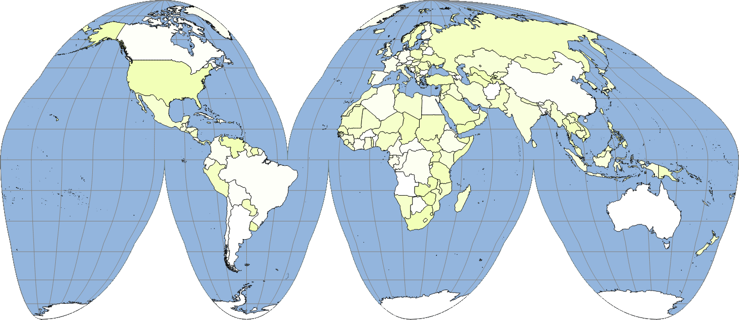
Marinus of Tyre's and Mercator's are by far the most popular projections used today in the Earth Sciences. However, they expand the surface area of the Earth respectively by 50% and 200%, imposing serious overheads in data storage, and more importantly, computation costs. While an equal-area projection is the evident solution, those supported by FOSS4G are scant; a choice is not straightforward.
ISRIC, the World Data Centre for Soils, creates and serves global high resolution maps of continuous estimates of soil properties and soil classes. ISRIC had until recently created its products in the millinery projection of Marinus of Tyre, but in face of ramping computation costs, it initiated a process to adopt an equal-area projection. After carefully benchmarking various candidates, the option rested on the Homolosine, a modern projection developed by J.P. Goode that is supported both by PROJ and GDAL.
This address details the advantages of the Homolosine projection over other FOSS4G supported equal-area projections. It also highlights the limitations of FOSS4G in working with the Homolosine and the strategies to overcome them.
None
about this event: https://talks.2019.foss4g.org/bucharest/talk/QXFDXE/
Topics
bucharest278General