Ep. 29: The Greer County Land Grab(?)
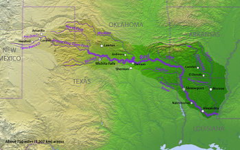
An 1818 map was used to negotiate a boundary treaty between the United States and Spain, then Mexico, then the Republic of Texas, then the State of Texas. The only problem was, the map was wrong! Learn about a boundary dispute between Texas and Oklahoma that made it to the U.S. Supreme Court and beyond!  
Audio is streamed directly from the publisher (media.blubrry.com) as published in their RSS feed. Play Podcasts does not host this file. Rights-holders can request removal through the copyright & takedown page.
Show Notes
An 1818 map was used to negotiate a boundary treaty between the United States and Spain, then Mexico, then the Republic of Texas, then the State of Texas. The only problem was, the map was wrong! Learn about a boundary dispute between Texas and Oklahoma that made it to the U.S. Supreme Court and beyond!