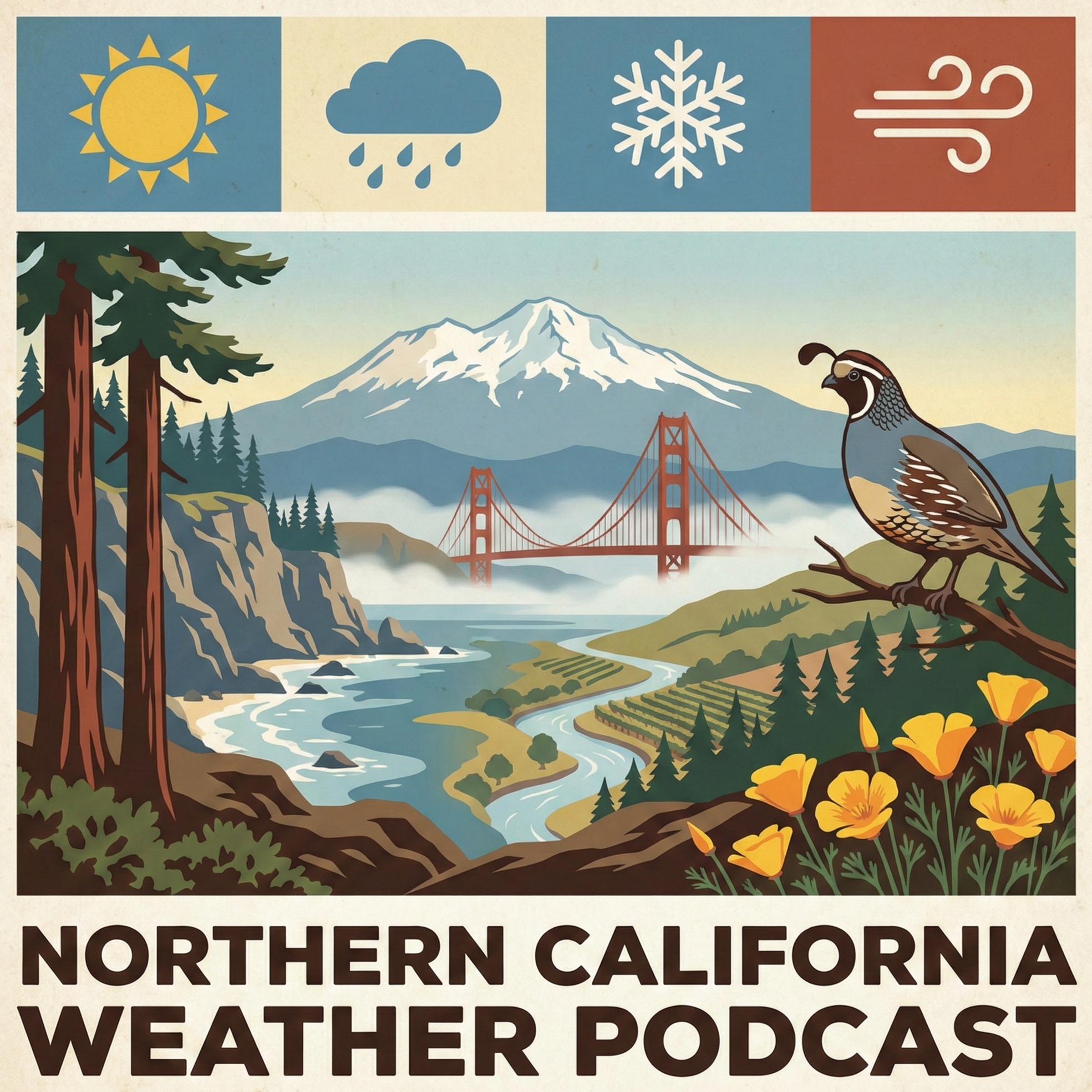
The NorCal Weather Podcast
74 episodes — Page 2 of 2
Northern California Weather March 4 Morning - 41° Above Normal
Good morning. Northern California. I'm Aaron Jolly. See that gray ceiling overhead? It's already packing its bags. A cold front is sweeping through right now, but here's the surprise. It's bringing almost no rain. Maybe a few drops on your windshield this morning, but that's it. The real story today is what follows. In the next 24 hours. Temperatures sit at 50 degrees under overcast skies. But watch what happens next. That front clears by late morning. And the winds take over. Northwest winds ramp up to 15 miles an hour this afternoon, gusting to 25. You'll feel it along the coast and through the gaps. Down in the Central Valley. Sacramento hits 68 degrees this afternoon with lighter winds. The Bay Area tops out at 64. Not bad for early March — that's right about where we should be. Tonight brings a treat. Skies go clear. And the full moon rises over a quiet landscape. Lows drop to 48 in the Bay Area, 44 in the Valley. That crisp, dry air will feel refreshing after today's gusty finish. Thursday looks similar — sunny, 65 degrees, but those north winds keep howling. Gusts could hit 31 miles an hour in the Valley. Here's where it gets interesting. An offshore wind pattern sets up this weekend. That means warmth. Saturday hits 72 in the Bay Area, 74 in the Valley. Sunday? 73 and 75 respectively. We're talking 41 degrees to 41 degrees above normal for early March. Spring is knocking early. We're gaining nearly two and a half minutes of daylight each day now. Sunrise at 6:35, sunset at 6:03. The spring equinox sits just two weeks away. But this weekend, it will feel like it's already here. For the extended outlook, check the latest forecast as confidence improves. That's your forecast — we'll be back tomorrow.
3/3 Northern California Weather 6 AM: Clear Skies
Good morning. Northern California. I'm Aaron Jolly. Folks, walk outside right now and just. Breathe. That 54 degrees on your skin with clear skies overhead? That's a ridge of high pressure doing exactly what we love it to do. It's parked right over us, shoving every storm system north and letting the sun run the show. In the next 24 hours. The Bay Area tops out around 64 degrees today. Light west winds, 2 to 9 miles an hour. Barely enough to rustle a napkin. Tonight dips to 51 degrees under partly cloudy skies. Push inland to the Central Valley and you're the winner today. Sunny skies, highs near 70 degrees by mid afternoon. That's the kind of warmth that makes your lunch break feel like a mini vacation. Tonight settles to 48 degrees under mostly clear skies. Now enjoy this calm. Because it has an expiration date. A cold front slides through Wednesday. Not a drop of rain. The air is bone dry. But behind that front, high pressure builds fast and creates a serious pressure gradient. Translation? Wind. Real wind. Wednesday through Friday, the coast and higher terrain could see gusts over 40 miles an hour. The Bay Area catches gusts to 24 miles an hour Wednesday. The Valley ramps up to 30 miles an hour by Thursday. Secure anything loose in the yard before you go to bed tomorrow night. Then the plot twist. By the weekend, winds flip offshore and temperatures surge. We're talking low to mid 70s across the Valley Saturday. Sunday could touch 75 degrees. And Monday looks like the warmest day of all. Valley highs pushing near 78 degrees. Almost April weather in early March. Oh. And tonight? Full Moon. Skies clear out after some early evening clouds. Perfect excuse to step outside after dinner. I'll be tracking those winds all week for you. For the extended outlook, check the latest forecast as confidence improves. That's your forecast — we'll be back tomorrow.
3/1 Northern California Weather 6 PM: Wind Advisory
Good evening. Northern California. I'm Aaron Jolly. A sneaky little low pressure system is sliding through tonight. and it's painting two very different pictures across the region. Up in the northern Sacramento Valley and foothills, scattered showers and thunderstorms are popping off this evening. Some of those storms could bring frequent lightning and small hail. Nothing severe, but enough to make you look twice out the window. In the next 24 hours. Meanwhile, the Sierra is catching light snow above 7,000 feet. An inch or two at most. Barely a dusting by mountain standards. Now swing south to the Bay Area. You topped out around 63 degrees today under partly sunny skies. Enjoy that memory. Because light rain and drizzle creep in tonight, mainly north of the Golden Gate. It lingers into Monday morning. We're talking under a tenth of an inch. Lows settle near 53 degrees. More of a mist than a soaking. Over in the Central Valley, you had the easiest day of anyone. Mostly sunny, highs near 67 degrees. Tonight dips to 49 degrees under partly cloudy skies. Monday stays friendly with sunshine and highs around 65 degrees. The Bay Area clears by midday Monday, reaching 63 degrees after morning fog burns off. Now the week ahead is where things get interesting. Tuesday, high pressure muscles in. Sunshine returns everywhere. Wednesday, a quick weak system brushes the north with light showers possible. Then Thursday and Friday. That's the headline. North to east winds kick up and temperatures climb into the low 70s. Saturday looks even warmer. We're talking 70 to 74 degrees under blue skies. That's the kind of warmth that makes you forget it's still early March. If this podcast helps you plan your week, drop us a quick rating. Takes five seconds and means a lot. For the extended outlook, check the latest forecast as confidence improves. That's your forecast — we'll be back tomorrow.
3/1 Northern California Weather Noon: 44° Above Normal
Good afternoon. Northern California. I'm Aaron Jolly. There's a big spinning low pressure system sitting about 500 miles off the coast right now. It's pulling cooler marine air straight at us. That's why you walked outside this morning into fog instead of sunshine. In the next 24 hours. If you're in the Bay Area, that patchy fog cuts visibility before 10 A.M. but it burns off by late morning. Temperatures climb into the low to mid 60s along the coast. Head inland to the Central Valley and you're looking at upper 60s to low 70s. Still plenty mild. We're running 44 degrees to 44 degrees above normal for early March. Now here's where it gets interesting. That low drifts closer tonight. Between midnight and 8 A.M. Monday, there's a chance of light rain across the North Bay and coastal areas. We're talking drizzle. Maybe a tenth of an inch. Enough to slick the roads for your Monday morning commute. but not enough to cancel anything. Overnight lows settle into the low 50s around the Bay. Upper 40s in the Central Valley. Monday morning fog and sprinkles taper off by mid morning. Highs bounce right back to the low to mid 60s at the coast, upper 60s inland. The week ahead tells a good story. Tuesday, high pressure muscles back in. Sunny skies, upper 60s. Wednesday brings one brief hiccup. A quick moving system clips northern areas with a slight chance of showers, then it's gone. Thursday and Friday? Offshore winds kick in with gusts up to 30 miles an hour through the hills. That pushes temperatures into the low 70s heading into next weekend. Perfect patio weather. Folks, this is the kind of early March stretch that makes you forget winter was ever a thing. Get outside and enjoy it. For the extended outlook, check the latest forecast as confidence improves. That's your forecast — we'll be back tomorrow.
2/28 Northern California Weather 6 PM: Wind Advisory
Good evening. Northern California. I'm Aaron Jolly. Right now. Northern California is soaking in 75 degrees under a quilt of overcast skies. Enjoy that warmth tonight. Because an upper level low is sliding in from the Pacific. and it's rewriting tomorrow's plans. In the next 24 hours. Here's the setup. That low pressure system pulls moisture onshore and cools everything down. Tonight stays mild and dry. but by Sunday afternoon, clouds thicken and temperatures drop. The Bay Area tops out near 62 degrees tomorrow. That's more than ten degrees cooler than today's 73. Light rain develops after 10 P.M. Sunday night, though most spots barely see a tenth of an inch. More of a mist than a soaking. Over in the Central Valley, you're the warm spot today. Highs hit 76 degrees under mostly cloudy skies. Tonight dips to 54 degrees. Sunday stays drier with partly sunny skies and highs near 68. Not bad at all. The North Bay and coastal areas catch the best rain chances Sunday night into Monday morning. Everywhere else? Odds stay low. and by Monday afternoon, the sun punches back through like it never left. Now the week ahead tells a nice story. Monday kicks off a warming trend with mostly sunny skies and mid 60s. Tuesday and Wednesday keep climbing into the upper 60s. A weak system may flick a few sprinkles across the north Wednesday, but nothing worth canceling plans over. Thursday and Friday turn breezy with north winds picking up. Highs push near 70 degrees under blue skies. One more thing worth noting. The spring equinox is just two weeks out. Sunrise rolls in at 6:41 A.M., sunset stretches to 5:58 P.M. We're gaining almost two and a half minutes of daylight every single day now. You can feel winter losing its grip. I'll be tracking that Sunday system all night. That's your forecast — we'll be back tomorrow. For the extended outlook, check the latest forecast as confidence improves. Stay safe, stay prepared. and enjoy the day.
2/28 Northern California Weather Noon: 44° Above Normal
Good afternoon. Northern California. I'm Aaron Jolly. Step outside and you might do a double-take at the calendar. We're looking at temperatures more typical of mid-April than late February. A ridge of high pressure parked over California is the reason. and it's giving us a spectacular send-off to meteorological winter. In the next 24 hours. Currently sitting at 68 degrees under mainly clear skies. That's after an overnight low of 56. The Bay Area climbs to 73 degrees this afternoon under mostly sunny skies. The Central Valley? Even warmer. Patchy fog burns off by mid-morning, then partly sunny with highs near 79 degrees. That's about 44 degrees to 44 degrees above normal for late February. Tonight, clouds roll in ahead of our next weather maker. Lows drop to 54 in the Bay Area and the Central Valley. Sunday tells a different story. An approaching low-pressure system brings cooler air and clouds. Bay Area highs fall to 62 degrees. The Central Valley cools to 68. There's a slight chance of rain late Sunday afternoon in the Valley, with a better chance Sunday night. Here's your five-day outlook. A brief cool-down Sunday and Monday with some light rain possible. Then high pressure rebuilds mid-week. Tuesday through Friday look sunny and mild with highs in the mid-60s to near 70. Spring equinox is now just three weeks away. and today's weather is a fitting preview. In Sunrise at 6, 41 this morning. Sunset at 5:59 this evening. We're gaining over two minutes of daylight each day now. That's your forecast — we'll be back tomorrow. For the extended outlook, check the latest forecast as confidence improves. Stay safe, stay prepared. and enjoy the day.
2/28 Northern California Weather 6 AM: 44° Above Normal
Good morning. Maine. I'm DJ Huzz. Folks, step outside right now and you'll swear it's mid April. That overcast sky is playing tricks on you. Because underneath it, temperatures are already sitting at 60 degrees. A high pressure ridge has parked itself right over us, compressing and warming the air like a lid on a slow cooker. That's pushing us 44 degrees to 44 degrees above normal for late February. In the next 24 hours. Down in the Bay Area, that gray ceiling burns off by mid morning. Then it's sunshine and 73 degrees. Patio coffee weather. Trailhead weather. The kind of Saturday you don't waste indoors. Tonight clouds creep back in with lows around 54. Slide over to the Central Valley and watch for patchy fog between 8 and 10 A.M. Once it lifts, partly sunny skies push highs near 76. Some spots flirt with 79 this afternoon. Lows tonight settle around 54 under mostly cloudy skies. Now here's where the plot twists. Sunday, a low pressure system muscles in from the Pacific. Bay Area highs drop to 62. Rain arrives after 10 P.M. The Valley stays drier at 68 degrees with just a slight chance of late showers. The week ahead tells a quick recovery story. Monday clears out, mid 60s. Then Tuesday through Friday, high pressure rebuilds with sunny skies and gusty offshore winds by Wednesday. Highs climb back into the upper 60s. One more thing worth noting. The spring equinox is just 20 days out. We're gaining over two minutes of daylight every single day now. You can feel it. So today? Get outside. Enjoy every minute of this gift. Sunday evening, keep that umbrella within arm's reach. That's your forecast — we'll be back tomorrow. For the extended outlook, check the latest forecast as confidence improves. Stay safe, stay prepared. and enjoy the day.
2/27 Northern California Weather 6 PM: 45° Above Normal
Good morning. Maine. I'm DJ Huzz. Step outside and you might think spring arrived early. We're sitting at 74 degrees under mainly clear skies right now. and that's the headline. A strong ridge of high pressure is parked overhead, delivering offshore flow and pushing temperatures 45 degrees to 45 degrees above normal for late February. In the next 24 hours. Here's how the next 36 hours play out across the region. The Bay Area enjoys sunny skies today with a high of 73 degrees. Tonight turns mostly cloudy with a low of 57. Saturday stays warm and mostly sunny, hitting 75 degrees. Down in the Central Valley, it's even warmer. Partly sunny skies today with a high of 79 degrees. Tonight brings clouds and a low of 56. Watch for patchy fog between 8 and 10 A.M. Saturday morning, then partly sunny with a high of 77. But changes arrive Sunday. That ridge breaks down as an upper-level low approaches. Clouds increase and temperatures drop back into the 60s. A slight chance of rain develops Sunday afternoon and evening, mainly from the North Bay northward into the Sierra foothills. Snow levels stay high, around 7,000 feet. Saturday is the warmest day of the bunch. Sunday and Monday cool off with those slight rain chances. By midweek, high pressure rebuilds and we dry out, though breezy north winds develop Thursday. In A couple of alerts to note, sneaker waves are possible along the Humboldt and Del Norte coast until 11 P.M. Tonight. and a Dense Fog Advisory goes into effect early Saturday morning for parts of the southern San Joaquin Valley. We're gaining over two minutes of daylight each day now. The spring equinox is just three weeks away. and today, it sure feels like it's already here. That's your forecast — we'll be back tomorrow. For the extended outlook, check the latest forecast as confidence improves. Stay safe, stay prepared. and enjoy the day.
2/27 Northern California Weather 6 AM: 46° Above Normal
Good morning. Maine. I'm DJ Huzz. Step outside and you might do a double-take at the calendar. We're looking at temperatures 46 degrees above normal for late February. The Bay Area climbs to 73 degrees today under mostly sunny skies. Light offshore flow keeps things pleasant through the afternoon. Tonight brings patchy clouds and a mild low of 57 degrees. In the next 24 hours. Head inland to the Central Valley and it's even warmer. Patchy fog lingers until about 10 A.M., especially around Bakersfield and Fresno. Then the sun breaks through. Highs push toward 75 degrees this afternoon. Tonight's low holds at 56 degrees. Your weekend looks fantastic. Saturday brings another warm day with the Bay Area at 69 degrees and the Valley reaching 76. Sunday cools slightly as clouds increase. A slight chance of rain arrives Sunday night into Monday, mainly for the Sierra Nevada. We stay well above normal through Saturday. A brief cooling trend arrives early next week. Highs settle into the low to mid 60s by Wednesday. That's actually right where we should be for this time of year. We're gaining over two minutes of daylight each day now. Sunrise this morning was at 6:42. Sunset comes at 5:57 this evening. The spring equinox sits just three weeks away — and today, it certainly feels like it's already here. That's your forecast — we'll be back tomorrow. For the extended outlook, check the latest forecast as confidence improves. Stay safe, stay prepared. and enjoy the day.
Flood Warning | Northern California Weather 6 AM
Good morning! I'm Aaron Jolly. And welcome to the Northern California Weather Podcast. It's Thursday, February 26th. You opened your door this morning and thought someone stole the view. That thick gray soup is real, folks. Dense fog has swallowed the Central Valley and North Bay interior valleys. Visibility is down to a quarter mile or less. A Dense Fog Advisory holds until 10 A.M. Low beams only. Extra following distance. No heroics on the commute. Over in the Bay Area, you're waking up to 53 degrees under that murk. The fog peels back before 7 A.M.. And then the sun takes over. Mostly sunny skies push you to a pleasant 68 degrees this afternoon. Tonight settles back to mostly cloudy with lows near 54 degrees. Head inland to the Central Valley and the fog hangs a little longer, clearing around 9 A.M. Once it burns off, partly sunny skies and highs climbing to 74 degrees. That almost feels like someone fast forwarded to April. Overnight lows dip to 51 degrees under partly cloudy skies. Important note for our northern listeners. A Flood Warning remains in effect for the Sacramento River at Vina Woodson Bridge and Tehama Bridge through this afternoon. Minor flooding is happening right now. Don't drive through flooded roads. Period. Looking ahead, Friday keeps the warmth rolling. Bay Area hits 70 degrees. Central Valley reaches 73. Then the weekend brings a plot twist. A slight chance of rain sneaks in Saturday afternoon. Sunday cools to the mid 60s with another round of possible showers. Monday dries things out. One more thing to brighten your morning. Sunrise came at 6:44 A.M. Sunset tonight stretches to 5:57 P.M. We're gaining nearly two and a half minutes of daylight every single day now. Spring equinox is just three weeks out. Charge up those sunglasses. You'll need them by mid morning. That's your forecast — we'll be back tomorrow.
Flood Warning | Northern California Weather 6 PM
Good evening! I'm Aaron Jolly. And welcome to the Northern California Weather Podcast for Wednesday, February 25th. That overnight rain left us with a little over a tenth of an inch and a damp start. But step outside right now.. 65 degrees, clear skies. And the air smells fresh. Not bad for a Wednesday night. The Bay Area topped out near 64 degrees today. And clouds are hanging around through the evening. The real sneaky move comes later. Patchy fog creeps in after 3 A.M., so early risers, keep that in mind. Overnight lows settle near 53 degrees with a gentle west breeze. Now push inland to the Central Valley. Totally different vibe. Mostly sunny skies drove temps up to 75 degrees this afternoon. That's practically spring. Tonight dips to 55 degrees as clouds build in. Thursday morning, fog blankets the Bay Area but clears by 7 A.M. Then sunshine takes over and highs climb to 68 degrees. The Valley pushes 73 degrees under blue skies. Both regions cool into the low to mid 50s overnight. So what's the bigger picture look like? Friday is the headliner. Bay Area hits 70 degrees. The Central Valley soars to 74. We're talking 47 degrees to 47 degrees above normal for late February. Saturday holds warm with partly sunny skies before an upper level low starts nudging in from the west. Sunday is where the plot twists. Clouds thicken. A slight chance of light rain arrives, especially after 4 P.M. Bay Area cools to 63 degrees, Valley around 66. That rain chance lingers Sunday night, then.. It's gone. Monday and Tuesday dry out completely with sunny skies and highs in the mid to upper 60s. One thing worth flagging. Dense fog advisories are possible through Saturday morning across the Central Valley. Visibility could drop below a quarter mile. If you're driving early, slow down and give yourself extra time. Charge your phone, set that alarm. And enjoy the warmth while it's here. That's your forecast — we'll be back tomorrow.
Flood Warning | Northern California Weather Noon
Good afternoon! I'm Aaron Jolly. Welcome to the Northern California Weather Podcast for Wednesday, February 25th. That overnight rain left about a tenth of an inch on your windshield and 57 degrees in the air. Clouds are still draped over us like a gray wool blanket. But folks, this is the last gloomy chapter for a while. The Bay Area tops out near 64 degrees today under mostly cloudy skies. Nothing dramatic. Tonight gets interesting though. Patchy fog rolls in between 3 A.M. And 5 A.M., so early birds commuting through the valleys.. Slow down and give yourself extra time. Lows settle around 53 degrees. Push inland to the Central Valley and you're a few notches warmer. Highs near 67 degrees today, still cloudy. Lows tonight around 52 degrees. Farther inland? That's where the sun flexes. Mostly sunny skies and 75 degrees. The kind of afternoon where you eat lunch outside and forget it's February. Now the good stuff. Thursday the clouds peel back. The Bay Area jumps to 68 degrees under mostly sunny skies. Central Valley hits 70. Inland valleys hover near 73. That warming trend keeps rolling into Friday, when the Bay Area touches 70 degrees and inland spots push into the mid 70s. Saturday could be the headliner.. Some areas flirting with 76 degrees. That's shorts weather in February. Soak up every minute of it. Sunday a cutoff low slides north of us. A few light showers are possible over higher terrain Sunday afternoon, but most of us stay dry. Monday looks similar. Think of it as a speed bump, not a storm. One thing to watch. Fog potential climbs later this week with all this lingering moisture. Valley drivers, keep those low beams ready. I'll be tracking that weekend system closely tonight. That's your forecast — we'll be back tomorrow.
Flood Warning | Northern California Weather 6 AM
Good morning! I'm Aaron Jolly. And welcome to the Northern California Weather Podcast. It's Wednesday, February 25th. Folks, that rain tapping on your roof overnight? It's packing up and leaving town. And what's walking in behind it.. Feels like a preview of spring. Let's start in the Bay Area. Those lingering showers fizzle out by 4 A.M. Clouds hang around, but you'll hit a comfortable 63 degrees by 2 P.M. That damp chill from yesterday? Gone. Tonight, patchy fog creeps in between 48 degrees and 5 A.M. Lows settle near 53 degrees. Now head inland to the Central Valley. Rain wraps up by 5 A.M. Then the sun punches through and just keeps climbing. You're looking at 75 degrees by 4 P.M. Seventy five. In February. That's the kind of afternoon where you eat lunch outside and forget what month it's. Winds flip from south to northwest around noon. Tonight cools to a pleasant 50 degrees under partly cloudy skies. Two things you'll want to know. A Flood Warning stays active for southwestern Mendocino County until late this morning. And up at Tahoe, a Wind Advisory means gusts to 45 miles an hour through this evening. Not the day for paddleboarding. Looking ahead, high pressure muscles in starting tomorrow. Thursday and Friday bring gorgeous upper 60s to low 70s. Saturday could push mid 70s in the Valley.. Almond blossoms are going to love that. A weak system nudges through Sunday with a slight chance of showers, nothing worth canceling plans over. Temperatures ease back a touch early next week. Here's something to smile about. We're gaining over two minutes of daylight every single day now. Spring equinox is three weeks out. You can feel it. If this podcast helps you plan your morning, a quick rating really does help others find us. That's your forecast — we'll be back tomorrow. Take care!
Flood Warning | Northern California Weather 6 PM
Good evening, folks! I'm Aaron Jolly. And welcome to the Northern California Weather Podcast for Tuesday, February 24th. If you've been enjoying any kind of dry streak, tonight's the night to say goodbye. A significant storm system is bearing down on our region. And it's bringing the works. We're talking rain, mountain snow. And wind that'll rattle your windows before sunrise. Step outside right now and you'll feel things are deceptively calm. Sacramento's sitting at a mild 54 degrees. Down in San Francisco, you're at 52 with some fog creeping through the Golden Gate. But don't let that fool you. By midnight, the leading edge of this atmospheric river starts pushing onshore. The coast from Mendocino down through Marin is looking at one to two inches of rain by Wednesday afternoon. You'll want to clear those storm drains tonight if you haven't already. Heading inland to the Sacramento Valley, you're seeing half an inch to an inch, with gusty south winds hitting 35 to 45 miles per hour overnight. That's the kind of wind that brings down branches, folks. Now up in the Sierra — this is where it gets serious. Snow levels start around 6,500 feet, then drop to about 5,000 feet by Wednesday evening as colder air wraps in behind the front. Donner Pass could see 12 to 18 inches of fresh snow through Thursday morning. If you're planning any mountain travel, Dress warmly and carry chains. I48 degrees over the summit? Take it slow or honestly, just wait it out. Here's your heads-up for the week ahead. A brief break Thursday gives us a chance to dry out, but another system lines up for Friday into Saturday. Not as strong, but enough to keep things wet. Temperatures stay cool — Sacramento in the low 50s, San Francisco hovering around 48 to 52. One bright spot? Lake Shasta's loving every drop of this. We're finally climbing back toward healthy storage levels after a rough start to the water year. That's your forecast — we'll be back tomorrow with storm totals and a look at that weekend system. , Northern California. Take care!
Flood Warning | Northern California Weather Noon
Good afternoon! I'm Aaron Jolly. Welcome to the Northern California Weather Podcast for Tuesday, February 24th. Folks, that drizzle on your windshield right now? Just the warm up act. Rain rolls in across the region starting at 8 AM and doesn't quit until 3 AM tomorrow. Peak soaking hits around 4 PM.. So your evening commute is going to be a wet one. Quick heads up on active alerts. A Flood Warning is in effect for central Mendocino County until 11:30 AM. Small streams near Willits are already over their banks. A Flood Advisory covers northwestern Humboldt County until 10 AM. And up at Tahoe, a Lake Wind Advisory kicks in at 7 PM tonight through 7 PM Wednesday. Gusts to 45 miles an hour. If you're lakeside, tie down anything loose. Over in the Bay Area, you'll hit 64 degrees around 1 PM. Then temperatures slowly slide to 56 degrees by 2 AM. South winds stay gentle, around 7 miles an hour with gusts to 20. Rain tapers before 4 AM. Slide east into the Central Valley and it's warmer. Temperatures climb to 74 degrees by 4 PM. That's February pretending to be April. Winds shift from south to northwest around 10 PM tonight. Lows settle near 56 degrees. Wednesday brings patchy fog between 8 and 10 AM, then cloudy skies with highs in the mid 60s. Nothing dramatic. Now here's the payoff for today's soaking. Thursday through Saturday looks gorgeous. Highs push into the upper 60s to mid 70s under partly sunny skies. A slight chance of rain sneaks back Saturday afternoon, but nothing close to what you're seeing today. One more thing worth celebrating. Sunrise at 6:46 AM, sunset at 5:54 PM. We're gaining over two minutes of daylight every single day now. You can feel it. I'll be tracking those flood warnings tonight. If anything changes, you'll hear it first thing tomorrow. That's your forecast — we'll be back tomorrow. Take care!
Flood Watch | Northern California Weather 6 AM
Good morning! I'm Aaron Jolly. And welcome to the Northern California Weather Podcast. It's Tuesday, February 24th. Folks, grab that umbrella before you walk out the door. Rain is the whole story today. And it's not messing around. Over in the Bay Area, showers crept in around 2 A.M. And they're sticking through 1 A.M. Wednesday. The heaviest punch lands around 4 P.M. Today. You're looking at a solid half to three quarters of an inch by tonight. South winds at 8 miles an hour keep things damp and breezy. Highs touch 64 degrees this morning, then here's the weird part.. Temperatures actually drop through the afternoon. You'll be sitting near 60 by late day. Rain tapers off by 4 A.M. Wednesday, leaving patchy fog and cloudy skies. Wednesday's high bounces back to 64. Now drive inland to the Central Valley. Same rain, completely different thermometer. Highs climb to 74 degrees by 4 P.M. That's a ten degree gap from the coast. Rain runs the same window, peaking around 4 P.M. At heavy coverage. Lows tonight settle near 54 around 5 A.M., then temperatures actually climb back to 59 by dawn. Winds flip from south to northwest around 10 P.M.. And that's your signal the rain is packing up. Wednesday? Partly sunny, 73 degrees. Almost like today never happened. The rest of the week dries out fast. Thursday both regions bounce back under mostly sunny skies. Bay Area hits 68, the Valley warms to 73. Friday stays steady in the upper 60s to low 70s. The weekend turns mostly cloudy but mild, with just a slight chance of light rain sneaking back Sunday. No drama. Just easy, late February calm. One more thing to smile about. We're gaining 2 minutes and 26 seconds of daylight today. Sunrise at 6:46 A.M., sunset at 5:54 P.M. Those longer evenings are really adding up. Keep that rain jacket close today. You'll want it through dinner. That's your forecast — we'll be back tomorrow. Take care!
Flood Watch | Northern California Weather 6 PM
Good evening! I'm Aaron Jolly. And this is the Northern California Weather Podcast for Monday, February 23rd. Folks, step outside right now and you're feeling a lovely 66 degrees. Soak that in.. Because a warm soaking rain is headed your way tonight. Let's start along the coast. Bay Area, rain rolls in around 9 P.M. Tonight. It builds overnight, with the heaviest downpour landing right around 10 A.M. Tuesday. Rain is likely all morning and into the afternoon. You hit 65 degrees today near 3 P.M., then slide to 55 degrees by 2 A.M. Winds flip from southeast to west around 3 P.M., so tonight gets breezy. Tuesday's high only reaches 63 degrees. Rain lingers into Wednesday morning. Now swing inland to the Central Valley. You're catching a quick splash between 5 P.M. And 7 P.M. Tonight. That's about it. Lows dip to 54 degrees around 5 A.M., then temperatures bounce right back. You'll hit 70 degrees by 1 P.M. Tuesday. Wednesday? Sunny and 67 degrees. The Valley shrugs this one off. Here's what matters most. Snow levels climb to ten and eleven thousand feet. That means the Sierra gets rain, not snow. Great for travelers. Not great for burn scars. Flood watches are up for Mendocino, Lake. And Humboldt counties. Two to four inches of rain possible through Tuesday. Wind advisories cover the Shasta Valley and Warner Mountains with gusts reaching 55 miles an hour. Tie down anything that isn't bolted. Looking ahead, Wednesday clears everything out. The Bay Area rebounds to 67 degrees by Thursday. The Central Valley flirts with 70 degrees through the weekend. A weak system might bring a slight chance of showers Sunday, but nothing worth worrying about. One more thing worth celebrating. We're gaining two minutes and twenty five seconds of daylight today. Sunrise at 6:48 A.M., sunset at 5:54 P.M. Those longer evenings are adding up fast. I'll be tracking this rain all night. Charge your phone and keep an umbrella by the door. That's your forecast — we'll be back tomorrow. Take care!
Flood Watch | Northern California Weather Noon
Good afternoon! I'm Aaron Jolly. Welcome to the Northern California Weather Podcast for Monday, February 23rd. Folks, enjoy this sunshine while you can.. Because tonight it vanishes. Right now you're sitting at 44 degrees under clear skies. The Bay Area climbs to 66 degrees today. The Central Valley edges to 67. Gorgeous stuff. Soak up every last ray. But around 3 P.M., winds flip from southeast to west. That's your signal. Rain hits the Bay Area by 7 P.M. And really gets going after 9 P.M. The heaviest downpours slam between 2 A.M. And 8 A.M. Tuesday, peaking around 4 A.M. You're looking at a quarter to three quarters of an inch in the Bay Area. That's enough to pond on the freeways. Slide over to the Central Valley and it's a lighter story. Rain rolls in around midnight. Totals stay modest, maybe a tenth to a quarter inch. The Valley dries out faster too. By Wednesday you're back to 66 degrees while the Bay Area is still wringing out its umbrella. Now the serious stuff. Northern Humboldt and Del Norte Counties are under a Flood Watch through Tuesday evening. Gusts hit 50 miles an hour along the North Coast tonight. If you're anywhere near Highway 101, stay sharp. Rockslides and localized flooding are real possibilities. Tuesday's highs drop to 63 in the Bay Area, 60 in the Valley. Temperatures actually fall through Tuesday afternoon as rain continues. Snow levels stay sky high, so this is all rain, no mountain snow. The week ahead tells a better story. This storm is a quick punch. Wednesday the rain tapers and a warming trend takes over. The Bay Area rebounds to 64 Wednesday, 66 Thursday. The Central Valley? You'll flirt with 70 degrees by Friday. That feels like early spring knocking on the door. Air quality sits moderate today but the rain scrubs everything clean by Tuesday. Silver lining on a wet day. I'll be tracking this storm all night. That's your forecast — we'll be back tomorrow. Take care!
Flood Watch | Northern California Weather 6 AM
Good morning! I'm Aaron Jolly. And welcome to the Northern California Weather Podcast. It's Monday, February 23rd. Folks, step outside right now and you'll feel a pleasant 48 degrees. Partly cloudy. Coffee weather. Enjoy it.. Because tonight's a different story. A storm is spinning offshore. And it's got its eyes on us. The Bay Area soaks up sunshine today, climbing to a gorgeous 66 degrees by afternoon. Then the rain sneaks in around 9 P.M. The heaviest stuff hammers down near 1 A.M. Lows settle to 50 degrees around 4 A.M. Winds flip from southeast to west by 3 P.M. Tomorrow, which is the storm waving goodbye. Now head inland to the Central Valley. You're looking at 69 degrees today. Almost spring. Rain catches up to you by 9 P.M. Too, peaking around 2 A.M. Lows drop to 43 degrees near 5 A.M. Then right back to 69 tomorrow afternoon. Here's the thing, though. Up in Mendocino, Humboldt. And Trinity counties, Flood Watches are active. Heavy rain could trigger flooding, rockslides. And greasy roads. If you're driving north tonight, slow down in those low lying areas. This isn't the night to test your tires. The week ahead tells a quick story. Rain clears Tuesday afternoon. Another round sneaks in Tuesday night. Then Wednesday dries out and the thermostat starts climbing. The Bay Area pushes 66 degrees by Thursday. The Central Valley flirts with 70. Weekend? Upper 60s to low 70s with sunshine. That warming trend feels like a promise. Sunrise today at 6:47 A.M. Sunset at 5:53 P.M. We're gaining two minutes and 25 seconds of daylight. Your evenings are getting longer whether you noticed or not. Charge your phone and grab an umbrella before bed tonight. You'll want both by midnight. That's your forecast — we'll be back tomorrow. Take care!
Northern California Weather: 02-22-2026
Good evening! I'm Aaron Jolly. And welcome to the Northern California Weather Podcast. It's Sunday, February 22nd. Folks, enjoy tonight. Because this quiet stretch has an expiration date. Right now you're sitting at a pleasant 63 degrees under partly cloudy skies. That's a solid rebound from this morning's 39 degree start. The Bay Area tops out around 64 degrees by 4 P.M. Before sliding to 50 overnight. Over in the Central Valley, you're even warmer. Hitting 66 degrees near 3 P.M., then dropping to 42 by dawn. Winds? Barely a whisper. Now here's where things get interesting. Monday starts calm enough. But after 10 P.M., a moisture loaded storm rolls in off the Pacific. This thing is tapping tropical humidity. Rain becomes likely across the Bay Area and steadier through the northern Central Valley. And this is warm rain. Snow levels rocket to 9,000 feet by Wednesday. That's bad news for our mountain snowpack. It's going to melt fast. Tuesday is the main event. Widespread rain blankets the region. The Bay Area picks up a quarter to half inch. The Central Valley sees lighter but persistent showers. Enough to push rivers up and turn low spots into puddles. Gusts reach 18 miles an hour in exposed areas. Messy commute, but nothing dangerous. Then Wednesday afternoon, the curtain drops. Skies start clearing. And the second half of the week? That's your reward for surviving the rain. Thursday through Saturday brings a warming, drying trend. Highs push into the upper 60s. The Central Valley flirts with low 70s by Friday. Saturday stays mostly cloudy and mild with just a slight chance of sprinkles. We're gaining over two minutes of daylight every day now. Spring is knocking. But don't retire that rain jacket. March always has one more trick. Charge your phone tonight and toss an umbrella by the door. You'll want both by Tuesday. That's your forecast — we'll be back tomorrow. Take care!
Northern California Weather: 02-22-2026
Good afternoon! I'm Aaron Jolly. And welcome to the Northern California Weather Podcast. It's Sunday, February 22nd. Folks, enjoy this quiet afternoon while you can. Northern California is sitting pretty right now. Clear skies, 39 degrees this morning, sunshine everywhere. Soak up every drop of it. Because a serious storm is loading up off the Pacific coast. And it's headed straight for us. Let's talk about today first. Down in the Bay Area, you might have caught a sprinkle before 8 this morning. That's done. Sun's running the show now, pushing you to 64 degrees right around 2 P.M. Winds are gentle, maybe 8 miles an hour from the south. Tonight those skies go partly cloudy. Lows settle near 49 degrees. You'll feel the wind shift southeast around 10 P.M. That's the storm knocking. Head inland to the Central Valley and it's even nicer. Mostly sunny, topping out at 66 degrees by 4 P.M. Here's something odd. Temperatures actually rise overnight to 44 degrees. Warm air sliding in ahead of that storm. Now the main event. Monday night, an atmospheric river takes aim. Heavy rain hits the Bay Area after 10 P.M. Monday, with lows near 55 degrees. Tuesday it's a soaker. Highs only 63 degrees with steady, persistent rain. The Central Valley gets hammered Tuesday night into Wednesday. Gusts hit 20 miles an hour. Rain totals approach half an inch. If you're near creeks in the North Bay or northern Sacramento Valley, watch for rising water Tuesday night. The week ahead tells a dramatic story. Monday stays dry until late. Tuesday and Wednesday bring the heaviest rain. Then everything flips. Thursday the sun returns. By Friday you're looking at upper 60s, maybe touching 70 degrees. That's nearly 42 degrees above normal. Almost feels like the storm buys us an early taste of spring. One more thing worth celebrating. Sunrise hit 6:49 this morning. We're gaining daylight fast. Charge your devices and clear those storm drains before Tuesday. That's your forecast — we'll be back tomorrow.
Northern California Weather: 02-22-2026
Good morning! I'm Aaron Jolly, and welcome to the Northern California Weather Podcast. It's Sunday, February 22nd. Folks, step outside right now and soak up that 44 degree sunrise. Clear skies. Gentle breeze. It's gorgeous. And it's a trick. A serious storm system is loading up offshore, and by tomorrow night, things get real. But today? Today is your gift. The Bay Area climbs to 63 degrees by 2 P.M. Under partly sunny skies. Perfect for a long walk, a farmers market run, whatever you've been putting off. Over in the Central Valley, you're even warmer. Highs near 66 degrees. Honestly, it feels more like April than February out there. Now here's where the plot thickens. Tonight, winds shift from south to southeast around 10 P.M. That's the storm knocking on the door. A slight chance of rain hits the Bay Area around 6 A.M. Monday. Just enough to slick up your commute. But Monday night after 10? Rain locks in and doesn't quit through Tuesday. Tuesday is the main event. An atmospheric river takes aim at the North Bay and coastal mountains. Rainfall rates could overwhelm drainage systems. We're talking flooding in low lying areas, slick roads, even shallow landslides. If you're in a flood prone spot, clear those gutters today while it's dry. The Bay Area picks up a quarter to half an inch. The Valley stays lighter, a tenth to a quarter inch. Here's what the rest of the week looks like. Wednesday, showers taper off. Thursday, sunshine returns like an old friend. And by Friday into the weekend? Temperatures jump 40 degrees above normal. Highs near 70 in the Valley. Upper 60s along the Bay. That kind of warmth will make Tuesday's storm feel like a distant memory. One more thing. We're gaining over two minutes of daylight today. Sunrise at 6:49, sunset at 5:52. The days are stretching, and that feels good. Quick favor. If you're enjoying these forecasts, share us with a friend or drop a rating. It really helps. That's your forecast — we'll be back tomorrow. Take care out there!
Northern California Weather: 02-21-2026
Good evening! I'm Aaron Jolly, and welcome to the Northern California Weather Podcast. It's Saturday, February 21st. Folks, soak in tonight's calm because it's about to get interesting. Right now you're looking at one of those gorgeous Northern California evenings. Bay Area sitting pretty near 60 degrees. Central Valley at 57 degrees under clear skies. Enjoy it. Seriously. Here's the deal. A powerful atmospheric river is loading up like a freight train aimed right at us. Tonight stays quiet. Bay Area lows dip to 50 degrees around 40 degrees AM. Central Valley drops to 41 degrees by 40 degrees AM. You'll notice the wind shifting from the south around 40 degrees PM tonight. That's the atmosphere clearing its throat. Sunday morning? A slight chance of rain sneaks into the Bay Area around 40 degrees AM. Highs climb to 63 degrees. Central Valley pushes to 64 degrees and stays mostly dry. But Monday afternoon the faucet starts turning. Rain becomes likely Monday night with heavy, steady rainfall hammering us all day Tuesday. Bay Area highs only reach 62 degrees. Central Valley drops to 57 degrees. This isn't a drizzle. This is a legit atmospheric river event. Now if you're anywhere near Siskiyou County above 40 degrees,500 feet, listen up. Winter Weather Advisories are already posted. Three to six inches of snow with gusts hitting 60 miles an hour. Stay off those mountain passes if you can. Here's your heads up for the week ahead. Wednesday brings a brief breather with lighter showers. Then Thursday and Friday? The sun comes roaring back. Mid 60s across most of the region. We're gaining over two minutes of daylight every day now. Spring is whispering. One more thing. If this forecast helped you plan your weekend, share it with someone who needs it. Word of mouth keeps us going. That's your forecast — we'll be back tomorrow. Stay safe out there, folks!
Northern California Weather: 02-21-2026
Good evening, folks! I'm Aaron Jolly, and welcome to the Northern California Weather Podcast for Saturday, February 21st. Here's the deal. The Central Valley woke up at 40 degrees this morning. Meanwhile, the Bay Area spent the afternoon flirting with 60 degrees. That's a 40 degree spread across one region. Classic Northern California doing its thing. Let's take a little tour. Down in the Bay Area, you topped out around 60 degrees today. There was a slight chance of rain near 40 degrees A.M., just enough to slick the roads for your coffee run. By afternoon? Partly sunny and gorgeous. Tonight you're holding steady in the low 50s. Comfortable sleeping weather. Now head inland to the Central Valley. Sunny skies pushed you to 57 degrees this afternoon, but tonight you're sliding back into the low 40s. Your car windshield will have frost on it by morning. Guaranteed. Here's where it gets interesting. Sunday, a warm storm system starts muscling in from the Pacific. Rain chances climb for the Bay Area, and the Valley gets a slight cooldown. Think of it as winter's last card to play before spring steals the deck. Here's your heads up for the week ahead. Monday through Wednesday, rain returns. The Bay Area catches the heavier stuff while the Valley sees lighter showers. Highs stay mild though, hanging in the low 60s across the board. Then Thursday and Friday? Everything dries out and warms up beautifully. The Bay Area touches 67 degrees by Friday. The Valley pushes toward 70. That's the kind of weather that makes you forget February even happened. One more thing. Sunset landed at 5:20 tonight. We're gaining almost three minutes of daylight every day now. You can feel it. So. If you're enjoying these forecasts, share us with a neighbor. It really does help more people find us. Bundle up if you're heading out early tomorrow. That's your forecast — we'll be back tomorrow. Take care!