
Winter Storm Warning: 24 Inches of Snow & 60 MPH Winds Threaten Wyoming, Montana, Dakotas This Easter
If you are planning to drive anywhere between the Rockies and the Great Lakes this Easter weekend, read this first. The National Weather Service has Winter Storm Warnings active across 12 states, and what should worry you is not the snow totals on their own. It is when those totals arrive. Two ...
Audio is streamed directly from the publisher (autoblog.com) as published in their RSS feed. Play Podcasts does not host this file. Rights-holders can request removal through the copyright & takedown page.
Show Notes
If you are planning to drive anywhere between the Rockies and the Great Lakes this Easter weekend, read this first. The National Weather Service has Winter Storm Warnings active across 12 states, and what should worry you is not the snow totals on their own. It is when those totals arrive. Two systems are stacking back-to-back, and the second drops its heaviest load Friday night into Saturday morning. That is peak Easter travel. Then it refreezes into Sunday, and roads that looked wet Saturday evening will have a fresh coat of ice by the time anyone heads to church.
The NWS Weather Prediction Center put it plainly in their Short Range Discussion: heavy snow from the Dakotas to northern Minnesota, freezing rain across the upper Great Lakes into New England. Two storms, not one. The gap between them is hours.
The Snowfall Forecast
The first system is clearing now, while the second builds Friday afternoon through Saturday. If you were planning to leave Friday evening or Saturday morning, that is the single worst window you could pick. And here is the part people always forget: Saturday's slush refreezes overnight. By Easter morning, you could be driving on black ice, not snow.
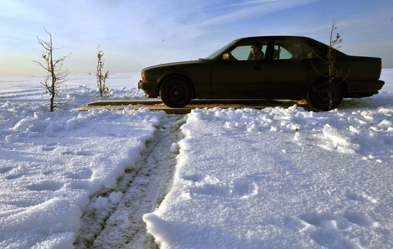
Wyoming and Montana: The Rockies Take the Worst of It
Wyoming is absorbing the hardest hit. The Sierra Madre and Snowy Ranges face 12 to 18 inches, up to 20 on the peaks, winds at 60 mph. The Tetons and Gros Ventre could get 12 to 18 inches on western slopes with 45 mph gusts. The northeast Bighorn Mountains are looking at 10 to 20 inches with 50 mph winds.
Highway 14 through Burgess Junction: the NWS says driving will be "nearly impossible." South Pass and Salt River Pass are the same story.
Montana's northern ranges are in a similar spot. The Pryor and northern Bighorns could see snow totals in excess of 24 inches on the highest peaks, with 50 mph gusts. Absaroka, Beartooth, Crazy Mountains: 1 to 2 feet. US-212 through the Beartooth corridor and I-90 west of Billings: postpone both.
The Dakotas and Minnesota: Where Easter Weekend Travel Falls Apart
Central North Dakota already has snow on the ground from the first system. None of it has melted. NWS Bismarck has now issued a Winter Storm Warning for south-central and southeast North Dakota through Saturday afternoon, with the second system expected to drop 9 to 15 inches across that zone and up to 17 inches in parts of the southeast. Bismarck-Mandan could see 6 to 14 inches on its own. North-central South Dakota is looking at 8 to 11 inches, with 6 to 9 spilling into Traverse County, Minnesota. Combined totals well over a foot in places, with 30 to 40 mph gusts on flat prairie highway where the wind has nothing to hit for 50 miles.
Minnesota's North Shore has its own winter storm warning. Seven to 10 inches, sleet, ice, Gale Warning on Superior. Even the Twin Cities has an advisory, which tells you something about the rest of the state.
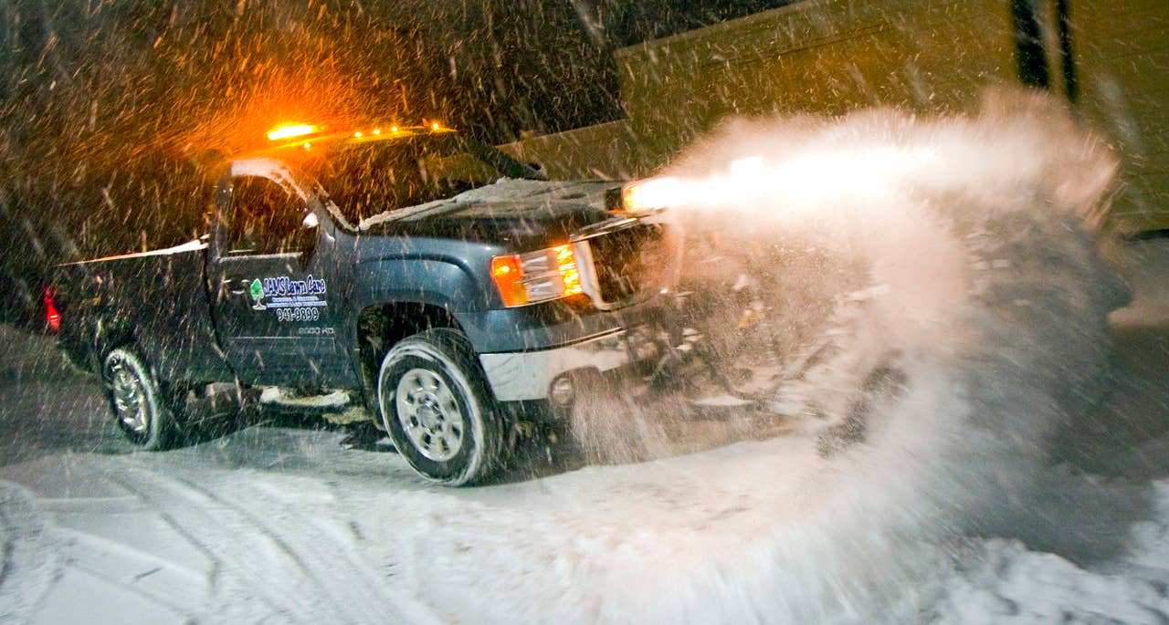
Carl D. Walsh for GMC
Elsewhere
Oregon's Cascades have been upgraded to a full winter storm warning, with 10 to 18 inches of snow expected. In northern California, the Sierra Nevada is bracing for up to 12 inches of accumulation alongside winds gusting to 60 mph; chain controls are already in effect on I-80 over Donner Pass and will remain so through Friday. Illinois is forecast to see around 9 inches of snow, with Cook and Lake Counties bearing the brunt of it. Michigan's Upper Peninsula is facing a double threat — 6 inches of snow combined with enough ice accumulation to bring down power lines and cause widespread outages. Maine is dealing with a similar mixed-precipitation situation, with snow and ice continuing through Friday.
The Highways
The stretch of I-94 running from Bismarck through Jamestown and into Fargo is shaping up to be one of the most treacherous corridors in the country this weekend. Drivers will face drifting snow, near-zero visibility, and virtually no shelter along the way — a combination that makes even short trips genuinely life-threatening. I-90 cutting across South Dakota isn't much better, sitting squarely in the path of two converging storm systems.
Beyond those two, several other routes are raising serious concerns. I-29 through Fargo is almost completely exposed to the open plains, leaving it highly vulnerable to blowing and drifting snow. I-35 north of the Twin Cities deteriorates steadily as you head toward Duluth, where conditions are expected to be significantly worse. Highway 61 along the North Shore of Lake Superior adds sleet, ice, and gale-force winds off the lake to an already difficult drive. Highway 14 near Burgess Junction is another high-risk corridor. And in California, I-80 over Donner Pass remains under chain controls, as noted in the Sierra Nevada forecast.
Before You Drive
Your tires are doing more work than your drivetrain this weekend, whether you have front-wheel drive or a $70,000 truck with four-wheel everything. AWD helps you accelerate. It does nothing for stopping on ice, which is exactly what every bridge and overpass will have after the refreeze. Check your tread (4/32 inches minimum) and check pressures, because cold drops them 1 to 2 PSI per 10 degrees and most people do not notice until they are sliding. Triple your following distance.
Throw a blanket, flashlight, phone charger, water, and cat litter in the trunk. And honestly, if you can leave Sunday afternoon instead of Friday night, do that. The snow will not care that it is Easter.